

RTK-GNSS survey accuracy is centimetre-level, while a handheld or phone GPS is typically good to about 5 m. For an AAI NOC, that gap decides whether your data is acceptable, because AAI asks for 0.5 m elevation and 3 m position. Learn how it works in our site elevation survey for airport NOC guide. Quick […]

AAI NOC Appeal: Appellate Committee Process (2026)
An AAI NOC appeal is a formal request to the Appellate Committee of the Ministry of Civil Aviation for a higher permissible height than the AAI Designated Officer granted. This guide explains who can appeal, the steps, the fees and the outcome. For quick fixes, read our AAI NOC objection reply guide. Quick Answer The […]

Defence NOC or AAI NOC? Decision Flowchart (2026)
Whether you need a defence NOC or an AAI NOC depends on what stands near your site: a civil airport, a military airfield, a defence establishment, or a mix. This decision flowchart gives the answer in just a few minutes. For a detailed side-by-side table, read our defence NOC vs AAI NOC comparison. Quick Answer […]
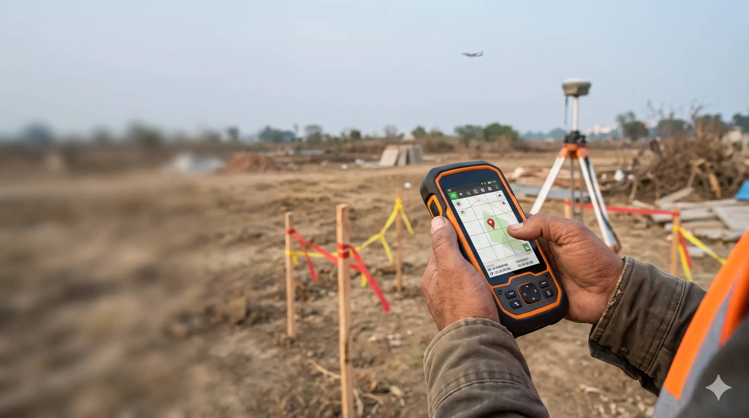
Wrong Coordinates or Elevation: Why Your NOC Gets Rejected or Void
Wrong coordinates or elevation can get your AAI NOC rejected, or make an issued NOC null and void later. AAI calculates your permitted height from the data you submit, so one error can undo the approval. Here are the common mistakes and fixes, starting with a proper site elevation survey for airport NOC. Quick Answer […]


Do You Need an AAI NOC? 5-Minute Checklist (2026)
You need an AAI NOC only if your site is inside the regulated zone around an airport and your top elevation exceeds the limit permitted for your grid. This 5-minute checklist shows exactly how to check your plot, step by step. New to the topic? Start with our guide on what is AAI NOC and […]

What Is AAI NOC and Who Needs It? (Complete India Guide 2026)
AAI NOC is the No Objection Certificate from the Airports Authority of India that confirms your building, tower or other structure will not obstruct flight paths near an airport. Whether you need one depends on your site’s distance and height, which an airport NOC survey establishes before filing. AAI NOC at a Glance Item Detail […]

AMSL Elevation Certificate for Airport NOC Explained
AMSL stands for Above Mean Sea Level. An AMSL elevation certificate is a signed document from a qualified surveyor that states the ground elevation of your site, measured against mean sea level, together with its WGS-84 coordinates. The Airports Authority of India uses these two values in NOCAS to work out how tall your structure […]

Wind Turbine Height Limits Near Airports in India
Yes, a mobile or telecom tower needs an airport NOC (height clearance from the Airports Authority of India) if it is built within the safeguarding radius of an airport, up to 20 km from a VFR airport or up to 56 km from an IFR airport, or if its height crosses the limits set in […]

Drone Aerial Survey vs Traditional Survey: Key Differences
A traditional survey measures selected points on the ground with a total station, GNSS receiver or level, and records them as plans and contours. A drone aerial survey flies a UAV over the site, captures overlapping images or laser data, and processes them into maps, elevation models and 3D data that cover the entire surface. […]

Drone Aerial Survey Cost in India (2026 Pricing Guide)
Drone aerial survey cost in India depends mainly on the survey area, the sensor used (RGB camera, LiDAR or thermal), the accuracy you need, terrain and the deliverables you want. Larger areas cost less per acre because mobilisation and ground control are spread over more land, and LiDAR costs more than photogrammetry because of the […]
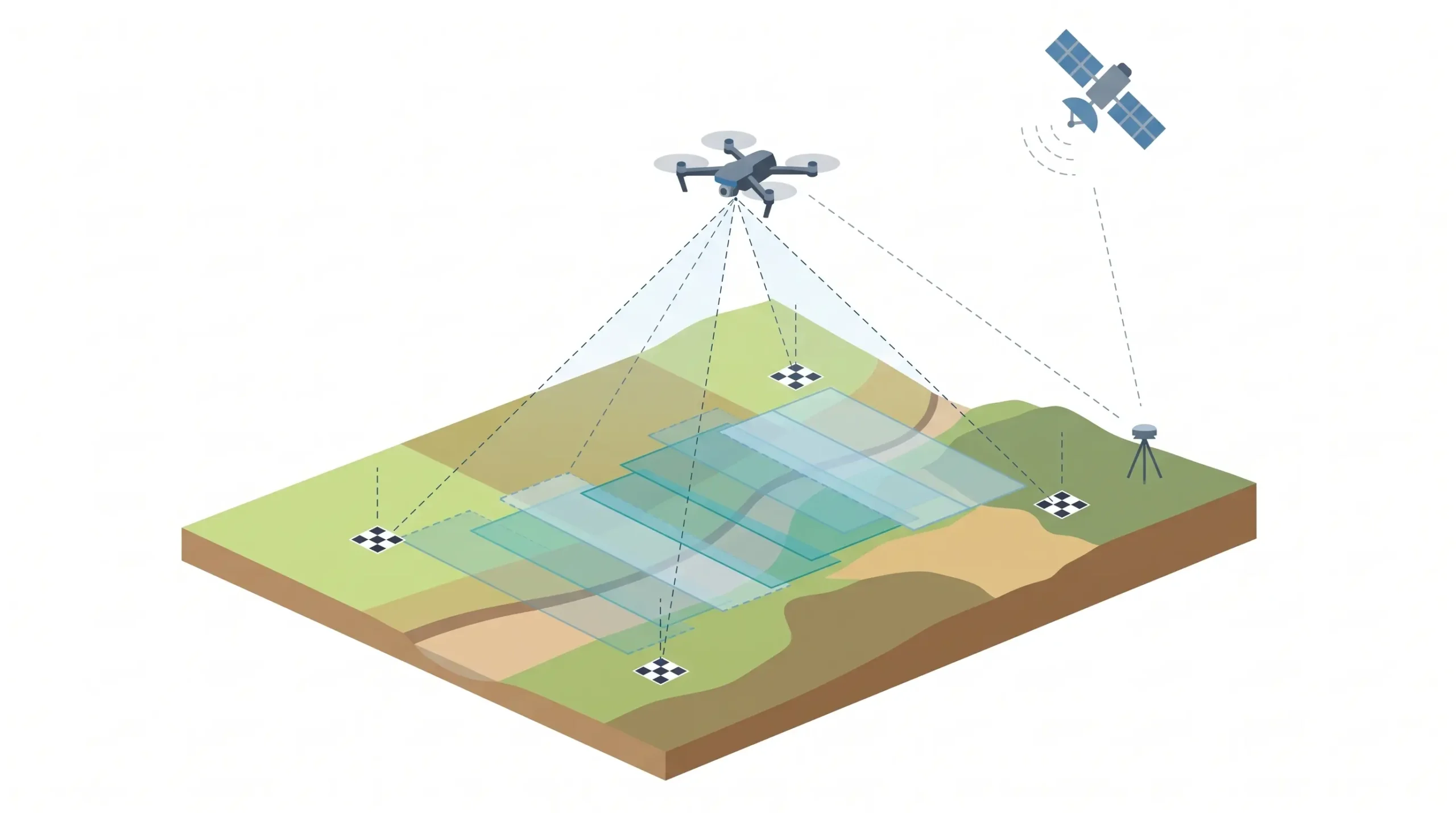
What is Drone Aerial Survey? Process, Equipment & Uses
A drone aerial survey uses an unmanned aerial vehicle (UAV) fitted with a camera or LiDAR sensor to capture overlapping images or laser data of land from the air. The data is processed into georeferenced outputs such as orthomosaic maps, elevation models, contours, 3D models and volume reports. It is faster and safer than manual […]

Do Solar Panels Need AAI NOC? Solar Farm Height Clearance
Solar panels need an AAI NOC only when the solar farm falls inside an airport’s safeguarding zone (up to 20 km from a VFR airport or up to 56 km from an IFR airport) and its highest point, such as tracker arrays, poles, inverter stations or evacuation towers, could cross the permitted height. Panels themselves […]

Do Mobile Towers Need Airport NOC? Rules Explained
Yes, a mobile or telecom tower needs an airport NOC (height clearance from the Airports Authority of India) if it is built within the safeguarding radius of an airport, up to 20 km from a VFR airport or up to 56 km from an IFR airport, or if its height crosses the limits set in […]

LiDAR Survey vs Traditional Survey: Key Differences
A traditional survey measures selected points on the ground using a total station, GNSS receiver or level, and records them as plans and contours. A LiDAR survey fires millions of laser pulses and captures the whole surface as a dense 3D point cloud. Traditional methods suit small, simple plots. LiDAR suits large, uneven, forested or […]

LiDAR Survey Cost in India (2026 Pricing Guide)
LiDAR survey cost in India depends mainly on the survey area, the platform used (drone, airborne, mobile or terrestrial), terrain and vegetation, required point density and accuracy, and the deliverables you need. Larger areas cost less per acre, and LiDAR typically costs more than photogrammetry because of sensor and processing costs. Our LiDAR survey services […]

What is LiDAR Survey? Process, Equipment & Uses
A LiDAR survey (Light Detection and Ranging) is a remote sensing method that fires millions of laser pulses at the ground and structures, measures how long each pulse takes to return, and builds an accurate 3D point cloud of the surface. At Surveying India, our LiDAR survey services turn that data into terrain models, contour […]

Scan to BIM Survey vs Traditional Survey: Key Differences
A traditional survey measures selected points on a site using tapes, laser distance meters, levels or a total station, and records them as 2D drawings. A Scan to BIM survey captures millions of points with a 3D laser scanner and converts them into an intelligent 3D BIM model. Traditional methods suit small, simple jobs. Scan […]

Scan to BIM Survey Cost in India – Pricing Guide
Scan to BIM survey cost in India depends mainly on the built-up area, the Level of Development (LOD), the disciplines modelled (architecture, structure, MEP) and site access. The total is always two parts added together: scanning (field capture) and BIM modelling (office work). Modelling is usually the larger share, and a higher LOD or heavy […]

What is Scan to BIM Survey? Process, Equipment & Applications Explained
A Scan to BIM survey is a process where a 3D laser scanner captures an existing building or site as a dense point cloud, and the data is then converted into an intelligent, editable 3D BIM model (usually in Revit). It gives architects, engineers and facility managers accurate as-built drawings without repeated manual site measurements. […]