
Topography Survey
& Drone Mapping
Scanning
& Digital Mapping
For Agriculture
SUPER DETAILED
We are certified, reliable & accredited
We are one of India’s largest surveying and spatial capabilities, with expertise in positioning and measurement (surveying), topography survey, spatial analysis, GIS Mapping, and 3D modelling and visualization.

Multispectral & NDVI Solution
SurveyingIndia provides high accuracy GPS surveys to satisfy a wide variety of location and set out requirements.
Read More
Landscape Survey
SurveyingIndia has extensive experience in producing detailed and accurate landscape surveys
Read More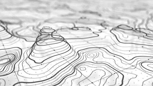
Contour Survey
Our services include detailed contour survey. Contour plans are a graphical representation of the lay of the land.
Read More
Drone Aerial Survey
Our solution combines drone technology with advanced software mapping capabilities and robust data delivery.
Read More
LiDAR Survey
Land surveys using advanced LiDAR technology have significant advantages over previous methods.
Read More
GIS & Mapping
A wide spectrum of business and public organisations in India have hired our GIS and remote sensing skills.
Read MoreWelcome
WE SEE YOUR WORLD CLEARLY
Our journey has been guided by a commitment to precision, continuous learning, and the adoption of reliable surveying technologies. With a capable team and a clear focus on quality, we strive to support our clients with survey solutions that are practical, compliant, and dependable.
We value long-term relationships built on trust, transparency, and consistent delivery. We look forward to collaborating with you and becoming a dependable partner in your projects. Please explore our services and feel free to get in touch with us to discuss how we can support your requirements.

MD, Surveying India
Want to Know More?
+91 9871880058


Facts and Digits
We believe in team work
Diversified & Equality

100
800
30
15
1200
10
Certified Drones Pilots
Expert Engineer

Friendly & Compassionate
Safety First
Trusted for mission-critical inspections, surveys, and infrastructure monitoring.
Trusted By
Our clientele includes Government authorities, Public Sector Undertakings, Private enterprises, and Public Limited companies.
Their continued trust reflects our commitment to accuracy, reliability, and excellence in surveying solutions.


Frequently Asked Questions – Land Survey & Drone Mapping Services
1. What services does Surveying India offer?
Surveying India provides drone aerial survey, LiDAR survey, DGPS survey, cadastral and land survey, contour survey, total station survey, landscape survey, GIS & mapping, 3D virtual reality modelling, multispectral/NDVI survey for agriculture, and Airport NOC (height clearance) survey. Services are used across infrastructure, real estate, agriculture, and government projects.
2. What areas in India does Surveying India serve?
Surveying India operates pan-India, with completed projects across multiple states and cities, including dedicated Airport NOC survey services in Bhopal, Ahmedabad, Lucknow, Chandigarh, Kota, and Jaipur. The team is based in Gurugram, Haryana, and mobilizes equipment and surveyors nationwide.
3. Is Surveying India certified for drone surveys?
Yes. Surveying India’s drone pilots are certified by DGCA-recognized training schools, and surveys are carried out in compliance with Indian drone regulations, making the output suitable for government, infrastructure, and legal submission requirements.
4. Which organizations has Surveying India worked with?
Surveying India’s clients include government authorities, Public Sector Undertakings (PSUs), private enterprises, and public limited companies, including organizations such as Tata, NHAI, and GMDA, reflecting its trusted role in mission-critical infrastructure and mapping projects.
5. How many projects has Surveying India completed?
Surveying India has completed 800+ projects covering over 1,200 sq. km of area, supported by a 30-member team and a fleet of 10 LiDAR/drone units, delivering 15+ specialized surveying services to date.
6. What is the difference between drone survey and LiDAR survey?
Drone (photogrammetry) survey captures high-resolution images to build 2D/3D maps and is well-suited for open, clearly visible terrain. LiDAR survey uses laser pulses that can penetrate vegetation cover, making it more accurate for forested, dense, or obstructed sites where photogrammetry alone would miss ground detail.
7. What is a DGPS survey and when is it needed?
DGPS (Differential GPS) survey provides centimeter-level positioning accuracy by correcting standard GPS signals, and is typically used for boundary demarcation, control point establishment, and large-scale mapping projects that require high positional precision.
8. Can Surveying India handle large-scale infrastructure projects?
Yes. Surveying India regularly supports large infrastructure projects such as highways, airports, and township developments, working with government authorities and PSUs where accurate, compliant survey data is required at scale.
9. What deliverables do I receive after a survey?
Depending on the service, deliverables typically include CAD drawings, orthomosaic maps, digital elevation models (DEM), contour plans, GIS-ready shapefiles, and detailed survey reports, tailored to the project’s engineering or regulatory requirements.
10. How do I request a quote from Surveying India?
You can request a quote by calling +91 9871880058, emailing info@surveyingindia.in, or submitting the online request form on the Surveying India website. The team responds with project scoping based on site location, area, and required survey type.