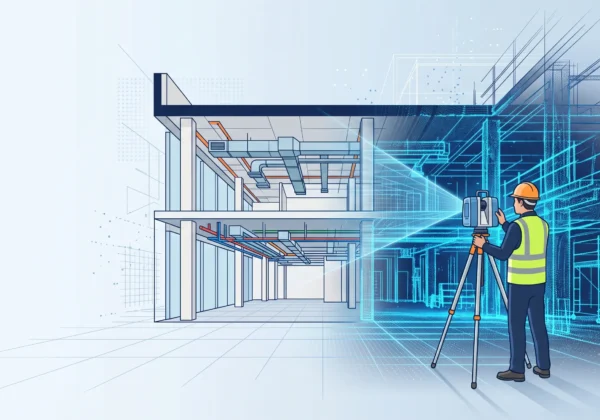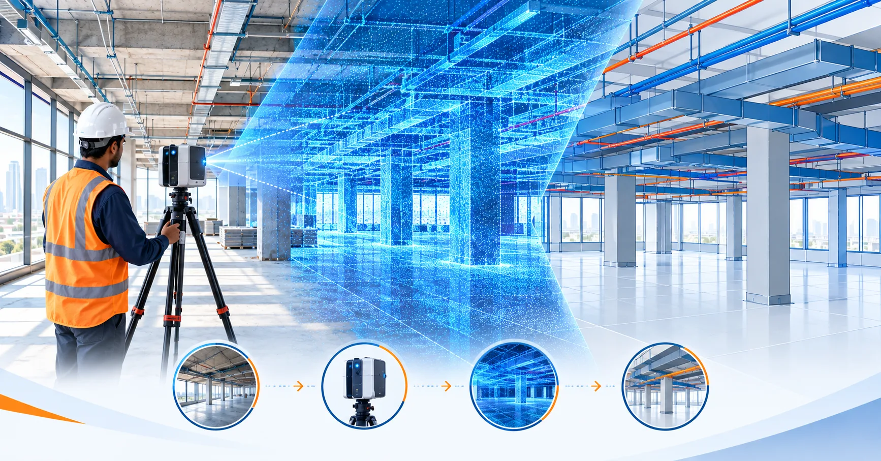
A Scan to BIM survey is a process where a 3D laser scanner captures an existing building or site as a dense point cloud, and the data is then converted into an intelligent, editable 3D BIM model (usually in Revit). It gives architects, engineers and facility managers accurate as-built drawings without repeated manual site measurements.
Scan to BIM Survey at a Glance
- What it is: A 3D laser scan of an existing building converted into an intelligent BIM model (usually Revit).
- Process: Scoping, scanning, registration, BIM modelling, QA check and delivery.
- Equipment: Terrestrial laser scanners, mobile SLAM scanners, drones and total stations.
- Most common LOD: LOD 300 for renovation and design coordination.
- Best for: Renovation, retrofit, heritage, industrial plants and facility management.
- Key benefits: Millimetre-level accuracy, fewer site revisits, less rework and early clash detection.
- Limitations: Concealed elements cannot be scanned, and glass or reflective surfaces create noise.
- Cost drivers: Area, complexity, LOD, disciplines (Architecture, Structure, MEP), site access and turnaround.
- Choosing a provider: Look for an in-house scanning team, a registration report, experienced Revit modellers and a QA process.
What is Scan to BIM Survey?
Scan to BIM is a two-part workflow that connects field reality with digital design:
- Scanning: A terrestrial laser scanner (TLS), mobile scanner or drone captures millions of 3D points of a structure.
- Modelling: BIM specialists convert that point cloud into a model made of real building elements such as walls, slabs, columns, beams, ducts, pipes and doors, each carrying data.
The result is not just a 3D picture. A BIM (Building Information Modelling) model is intelligent: elements have dimensions, materials, classifications and relationships. That is what separates it from a simple 3D mesh or CAD drawing.
Scan to BIM is used for existing structures. For a new building, the BIM model is created during design. If the building already exists and reliable drawings are missing, Scan to BIM creates them.
Why Scan to BIM Matters
Most older buildings in India, whether commercial towers, factories, hospitals or heritage properties, have outdated, incomplete or missing drawings. Designing a renovation from those drawings leads to clashes, change orders and delays. A Scan to BIM survey solves this by:
- Capturing the actual condition, including deviations, sagging slabs and unrecorded alterations
- Cutting manual measurement and repeated site visits
- Giving all stakeholders one coordinated, shared model
- Supporting clash detection before construction starts
Metro projects with older building stock, such as renovation work in Mumbai or Delhi NCR, benefit the most from reliable as-built data.
The Scan to BIM Process, Step by Step
1. Project Scoping and Planning
The team defines the purpose, required LOD, accuracy tolerance, file formats (RVT, IFC, DWG, E57/RCP) and areas to scan. A site walk-through identifies access limits, reflective surfaces and occupied zones.
2. Site Control and Scanning
Control points are established, often with a total station, so all scans share one coordinate system. Scanners are placed in overlapping positions for full coverage, including ceilings, plant rooms and above-ceiling spaces where accessible.
3. Registration and Point Cloud Processing
Individual scans are stitched (“registered”) into one unified point cloud. Noise, stray reflections and moving objects are removed. A good registration report shows error values, so ask your vendor for it.
4. BIM Modelling
Modellers import the cleaned point cloud into Autodesk Revit (or similar software) and model the elements to the agreed LOD. Architecture, structure and MEP are modelled as separate disciplines or as a federated model.
5. Quality Check and Deviation Analysis
The finished model is overlaid on the point cloud to check deviations. A colour-coded deviation report confirms the model sits within tolerance.
6. Delivery
Deliverables typically include the BIM model, point cloud files, 2D plans, sections, elevations and a QA report.
Equipment Used in a Scan to BIM Survey
| Equipment | Best For | Notes |
|---|---|---|
| Terrestrial laser scanner (e.g., Leica RTC360, FARO Focus) | Buildings, industrial plants, high-accuracy needs | Millimetre-level accuracy, long range |
| Mobile / SLAM scanner (e.g., Leica BLK2GO, NavVis) | Large interiors, quick walkthrough capture | Faster, slightly lower accuracy |
| Drone with LiDAR / photogrammetry | Roofs, facades, large sites | Reaches areas people cannot |
| Total station | Control networks | Anchors scans to a precise coordinate system |
| Processing software (Cyclone, ReCap, Revit, CloudCompare) | Registration and modelling | Choice depends on workflow |
Manufacturers such as Leica Geosystems and FARO publish detailed scanner specifications. For large sites, corridors or terrain, a LiDAR survey can be combined with building-level scanning in a single workflow.
Understanding LOD in Scan to BIM
Level of Development (LOD) describes how detailed and reliable each model element is. The most widely used framework is published by BIMForum.
- LOD 100-200: Conceptual, approximate geometry. Suitable for early feasibility.
- LOD 300: Accurate size, shape and location. The most common level for renovation and design coordination.
- LOD 350: Adds interfaces with other systems, useful for MEP coordination.
- LOD 400: Fabrication-level detail.
Higher LOD means more modelling time and cost, so specify only what your project needs.
Applications of Scan to BIM
- Renovation and retrofit: Accurate existing conditions before redesign.
- Facility management: An as-built model with asset data supports maintenance, space planning and digital twins.
- Industrial plants: Pipe racks, equipment layouts and brownfield expansions where shutdown time is costly.
- Heritage and conservation: Non-contact documentation of fragile structures.
- Construction verification: Comparing as-built conditions with design intent.
- Infrastructure: Bridges, tunnels, metro stations and utilities.
Scan to BIM and LiDAR Services Across India
Surveying India provides Scan to BIM survey services in Mumbai, Pune, Delhi NCR, Bengaluru, Hyderabad, Chennai, Kolkata and Ahmedabad.
For terrain, corridor and large-site mapping, our LiDAR survey services are available in Mumbai, Pune, Delhi, Gurugram, Bengaluru, Hyderabad and Chennai.
Scan to BIM vs. Traditional Survey
| Factor | Traditional Manual Survey | Scan to BIM |
|---|---|---|
| Data captured | Selected points | Millions of points, full geometry |
| Accuracy | Depends on operator | Millimetre-level with proper control |
| Site time | Longer, repeat visits | Faster, single capture |
| Output | 2D drawings | Intelligent 3D model + 2D |
| Revisits for missed data | Common | Rare, the point cloud holds everything |
| Clash detection | Limited | Built into the workflow |
Benefits and Limitations
Benefits
- High accuracy and reliable as-built data
- Fewer design errors and less rework
- Faster project timelines
- One data source for all stakeholders
- Safer capture of hard-to-reach areas
Limitations to know
- Hidden elements (inside walls, above solid ceilings) cannot be captured unless exposed
- Reflective or glass surfaces can create noise
- Very high LOD increases modelling effort
- Skilled processing is essential; poor modelling can undo good scanning
What Affects Scan to BIM Cost?
Pricing varies by provider and project, so treat any single “per sq ft” figure with caution. The main drivers are:
- Total area and building complexity
- Required LOD and disciplines (Architecture, Structure, MEP)
- Site accessibility and number of scan positions
- Level of detail in MEP systems
- Turnaround time and deliverable formats
Always request a scope-based quotation instead of comparing only headline rates.
How to Choose a Scan to BIM Service Provider
- Do they own professional-grade scanners and run their own field team?
- Can they share a registration accuracy report?
- Do they have experienced Revit modellers across architecture, structure and MEP?
- Do they follow information management practices aligned with ISO 19650?
- Do they provide a QA process with deviation analysis?
- Do they have sample projects similar to yours?
- Can they mobilise quickly in your city?
Local mobilisation matters. For example, we support Scan to BIM in Pune and Hyderabad with dedicated field coordination.
Frequently Asked Questions
What is a Scan to BIM survey in simple words?
It is a method where a laser scanner captures an existing building in 3D, and the data is converted into an intelligent BIM model used for design, renovation and facility management.
How accurate is Scan to BIM?
With professional terrestrial scanners and proper control, point cloud accuracy is typically within a few millimetres. Final model accuracy depends on the agreed LOD and tolerance.
What is the difference between a point cloud and a BIM model?
A point cloud is raw 3D measurement data made of points. A BIM model is a structured model of real building elements with data attached. Scan to BIM converts the first into the second.
Which software is used for Scan to BIM?
Commonly Autodesk Revit for modelling, with Leica Cyclone, FARO Scene or Autodesk ReCap for point cloud processing.
How long does a Scan to BIM project take?
Scanning a typical building can take hours to a few days. Modelling time depends on area, LOD and complexity: a small building may take days, a large complex may take weeks.
Can Scan to BIM capture MEP services?
Yes, for exposed pipes, ducts, cable trays and equipment. Concealed services cannot be captured by scanning alone.
Is Scan to BIM suitable for old and heritage buildings?
Yes. It is non-contact and records complex geometry accurately, which is why it is widely used for conservation work.
What file formats do I receive?
Usually RVT, IFC, DWG/PDF drawings, and point clouds in E57, RCP or LAS formats, depending on your requirement.
What is the difference between Scan to BIM and LiDAR survey?
LiDAR is the measurement technology. Scan to BIM is a workflow that uses laser scanning data to produce a BIM model. LiDAR surveys can also deliver terrain models and topographic data without BIM.
Conclusion
A Scan to BIM survey replaces guesswork with measured reality. By converting laser scan data into an intelligent BIM model, it helps teams plan renovations, manage facilities and coordinate disciplines with fewer errors and less rework. The key to a successful project is a clear scope, the right LOD and a provider that combines strong field capture with skilled modelling.
Planning a renovation, retrofit or facility documentation project? Explore our complete Scan to BIM Survey services or contact our team for a scope-based quotation.