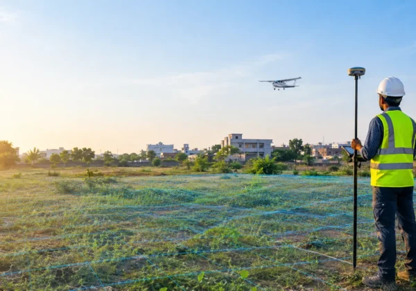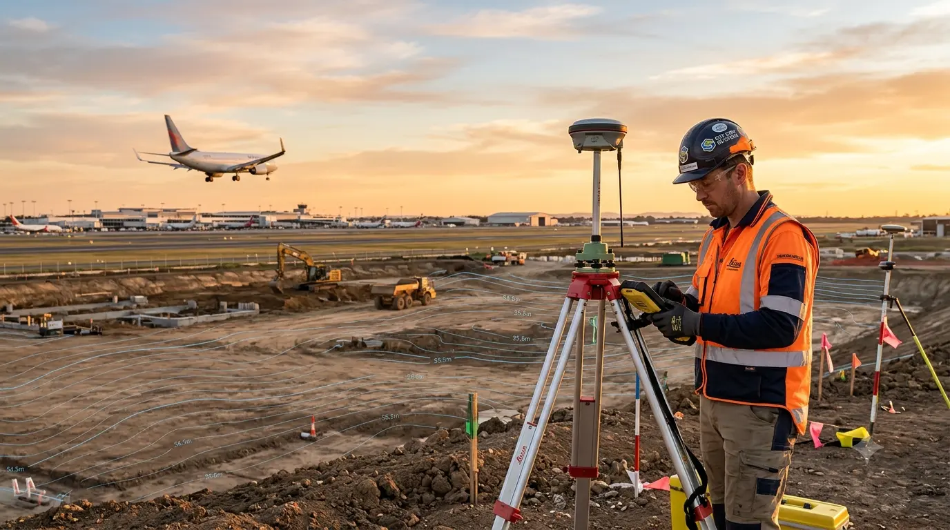
AMSL stands for Above Mean Sea Level. An AMSL elevation certificate is a signed document from a qualified surveyor that states the ground elevation of your site, measured against mean sea level, together with its WGS-84 coordinates. The Airports Authority of India uses these two values in NOCAS to work out how tall your structure can be, so the certificate is the first document every airport NOC application depends on. Our site elevation survey for airport NOC delivers certificates in AAI’s prescribed format, as part of our wider Airport NOC survey services.
Get AMSL Elevation Certificate
AMSL Elevation Certificate at a Glance
- What AMSL means: Height of a point above mean sea level, also called the Reduced Level (RL) of the site.
- Why AAI needs it: Permissible height is set as an elevation above sea level, so AAI must know where your ground sits on that scale.
- Accuracy AAI expects: Site elevation within 0.5 m, coordinates to 1/10th of a second, position within 3 m.
- Coordinates: WGS-84 datum, with at least four corner points including the one nearest the airport.
- Who can issue it: A licensed surveyor, architect or engineer, or an AAI-empanelled surveyor.
- Instruments: DGPS or total station, not a handheld GPS or phone reading.
- Risk of errors: Application data cannot be edited after submission, so a wrong certificate can mean starting over.
What is AMSL Elevation?
AMSL means Above Mean Sea Level. It is the vertical distance between a point on the ground and the average level of the sea, which surveyors use as the common zero for heights. On Indian drawings you will also see it called RL (Reduced Level) or MSL elevation. If your plot is at 612.4 m AMSL, the ground there is 612.4 metres above that reference level.
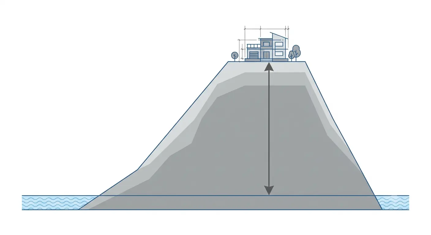
Why use sea level at all? A runway at one airport and a building site 15 km away can be at very different ground heights. A common zero lets aviation authorities compare all of them on one scale, and it is the same scale pilots and altimeters use.
Why Airports Need Your AMSL Elevation Certified
An airport protects the airspace around it using imaginary surfaces that are defined as elevations above sea level. When you apply for an NOC, AAI calculates the Permissible Top Elevation (PTE) for your exact location. Your structure’s highest point must stay below it. The maximum height you can build above ground is:
Maximum height above ground = PTE (AMSL) minus site ground elevation (AMSL)
| Item | Illustrative Value |
|---|---|
| Permissible Top Elevation at the site | 650.0 m AMSL |
| Certified ground elevation of the plot | 612.4 m AMSL |
| Maximum height above ground | 650.0 – 612.4 = 37.6 m |
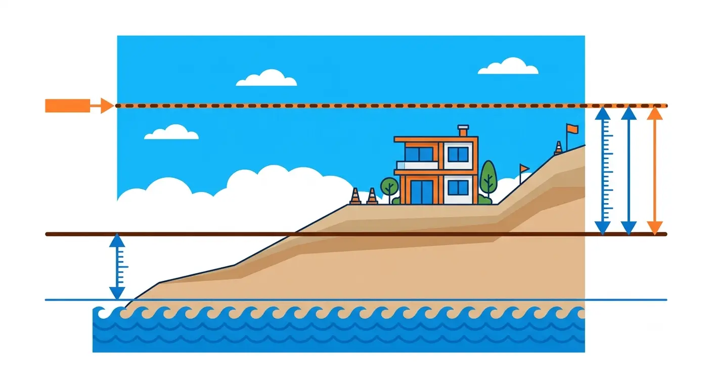
This example is illustrative, not a real site. It shows why precision matters: if the ground elevation is wrong by a few metres, the allowed building height is wrong by the same amount. A building designed to the wrong number can end up above the permitted top elevation. That is why AAI requires a certified value from a qualified person, not an estimate from a map or app. For more on how height limits work, read our guide on building height restrictions near airports.
AMSL vs Ellipsoidal Height: A Common Source of Errors
GNSS receivers do not measure height above sea level directly. They measure height above a mathematical shape of the Earth called the ellipsoid (WGS-84). Mean sea level follows the geoid, an uneven surface shaped by gravity, which NOAA explains here. The difference between the two, called geoid separation, can be tens of metres in India.
| Height Type | Reference Surface | Use for AAI NOC? |
|---|---|---|
| Ellipsoidal height | WGS-84 ellipsoid (mathematical) | No. This is the raw GNSS value |
| Orthometric height (AMSL / RL) | Mean sea level (geoid) | Yes. This is what AAI needs |
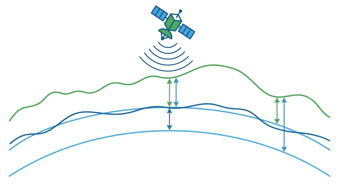
A surveyor who simply reads the GNSS height and puts it on a certificate will give AAI the wrong number, sometimes by tens of metres. A proper survey applies a geoid model or levels from a known benchmark to convert to AMSL. This is one of the biggest reasons certificates get sent back.
What AAI Requires on the Certificate
AAI’s guidelines, including Air Traffic Management Circular No. 06 of 2017, set exact tolerances for the survey. As summarised in our guide, the key requirements are:
| Requirement | Standard |
|---|---|
| Site elevation (AMSL) | Accurate within 0.5 metres |
| WGS-84 coordinates | Accurate to 1/10th of a second, in DD°MM’SS.s” format |
| Position accuracy | Within 3 metres |
| Coordinate points | Minimum four corner points, including the point nearest the airport |
| Vertical datum | Clearly stated (MSL / Indian Datum), with transformation parameters where applicable |
| Reference | Tied to a recognised permanent benchmark or GNSS control point |
 Even a triangular plot needs a fourth coordinate on the side facing the airport. Confirm the current format and limits on the AAI NOCAS portal before filing, since requirements can be updated.
What Should Be on an AMSL Elevation Certificate?

| Field | What to Include |
|---|---|
| Site coordinates | WGS-84, all corner points, DD°MM’SS.s” |
| Site elevation | Metres AMSL, within 0.5 m accuracy |
| Benchmark reference | Description and elevation of the control point used |
| Survey method | Instrument (DGPS or total station) and survey date |
| Surveyor details | Name, licence or empanelment number, signature and stamp |
| Applicant and site details | Plot, CTS or survey number, and applicant name matching ownership documents |
Who Can Issue an AMSL Elevation Certificate?
AAI does not accept certificates from any provider. As described in our guide, the certificate must come from a licensed surveyor, architect or engineer, or a surveyor empanelled by AAI for this purpose. Our guide also notes that certificates issued by the Survey of India are not accepted by AAI for this purpose. The Survey of India remains a source of national benchmark data, but the NOC certificate itself must come from an eligible professional. Always check the latest eligibility on NOCAS before you commission the survey.
How an AMSL Elevation Survey Is Done
- Benchmark identification. The survey starts from a recognised benchmark or GNSS control point so every height can be traced.
- Coordinate capture. DGPS or total station instruments record latitude and longitude at all corner points, plus the point nearest the airport.
- Elevation capture. Ground elevation is recorded at the same points and referred to mean sea level, meeting the 0.5 m requirement.
- Structure height points. For buildings, the highest point and rooftop items such as water tanks, lift motor rooms, masts and lightning arresters are included in the declared height.
- Certificate preparation. Data is compiled in AAI’s format and signed and stamped by the eligible surveyor.
- Cross-check against the zoning map. Before filing, the coordinates are checked against the airport’s zoning map to confirm the likely permissible height. See what is CCZM.
The field work uses DGPS survey and total station survey instruments. For large or multi-structure sites, a drone aerial survey helps map the layout. Flying near airports needs airspace permission, as explained in AAI NOC vs DGCA clearance.
AMSL Certificate for Different Structures
- Buildings: Plot corners plus the highest point of the proposed structure. See building height clearance AAI NOC.
- Mobile towers: Tower location, plus building height for rooftop towers. See mobile tower airport NOC rules.
- Solar plants: Boundary and key structures across the whole plant, since ground level varies across large plots. See solar panel airport NOC and solar power project AAI NOC.
- Wind turbines: One set of coordinates and elevation per turbine. See wind turbine height limit airport and wind turbine windmill AAI NOC.
- Transmission towers: Each tower location near an airport. See transmission tower AAI NOC.
- Near defence airfields: Same survey data, separate clearance route. See defence IAF height clearance NOC.
Common Mistakes in AMSL Elevation Certificates
- Using ellipsoidal GNSS height instead of AMSL.
- Using a phone, handheld GPS or Google Earth value instead of survey-grade instruments.
- Wrong datum: Coordinates not in WGS-84, or the vertical datum not stated.
- Fewer than four corner points, or missing the point nearest the airport.
- Wrong format: Degrees, minutes and seconds not given to 1/10th of a second.
- Unqualified issuer: Certificate not signed by an eligible licensed or empanelled professional.
- Name mismatch: Applicant name not matching ownership documents.
- Missing rooftop items in the declared building height.
See why airport NOC applications get rejected for the wider list.
What Happens If the Certificate Is Wrong?
NOCAS applications cannot be edited once they are submitted, so an error found after filing usually means a fresh application, and the clock restarts. A wrong elevation can also lead to an NOC that does not match the real site, which can cause problems later during inspection or when the structure is built. Never submit estimated or copied data. Our GSR 751(E) guide explains why accurate data matters for compliance.
How Long Does an AMSL Elevation Survey Take?
Field work for a single plot is usually quick, often a day. Large sites such as solar plants and wind farms take longer, depending on area and the number of points. Certificate preparation follows the survey. After that, AAI’s review runs through NOCAS. For details on the full timeline, read our AAI NOC approval timeline guide. To plan filing, see the NOCAS portal application process, the documents required for airport height clearance NOC and the NOCAS application documentation guide. To understand why the radius matters, see VFR vs IFR airport NOC distance zones.
Airport NOC Survey Services Across India
Surveying India provides AMSL elevation surveys and certificates for airport NOC applications in Delhi NCR, Mumbai, Pune, Bengaluru, Ahmedabad, Jaipur, Kota, Lucknow, Chandigarh, Bhopal, Nagpur, Indore, Varanasi, Patna, Raipur, Guwahati, Surat and Dholera.
Frequently Asked Questions
What is an AMSL elevation certificate?
It is a signed certificate from a qualified surveyor that states the ground elevation of your site above mean sea level, along with its WGS-84 coordinates. AAI uses it to calculate the maximum height allowed for your structure.
What does AMSL stand for?
AMSL stands for Above Mean Sea Level. It is the height of a point above the average level of the sea and is also called Reduced Level (RL).
Why does AAI need AMSL elevation?
Permissible heights around airports are set as elevations above sea level. AAI needs your certified ground elevation to calculate how much height is available above the ground at your site.
What accuracy does AAI require for site elevation?
Site elevation should be accurate within 0.5 metres, coordinates to 1/10th of a second and overall position within 3 metres, as summarised from AAI guidelines. Confirm the latest requirements on NOCAS.
Who can issue an AMSL elevation certificate for airport NOC?
A licensed surveyor, architect or engineer, or an AAI-empanelled surveyor. Survey of India certificates are not accepted for this purpose, as noted in AAI guidance summarised in our guide.
Can I use Google Earth or a phone GPS for site elevation?
No. Those values are not accurate enough and are not accepted. The survey must use DGPS or total station instruments with traceable control.
What is the difference between AMSL and GPS height?
GPS or GNSS measures height above a mathematical ellipsoid, while AMSL is measured from mean sea level. The two can differ by tens of metres, so GNSS heights must be converted correctly before use in an NOC.
How many coordinate points are needed for the certificate?
At least four corner points of the plot, including the point nearest to the airport. Even triangular plots need a fourth point on the side facing the airport.
Can I correct the elevation data after submitting on NOCAS?
No. Application data cannot be edited after submission, so errors usually mean filing again. Check the certificate carefully before you submit.
Is an AMSL certificate needed for every airport NOC application?
Yes, for buildings, towers, solar plants, wind turbines and other structures that fall under the airport height clearance rules, a certified coordinate and elevation survey is the starting point.
Conclusion
An AMSL elevation certificate looks like a simple document, but every height decision in an airport NOC depends on it. Get the vertical datum right, use survey-grade instruments, cover all required corner points and have the certificate issued by an eligible surveyor in AAI’s format. A clean certificate saves weeks of remarks and resubmission and protects your design from being built on the wrong number.
Need a certified elevation survey? Explore our site elevation survey for airport NOC or contact our team for a quote. You can also email info@surveyingindia.in.