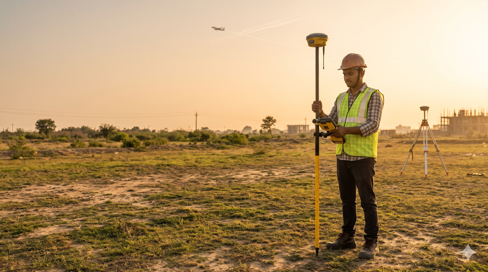
RTK-GNSS survey accuracy is centimetre-level, while a handheld or phone GPS is typically good to about 5 m. For an AAI NOC, that gap decides whether your data is acceptable, because AAI asks for 0.5 m elevation and 3 m position. Learn how it works in our site elevation survey for airport NOC guide.
Quick Answer
- Phone or handheld GPS is typically accurate to about 4.9 m in open sky, according to GPS.gov. That is outside AAI’s tolerance.
- RTK-GNSS with a survey-grade dual-frequency receiver can reach centimetre-level positions in real time.
- AAI requires site elevation within 0.5 m AMSL (EGM-08) and WGS-84 position within 3 m.
- Elevation is the weak point. GNSS height must be converted to EGM-08 mean sea level, and vertical error is usually larger than horizontal error.
What AAI Requires From Your Survey
| Item | Requirement |
|---|---|
| Coordinates | WGS-84, DD MM SS.s, position accuracy within 3 m |
| Elevation | Metres AMSL, referenced to EGM-08, accuracy 0.5 m |
| Top elevation of the structure | Same 0.5 m accuracy |
| Plot above 300 sq m | All corners plus the point nearest the airport |
| Plot 300 sq m or less | One coordinate at the nearest point |
| Highest point | Enter it if it is above the corners |
| Certificate | Standard AAI format, from a licensed surveyor, architect or engineer, or an AAI-empanelled surveyor |
| Responsibility | The applicant is responsible for the accuracy of location and elevation |
AAI’s NOCAS guidelines page also states that site coordinate and elevation certificates issued by the Survey of India are not accepted. For the paperwork, see NOCAS application documentation and documents required for airport height clearance NOC.
Four Survey Methods Compared
| Method | Typical accuracy | Meets AAI tolerance? |
|---|---|---|
| Phone or handheld GPS | About 5 m in open sky; worse near buildings and trees | No |
| Single-frequency GPS with simple corrections | Metre-level | Not reliably, especially for elevation |
| Survey-grade dual-frequency GNSS, RTK | Centimetres under good conditions | Yes, when done correctly |
| Survey-grade GNSS, static observation | Millimetre to centimetre level | Yes |
| Total station from a known control point | Millimetre level over short distances | Yes, with correct control |
GPS.gov says high-end users can boost accuracy with dual-frequency receivers or augmentation, enabling real-time positioning within a few centimetres. Accuracy always depends on sky view, satellite geometry, atmosphere and receiver quality.
The word “DGPS” is used loosely in India. In NOC work, it usually means survey-grade, dual-frequency GNSS with a base or reference, not an old code-based beacon system. Our DGPS survey and total station survey services cover both.
Why the Gap Matters for an NOC
Horizontal error. AAI’s tolerance is 3 m. A phone’s 5 m is already beyond it. Near an airport’s approach and transition areas, the permitted elevation changes with your position, so a displaced point can give a different limit. AAI also plots your coordinates on a map, and a mismatch with the actual site can make the assessment invalid. See wrong coordinates NOC rejected.
Vertical error. The tolerance is 0.5 m, and GNSS height is usually less accurate than horizontal position. That makes elevation the more dangerous error.
An illustrative example. Suppose the permitted top elevation for your grid is 240 m AMSL and the true highest ground level is 215.40 m. The maximum building height is 24.6 m. If the elevation is entered 5 m too low (210.40 m), the plan appears to allow 29.6 m, and the building tops out 5 m above the limit. These numbers are examples only.
The Hidden Problem: Ellipsoidal Height vs EGM-08 Mean Sea Level
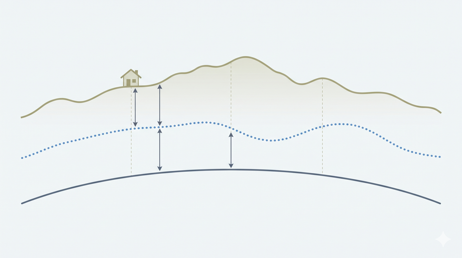
GNSS receivers measure height above a mathematical ellipsoid (h). AAI wants height above mean sea level on the EGM-08 geoid (H). The relation is:
H = h − N, where N is the geoid undulation at your location.
In India, N is large and varies from place to place, so skipping this step can produce an error of tens of metres. A good surveyor:
- Applies a geoid model (EGM-08 for AAI) to convert ellipsoidal height.
- Checks the result against a known benchmark or control point near the site.
- States the vertical datum on the certificate.
Our guide to the AMSL elevation certificate covers what the certificate must show.
What AAI-Derived Equipment Rules Look Like
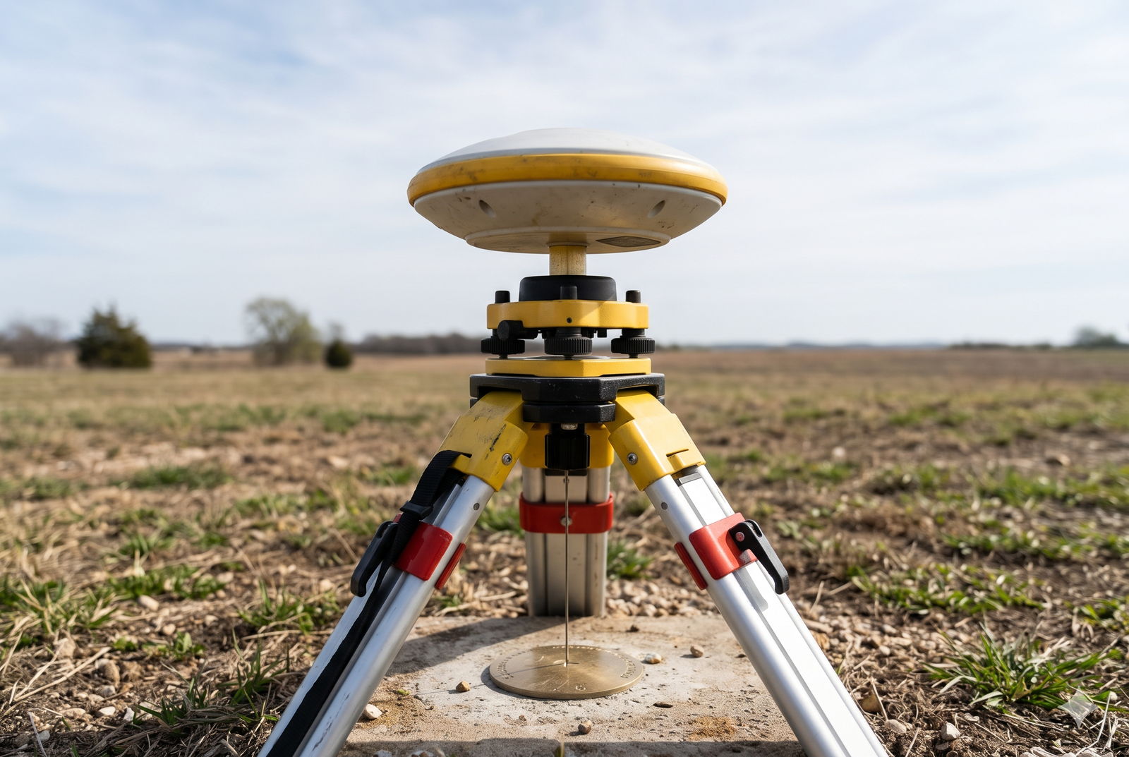
AAI’s procedures require survey-grade equipment such as an electronic total station and differential GPS. A Bhubaneswar Development Authority notice (2020), which reproduces requirements from AAI’s ATMC 6 of 2017, lists these specifications:
| Equipment | Horizontal accuracy | Vertical accuracy |
|---|---|---|
| GNSS, static and fast static | 5 mm ± 0.5 ppm or better | 10 mm ± 1 ppm or better |
| GNSS, kinematic and RTK | 10 mm ± 1 ppm or better | 20 mm ± 1 ppm or better |
| Observation rule | Requirement |
|---|---|
| Receiver | Survey-grade, dual-frequency |
| Observation | Minimum six hours, with a base station such as the aerodrome reference point |
| Photographs | At least four photographs of the GNSS observation, with date and time |
| Output | Coordinates in DMS, heights in EGM-08 |
| Total station | Angular accuracy 1″, a known reference point, 3-decimal metre output |
This is a secondary reproduction, so confirm the latest format and rules on NOCAS before you rely on it.
How RTK Is Done Right
These are good-practice points that experienced surveyors follow:
- Use only a fixed RTK solution, not a float one.
- Use a stable base or reliable network corrections, and keep the baseline reasonable.
- Record and measure the antenna height carefully.
- Repeat observations at different times and compare them.
- Tie to a known benchmark and check elevation against it.
- Back up with a total station where the sky view is poor.
- Keep the raw data, base details, geoid model name and photographs.
Where RTK Struggles
RTK needs a clear view of the sky. Tall buildings, dense trees and nearby walls cause multipath and signal loss, and results can degrade quickly. In such places, the surveyor should use a total station from a controlled point, or extend the observation time. If a certifier says RTK was “fixed” under heavy canopy, ask for the check observations.
Which Survey Method Fits Your Site?
| Site type | Preferred approach |
|---|---|
| Open plot, clear sky | RTK-GNSS with benchmark check, or static observation |
| Plot with trees or buildings nearby | GNSS control plus total station |
| Existing building, top elevation needed | Total station from GNSS-fixed control |
| Large site (solar, wind, industrial) | GNSS control with total station or other mapping, as AAI accepts |
For larger sites, our Cadastral and land survey work and aerial drone survey services can supply supporting data. For the certificate itself, ask the surveyor to confirm the method is acceptable to AAI.
Choosing a Surveyor for NOC Data
Ask these questions:
- Are you a licensed surveyor, architect or engineer, or AAI-empanelled?
- Which equipment will you use, and is it calibrated?
- How do you convert to EGM-08, and what benchmark will you check against?
- Will the certificate follow AAI’s standard format?
- Can I see check observations and photographs?
Also see the WGS-84 coordinates certificate for NOC page and our overview of airport NOC survey services in India.
What Good Data Prevents
Accurate data helps you avoid airport NOC rejection reasons and a possible AAI NOC objection reply or AAI NOC appeal. If you are new to the topic, start with what is AAI NOC and who needs it, check the 5-minute AAI NOC required checklist, and use the defence NOC or AAI NOC flowchart if a military airfield is nearby. Zoning limits are explained in the colour coded zoning map guide, and height checks for specific structures are covered in building height clearance AAI NOC.
Frequently Asked Questions
Can I use my phone’s GPS for an AAI NOC?
No. Phone GPS is typically accurate to about 4.9 m in open sky, and AAI requires 3 m position and 0.5 m elevation from a certified survey.
Is RTK-GNSS accurate enough for AAI?
Yes, when a survey-grade, dual-frequency receiver gets a fixed solution, elevation is converted to EGM-08 and checked against a benchmark.
What is EGM-08?
It is the global geoid model AAI uses as the vertical reference for AMSL. GNSS ellipsoidal heights must be converted to it.
What does AAI mean by DGPS?
In practice it refers to survey-grade, differential or dual-frequency GNSS observation with a base, not a handheld receiver.
Does AAI accept Survey of India certificates?
No. AAI’s NOCAS guidelines page says site coordinate and elevation certificates issued by the Survey of India are not accepted.
Can I rely on drone data for NOC coordinates and elevation?
AAI’s equipment rules name total stations and differential GPS. Ask the certifier to confirm in writing that any other method is acceptable.
What if my RTK reading does not fix?
The surveyor should extend the observation, use static GNSS, or switch to a total station from controlled points.
Get Your NOC Survey Done Right
Send us your plot location, and we will confirm the survey method and the data AAI expects. Visit Surveying India or contact us. We work in Delhi NCR, Mumbai, Bengaluru and Jaipur. For background, see GPS.gov on GPS accuracy, NOCAS and the Ministry of Civil Aviation.
Last updated: 30 October 2026. This article is technical guidance. Always confirm the current AAI format, rules and accuracy requirements on NOCAS.