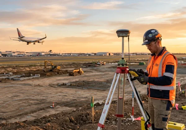
You need an AAI NOC only if your site is inside the regulated zone around an airport and your top elevation exceeds the limit permitted for your grid. This 5-minute checklist shows exactly how to check your plot, step by step. New to the topic? Start with our guide on what is AAI NOC and who needs it.
Quick Answer
- Required: your site is within 20 km of a VFR airport or 56 km of an IFR airport, and your requested top elevation is above the permitted level for your grid (or no zoning map exists for that airport).
- Not required: your site is beyond that distance and under 150 m AGL, or your top elevation is within the Colour Coded Zoning Map (CCZM) limit and the site is not in a compulsory-NOC area.
- How to check: convert your planned height into metres above mean sea level (AMSL) and compare it with the permitted top elevation for your coordinates.
What You Need Before You Start
Keep these three things ready:
- Plot location: latitude and longitude in WGS-84 (a phone GPS pin works for a first check; a surveyed value is needed for filing).
- Planned height: total height above ground level (AGL), including parapet and rooftop items.
- Site elevation: ground level in metres AMSL. If you do not have it, a site elevation survey gives a certified figure.
The 5-Minute AAI NOC Checklist

Step 1: Identify the Nearest Airport and Its Type
Find the closest civil airport, then note whether it is VFR (visual flight rules) or IFR (instrument flight rules). Most major airports are IFR. Also check for a military airfield nearby, because defence airfields follow a separate process. Our guide to VFR vs IFR airport NOC distance zones explains how to tell them apart.
Step 2: Check the Distance From the Airport
Distance is measured from the Aerodrome Reference Point (ARP), not the airport boundary.
| Airport type | Distance from ARP | Result if you are beyond it |
|---|---|---|
| VFR | 20 km | Auto-settled if height is under 150 m AGL |
| IFR | 56 km | Auto-settled if height is under 150 m AGL |
AAI’s auto-settle rule means a site beyond these distances with a height below 150 m AGL gets a system-generated “NOC not required” letter. If you are inside the distance, continue to Step 3.
Step 3: Convert Your Height to AMSL
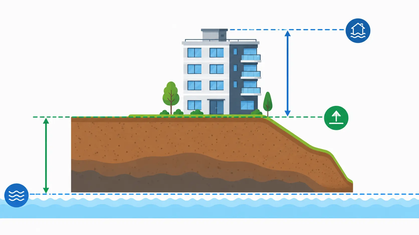
Airport limits are written in metres above mean sea level, not floors or metres above the ground.
Top elevation (AMSL) = site elevation (AMSL) + building height (AGL)
Include everything that rises above the roof. Under AAI’s undertaking, items such as aerials, masts, lightning arresters, vent pipes and overhead water tanks must not project above the permitted top elevation. Where the plot is uneven, AAI considers the highest ground elevation on the plot.
Step 4: Find the Permitted Top Elevation for Your Plot
You have two options:
- CCZM: For airports where AAI has published a map, locate your plot’s grid using WGS-84 coordinates and read the Permissible Top Elevation (PTE) for its colour. Read our guide to the colour coded zoning map (CCZM) if the grid system is new to you.
- NOCAS approximate top elevation tool: AAI’s NOCAS portal lets you enter coordinates and see an approximate top elevation without logging in. AAI states these values are indicative and for planning only.
If your airport has no CCZM, the NOCAS application itself is the route, because the system calculates the PTE from your coordinates and elevation.
Step 5: Read the Result
| Your situation | What it means |
|---|---|
| Beyond 20 km (VFR) or 56 km (IFR) and under 150 m AGL | AAI NOC not required (auto-settle) |
| Top elevation at or below CCZM PTE, not in a compulsory-NOC area | AAI NOC not required; your local body approves the plan |
| Top elevation above CCZM PTE | Apply to AAI through NOCAS |
| Home grid is red | Apply to AAI through NOCAS |
| Site in approach, take-off or transitional area | Local body cannot approve it alone; AAI NOC needed |
| Requested height above 150 m | Apply through NOCAS |
| Near a military airfield | Defence authority clearance, separate from AAI |
| Structure inside airport premises | Airport operator’s permission is also required |
Worked Example (Illustrative Numbers)
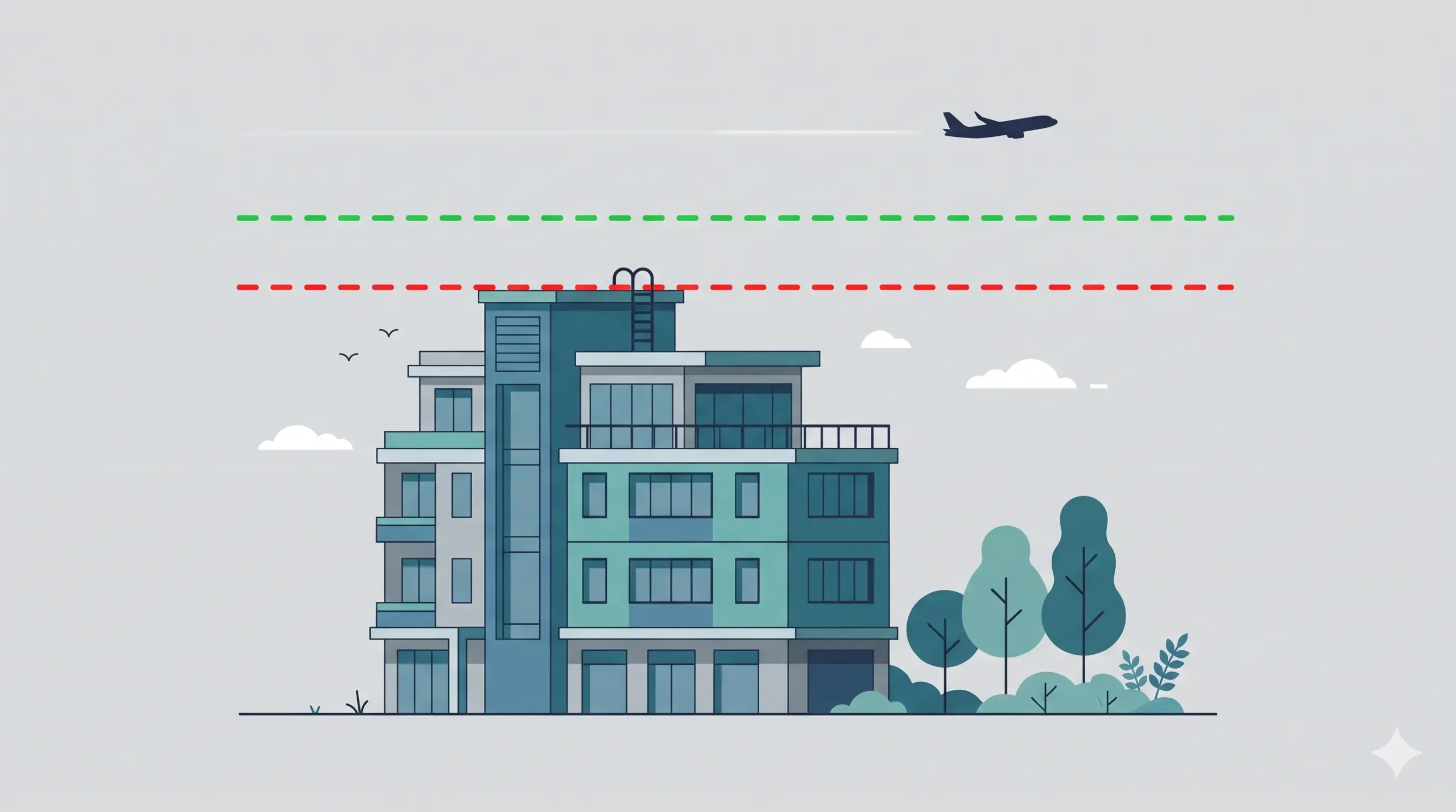
Suppose your plot is within an IFR airport’s zone, where a CCZM exists.
- Site elevation: 215.40 m AMSL (highest point of the plot)
- Planned building height: 30 m AGL
- Top elevation: 215.40 + 30 = 245.40 m AMSL
Now compare with the PTE for your grid:
- If PTE is 260 m AMSL: 245.40 is below 260, so no AAI NOC is needed. Your local body approves the plan and certifies the height on the sanction plan.
- If PTE is 240 m AMSL: 245.40 exceeds 240, so you need an AAI NOC. To avoid it, the maximum height would be 240 − 215.40 = 24.6 m AGL.
This is an example only. Always use the PTE for your own coordinates.
Structure-Specific Checks
Different structures face the same test, but each has its own details:
- Buildings and extra floors: use the steps above. For an alteration, AAI asks for a copy of the earlier NOC. See building height clearance AAI NOC and our guide to building height restrictions near airports.
- Mobile and telecom towers: AAI has its own auto-settle rules for masts filed through SACFA. Read mobile tower airport NOC rules.
- Solar projects: panels are low, but poles, inverters and transmission lines can matter. See solar power project AAI NOC and solar farm height clearance.
- Wind turbines: blade tip height counts. See wind turbine and windmill AAI NOC and wind turbine height limits near airports.
- Chimneys, hoardings, poles and power lines: covered by the same rules. Overhead high-tension lines are not permitted within 1,500 m of the inner edge of the approach and take-off climb surface.
Special Cases That Change the Answer
Military airfields. AAI NOCAS handles civil aerodromes. A site near an Air Force, Army or Navy airfield needs clearance from the defence authority, and a site near a defence establishment can need a separate local military authority NOC. Read defence IAF height clearance NOC, defence NOC in India and NOC from local military authority for construction.
Both civil and defence zones. Some cities have both. You may need more than one clearance.
Existing NOC. If you already hold an NOC and want more height, file a review application. Do not build above the elevation stated in your NOC.
If the Checklist Says “Yes”: What Happens Next
- Get a certified survey with WGS-84 coordinates and AMSL elevation. AAI requires elevation within 0.5 m and position within 3 m. See how an AMSL elevation certificate is prepared.
- Collect the documents required for airport NOC.
- File online by following the NOCAS portal application process. Our NOCAS application documentation page has the checklist.
- Track the file. AAI’s circular sets a maximum of 15 working days from receipt. See the AAI NOC approval timeline for real-world expectations.
The standard height NOC has no application fee, and the certificate is valid for 8 years from issue.
Mistakes That Make the Checklist Wrong
- Comparing floors or AGL height with an AMSL limit
- Using Google Maps elevation instead of a surveyed value
- Forgetting rooftop structures such as tanks and antennas
- Measuring distance from the runway or boundary instead of the ARP
- Assuming a neighbour’s approved height applies to your plot
- Treating a municipal permit as a substitute when your height exceeds the PTE
Many rejections come from these errors. See airport NOC rejection reasons and the legal background in GSR 751(E) airport NOC rules. Also note that AAI NOC and DGCA clearance are different, explained in AAI NOC vs DGCA clearance.
Check Your City
Rules are national, but airports and zoning maps differ. Start with your city page: Delhi NCR, Mumbai, Bengaluru, Pune, Nagpur, Indore, Patna or Guwahati. Our full range is on the airport NOC survey services in India page.
Frequently Asked Questions
How do I know if an AAI NOC is required for my plot?
Check the distance from the airport’s ARP, convert your height to AMSL, and compare it with the permitted top elevation for your coordinates on the CCZM or NOCAS. If it exceeds the limit, an NOC is required.
Is an AAI NOC required for a small house?
It depends on location and elevation, not building size. A house inside the zone whose top elevation exceeds the permitted level needs an NOC.
My plot is 25 km from the airport. Do I need an NOC?
For a VFR airport, a site beyond 20 km and under 150 m AGL is auto-settled. For an IFR airport, 56 km is the relevant distance, so a plot at 25 km is still inside the zone.
Can I check without registering on NOCAS?
Yes. NOCAS provides an approximate top elevation tool that needs no login, but the result is indicative only.
Is municipal approval enough?
Only if your height is within the CCZM permitted top elevation and the site is not in a compulsory-NOC area. Otherwise, you also need an AAI NOC.
Do I need a new NOC to add a floor?
If the new top elevation exceeds the permitted level or your existing NOC, yes. For alterations, AAI asks for a copy of the earlier NOC.
What is an auto-settle letter?
A system-generated, unsigned letter from AAI stating that an NOC is not required for your application. Keep it with your records.
Not Sure What Your Result Means?
Send your plot location and planned height, and our team will confirm the result in writing. Visit Surveying India or contact us. You can also verify rules on the Airports Authority of India website and the Ministry of Civil Aviation site.
Last updated: 28 October 2026. This checklist is for planning. The permitted height for your site is the one stated in your NOC or AAI’s assessment.