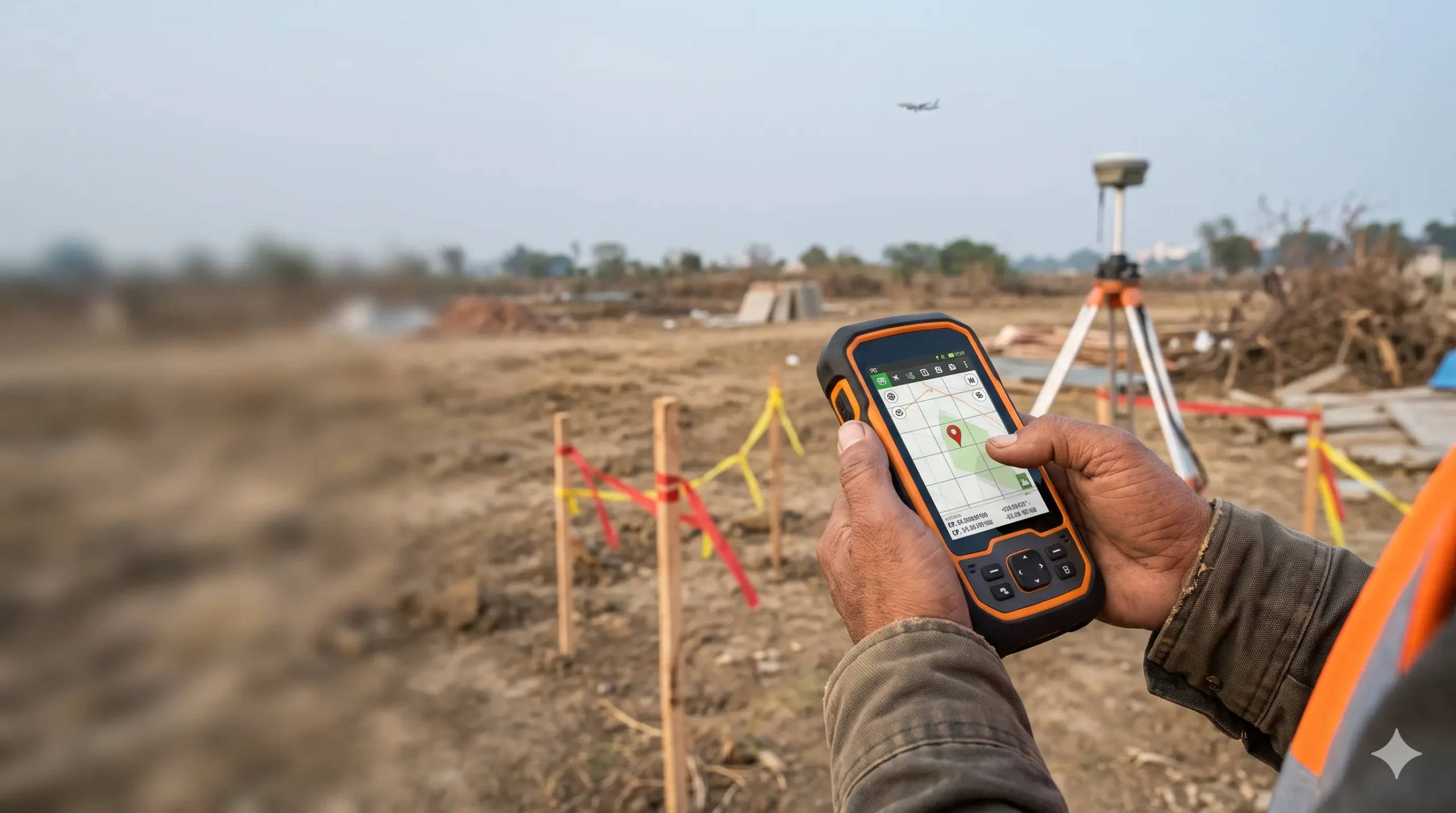
Wrong coordinates or elevation can get your AAI NOC rejected, or make an issued NOC null and void later. AAI calculates your permitted height from the data you submit, so one error can undo the approval. Here are the common mistakes and fixes, starting with a proper site elevation survey for airport NOC.
Quick Answer
- AAI uses your WGS-84 coordinates and site elevation (AMSL) as the basis for the permissible top elevation.
- If the data differs from the actual site, AAI’s terms say the assessment becomes invalid, and a coordinate mismatch makes it null and void.
- The fix is a certified survey with correct datum, all corners, the highest point and the accuracy AAI requires: 0.5 m for elevation and 3 m for position.
Why These Two Numbers Decide Everything
NOCAS calculates the Permissible Top Elevation (PTE) automatically from the site coordinates, using AAI’s aerodrome, navigation-aid and instrument-procedure criteria. The coordinates tell the system where your site is relative to the runway, approach paths and navigation aids. The elevation tells you how much height above the ground that limit leaves you. For the basics, read what is AAI NOC and who needs it.
In the CCZM method, the maximum height above ground is the PTE minus your site elevation. So an elevation error moves your allowed height directly, as explained in the colour coded zoning map (CCZM) guide.
What AAI Actually Requires
| Requirement | AAI rule |
|---|---|
| Datum | WGS-84 for coordinates |
| Format | DD MM SS.s (degrees, minutes, seconds to one-tenth of a second) |
| Position accuracy | Within 3 m |
| Elevation | Metres AMSL, accuracy 0.5 m |
| Plot above 300 sq m | Coordinates and elevation of all corners, plus the point nearest the airport |
| Plot 300 sq m or less | One coordinate: the nearest point to the airport |
| Triangular plot | Minimum four coordinates, the fourth on the side facing the airport |
| Highest point | If higher than the corners, its elevation must also be entered |
| Who can certify | Survey of India, CPWD or State PWD, government-authorised agencies, Railways or MES, aerodrome operators, or licensed surveyors, architects and engineers authorised by the local body |
These come from AAI’s ATMC 6 of 2017. Our documents required for airport height clearance NOC page lists the full paperwork.
What Happens When the Data Is Wrong
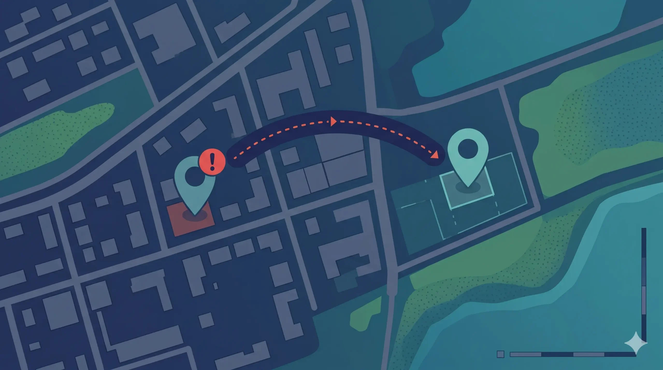
AAI’s own letters spell out the consequences. A system-generated assessment issued by AAI states three conditions that matter here:
- The site elevation and coordinates provided by the applicant are used for the calculation. If the actual data differs, the assessment becomes invalid.
- AAI plots your coordinates on street-view and satellite maps. The applicant or owner must ensure the plotted point matches the site. If there is a discrepancy, the assessment is treated as null and void.
- The airport operator or a representative may visit the site to confirm compliance.
The Undertaking 1A you sign adds that the NOC will be null and void if the submitted details differ from the actual, and that the coordinates must cover all plot or survey numbers in the application. The authorisation part also makes the owner responsible for the data and indemnifies AAI against losses from incorrect information.
So there are two failure points:
- Before the NOC: the application is rejected or sent back. See airport NOC rejection reasons.
- After the NOC: the NOC loses its protective value. This is the more expensive failure, because construction may already be under way.
10 Common Coordinate and Elevation Errors
| # | Error | Why it fails | Fix |
|---|---|---|---|
| 1 | Coordinates in a local datum or UTM, not WGS-84 | The point lands in the wrong place | Convert to WGS-84 and cross-check on a map |
| 2 | Decimal degrees typed as DD MM SS | A small digit slip shifts the point by kilometres | Recompute in DD MM SS.s and verify |
| 3 | Latitude and longitude swapped | The pin falls in a different region | Check N and E labels against the location |
| 4 | Elevation taken from Google Earth or a web map | Not a surveyed AMSL value | Get a certified survey |
| 5 | GNSS ellipsoidal height used as AMSL | The two differ by tens of metres in India | Apply a geoid correction or tie to a benchmark |
| 6 | One point for a plot above 300 sq m | All corners are required | Add every corner and the nearest point |
| 7 | Highest point missing | AAI uses the maximum site elevation | Survey and enter the highest ground point |
| 8 | Coordinates miss part of the land | Undertaking says they must cover all plot numbers | Include every CTS or survey number |
| 9 | Certificate from an unauthorised source | Not an accepted certifier | Use an authorised agency or licensed professional |
| 10 | Application, drawings and certificate disagree | The data is inconsistent | Reconcile all three before filing |
A Simple Example (Illustrative Numbers)
Assume your grid’s permitted top elevation is 240 m AMSL, and the true ground level at the highest point is 215.40 m AMSL.
- Correct data: allowed height above ground = 240 − 215.40 = 24.6 m.
- Elevation entered 5 m too low (210.40 m): the plan appears to allow 240 − 210.40 = 29.6 m. You design a 29.6 m building, which tops out at 245 m AMSL, 5 m above the limit.
If the coordinates are wrong instead, the limit itself changes, since the permitted elevation depends on your position relative to the runway and approach paths. Near approach areas, it varies with distance from the runway end. These numbers are examples only.
Elevation Mistakes That Fool Even Careful Teams
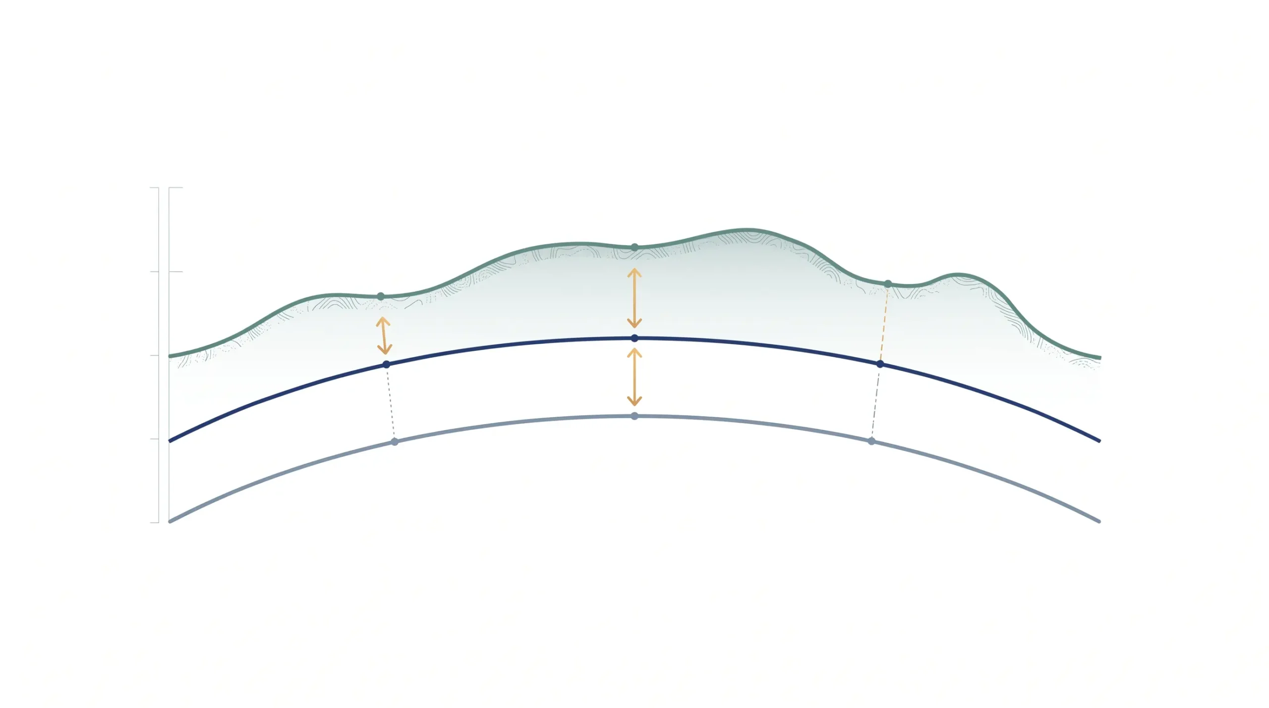
Ellipsoidal vs AMSL height. Survey-grade GNSS gives height above a mathematical ellipsoid, not above mean sea level. In India the difference between the two can be tens of metres. A proper survey applies a geoid model and checks it against a known benchmark. See how an AMSL elevation certificate is prepared.
Wrong ground reference. Roads, basements and plinth levels are all different from natural ground level at the highest point of the plot.
Rooftop items. Overhead tanks, antennas and lightning arresters must stay within the permitted top elevation, per Undertaking 1A. The top elevation needs the same 0.5 m accuracy as site elevation.
Pre-Filing Verification Checklist

- Confirm the datum is WGS-84 and the format is DD MM SS.s.
- Plot every coordinate on a satellite map and check it sits on your plot.
- Confirm the N and E labels and that latitude and longitude are not swapped.
- Check that corner coordinates cover all survey or CTS numbers.
- Include the nearest-to-airport point and the highest ground point.
- Verify the elevation is AMSL, not ellipsoidal or from a web map.
- Match the survey, drawings and application data line by line.
- Check that the certifier is on AAI’s accepted list and the certificate follows the standard NOCAS format.
You can also confirm your distance zone with the VFR vs IFR airport NOC distance zones guide, and quickly test applicability using the 5-minute AAI NOC required checklist.
If You Find an Error After Filing or After the NOC
Before the NOC is issued: correct the data and respond point by point. Use the formats in our AAI NOC objection reply guide.
After the NOC is issued: stop work above the level you are sure about, get a fresh certified survey, and write to the concerned AAI NOC office with the corrected data. AAI’s circular does not describe a separate correction procedure, so a fresh or revised assessment may be needed. A review (once only) or appeal may apply if the height itself is in dispute. Never build on the assumption that an old NOC covers wrong data.
If your site is near a military airfield, remember that defence clearance is separate. See defence IAF height clearance NOC, defence NOC in India, NOC from local military authority for construction and defence NOC vs AAI NOC.
Why Hire a Qualified Surveyor
A DGPS or RTK survey tied to a benchmark gives repeatable coordinates and a defensible elevation, with a certificate in the format AAI expects. It also helps in structure-specific cases, such as building height clearance AAI NOC, mobile tower airport NOC rules, solar power project AAI NOC and wind turbine and windmill AAI NOC. For the filing steps, follow the NOCAS portal application process and check the AAI NOC approval timeline. For legal background, see GSR 751(E) airport NOC rules and AAI NOC vs DGCA clearance.
Frequently Asked Questions
Can wrong coordinates make an AAI NOC void?
Yes. AAI’s assessment terms state that if the plotted coordinates do not correspond to the site, the assessment is treated as null and void.
What accuracy does AAI require?
Elevation within 0.5 m AMSL and coordinates in DD MM SS.s with position accuracy within 3 m.
Can I use Google Earth elevation?
No. AAI asks for a certified site elevation from an authorised certifier. Web map elevations are not surveyed AMSL values.
Do I need coordinates for every corner of my plot?
For plots above 300 sq m, yes: all corners plus the point nearest the airport. For smaller plots, one coordinate at the nearest point is enough.
Which elevation does AAI use if my plot slopes?
The maximum site elevation of the plot, so enter the highest point if it is above the corner levels.
Who can certify coordinates and elevation?
Survey of India, CPWD or State PWD, authorised government agencies, Railways or MES, aerodrome operators, or licensed surveyors, architects and engineers authorised by the local body.
What if I already built and the data was wrong?
Get a fresh certified survey and write to the concerned AAI NOC office. Take legal advice if you have received a notice.
Get Your Data Checked Before You File
Send us your plot location and the figures you plan to submit, and we will check them against AAI’s requirements before you file. Visit Surveying India or explore our airport NOC survey services in India. We work in Delhi NCR, Mumbai, Bengaluru, Pune and Lucknow. Verify current rules on the NOCAS FAQ, the Ministry of Civil Aviation website and, for datum and benchmarks, Survey of India.
Last updated: 29 October 2026. This article is for guidance and does not replace AAI’s rules or your NOC letter.