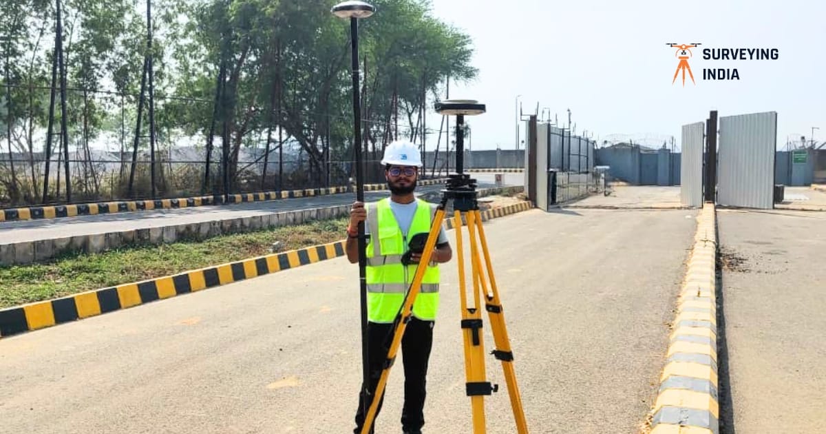
Everything you need to know about topographic surveys in India — process, uses, and how to read a topo map.
Prior to constructing anything on a plot of land, it is crucial to be aware of one key factor: the physical appearance of the land. This pertains to its actual state, rather than just its depiction on paper. This is where a topographic survey comes into play.
A topographic survey, also known as a topo survey, documents the precise contour of a plot of land, including its elevation, incline, dips, and all natural or artificial elements present on the site. This is a crucial tool utilized by construction companies, architects, and government agencies throughout India to prepare for any building or land development endeavor.
Learn all about topographic surveying and mapping in simple terms with this guide. No advanced degree in engineering is required.
What Is a Topographical Survey?
A topographical survey is a detailed measurement of a land’s shape, elevation, and features such as hills, slopes, trees, roads, and drains — shown on a map using contour lines. It helps engineers, architects, and planners understand the natural layout of land before designing a building, road, or drainage system. In India, it is a mandatory first step for most large construction and infrastructure projects.
What Is a Topographical Survey, Explained Simply
Think of a topographic survey as a 3D photograph of land, turned into a 2D map.
A normal land survey tells you the boundary of a plot — where it starts and ends. A topographical survey goes one step further. It tells you:
- How high or low different parts of the land are
- Where the slopes rise and fall
- Where trees, poles, drains, wells, or existing structures sit
- How rainwater will naturally flow across the land
This is the topographical survey meaning in one line: it is a map that shows the true shape of land, not just its outer boundary.
If someone asks what is a topographical survey in everyday terms — it is the document that tells you exactly what you are building on, before you build.
Why Topographic Surveys Matter Before Construction or Land Planning
Omitting this stage is a costly blunder that developers should avoid.
Topographic Survey Data Prevents Design Mistakes
An architect designing a building on a sloped plot in Lucknow or a hilly plot in Shimla needs to know the exact ground levels first. Without this data, foundation depth, retaining walls, and drainage design are all guesswork.
Topographic Survey Helps Control Flooding
Every city has low-lying pockets that flood every monsoon. A topo survey shows the natural flow of water across a site. Engineers use this to plan drains, culverts, and stormwater systems correctly — instead of finding out during the first heavy rain.
Topo Survey Reports Speed Up Approvals
Municipal bodies and development authorities in India, including agencies working under norms set by the Bureau of Indian Standards (BIS), often require topographic data for layout approvals, especially for larger plots, gated communities, and infrastructure projects. Having accurate survey data ready avoids delays at the approval stage.
Topographic Survey Improves Cost Estimation
Contractors use the survey to estimate how much earth needs to be cut or filled before construction starts. Wrong estimates here directly inflate the project budget.
How a Topo Survey Is Conducted: Instruments and Process
A topographic survey is not done with a single tool. Surveyors combine a few instruments depending on the size and terrain of the site.
Instruments Used in a Topographic Survey
| Instrument | What It Does | Best Suited For |
|---|---|---|
| Total Station | Measures distance, angle, and elevation in one reading | Medium to large plots, urban sites |
| GPS/GNSS Receiver | Captures precise location coordinates using satellites | Large open sites, highways, rural land |
| Auto Level / Dumpy Level | Measures height differences between points | Smaller sites, basic elevation checks |
| Drone (UAV with photogrammetry) | Captures aerial images to build elevation models | Large sites, hilly or hard-to-reach terrain |
Most professional survey teams in India today rely heavily on the Total Station Survey method for accuracy, especially on plots where boundary points and elevation both need to be captured together.
Topo Survey Process, Step by Step
- Site reconnaissance – The surveyor walks the site first to understand its shape, access points, and any obstacles.
- Setting reference points – Fixed points called benchmarks are placed. Every other measurement on the site is compared against these points.
- Data collection – Using a Total Station, GNSS receiver, or drone, the team records thousands of elevation and location points across the site.
- Processing the data – This raw data is processed in survey software to generate a digital elevation model of the land.
- Drawing the map – The final topographic map is drawn with contour lines, spot elevations, and all visible features marked.
This process often overlaps with a Contour Survey, since contour lines are one of the main outputs of any topographic mapping exercise.
How to Read a Topographic Map: Contour Lines and Elevation Explained
This is the part most non-engineers find confusing. It is simpler than it looks.
Contour Lines in a Topographic Survey
A contour line is a line on a map that connects all points at the same height above sea level.
Picture a hill. Now imagine slicing it horizontally at every 1-metre height, like cutting a loaf of bread into thin slices. Each slice, seen from above, becomes one contour line on the map.
Reading Contour Spacing on a Topo Map
- Contour lines close together mean the land is steep at that spot.
- Contour lines far apart mean the land is nearly flat.
- A closed loop of contour lines usually marks a hilltop or a depression, depending on the elevation numbers written on them.
Reading Elevation on a Topographic Map
Every few contour lines carry a number, such as 120 or 125. This number tells you the height at that line, usually in metres above mean sea level. Compare two numbers, and you instantly know which direction is uphill and which is downhill.
Symbols Used in Topographic Surveying
Topographic maps also use standard symbols for trees, buildings, water bodies, roads, and marshland. These symbols are fairly standardised across Indian survey practice, making it easier to compare maps from different regions.
Survey of India’s Topographical Maps: A Public Reference
India has a long history of topographic mapping. The Survey of India, the country’s national mapping agency under the Department of Science and Technology, has been producing topographical maps of the country for over two centuries.
These maps cover the entire country at various scales and are widely used as a public reference for terrain, elevation, and regional planning. While Survey of India’s maps are not a substitute for a site-specific topographic survey, they are a valuable starting point for understanding the broader terrain of a region before a detailed, site-level survey is carried out.
You can explore official map details directly on the Survey of India website.
Topographic Survey vs Other Common Land Surveys
| Survey Type | What It Measures | Typical Use Case |
|---|---|---|
| Topographic Survey | Elevation, contours, natural and man-made features | Pre-construction planning, drainage design |
| Boundary Survey | Legal limits of a plot | Property demarcation, ownership disputes |
| Contour Survey | Elevation shown purely through contour lines | Earthwork estimation, site grading |
| Total Station Survey | Precise distance, angle, and elevation data using one instrument | Detailed engineering surveys, layout work |
Conclusion
A topographic survey is not paperwork. It is the foundation of every safe, well-planned construction project. It tells you the real shape of your land — its highs, lows, slopes, and existing features — before you spend a single rupee on design or construction.
Whether you are building a home, planning a layout, or developing infrastructure, a proper topographic survey protects your investment from costly surprises later. Pairing it with services like a Contour Survey or a Total Station Survey ensures your project starts on accurate, reliable ground data.
Frequently Asked Questions
1. What is a topographical survey used for? It is used to understand the exact shape, elevation, and features of a piece of land before construction, drainage design, or land planning. It helps architects and engineers avoid design errors caused by incorrect assumptions about the land’s slope or height.
2. How long does a topographic survey take in India? For a small residential plot, it can take one to two days. Larger sites, hilly terrain, or projects using drone-based survey methods may take one to two weeks, depending on size and accessibility.
3. What is the difference between a topo survey and a boundary survey? A boundary survey only marks the legal limits of a plot. A topo survey additionally records elevation, slopes, and physical features across the entire site, which a boundary survey does not cover.
4. Are Survey of India maps enough for construction planning? No. Survey of India’s topographical maps are useful as a general reference for regional terrain, but they are not detailed enough for site-specific construction. A dedicated topographic survey of the actual plot is required for accurate design work.
5. Which instrument is most commonly used for topographic surveys today? A Total Station is the most commonly used instrument, since it captures distance, angle, and elevation in a single reading. Drones are increasingly used for larger or hard-to-access sites.