Photogrammetry vs LiDAR: What’s the Difference & Which Does Your Project Need?
Every survey project starts with one question: how do we capture the site accurately? Two technologies dominate this decision today — photogrammetry and LiDAR survey. Both create 3D maps of land, buildings, and infrastructure, but they work in very different ways and suit different jobs. If you pick the wrong one, you can lose weeks and pay for a re-survey. This guide breaks down both technologies in plain language, compares them side by side, and helps you choose the right one for your project.
Quick Answer: Photogrammetry vs LiDAR
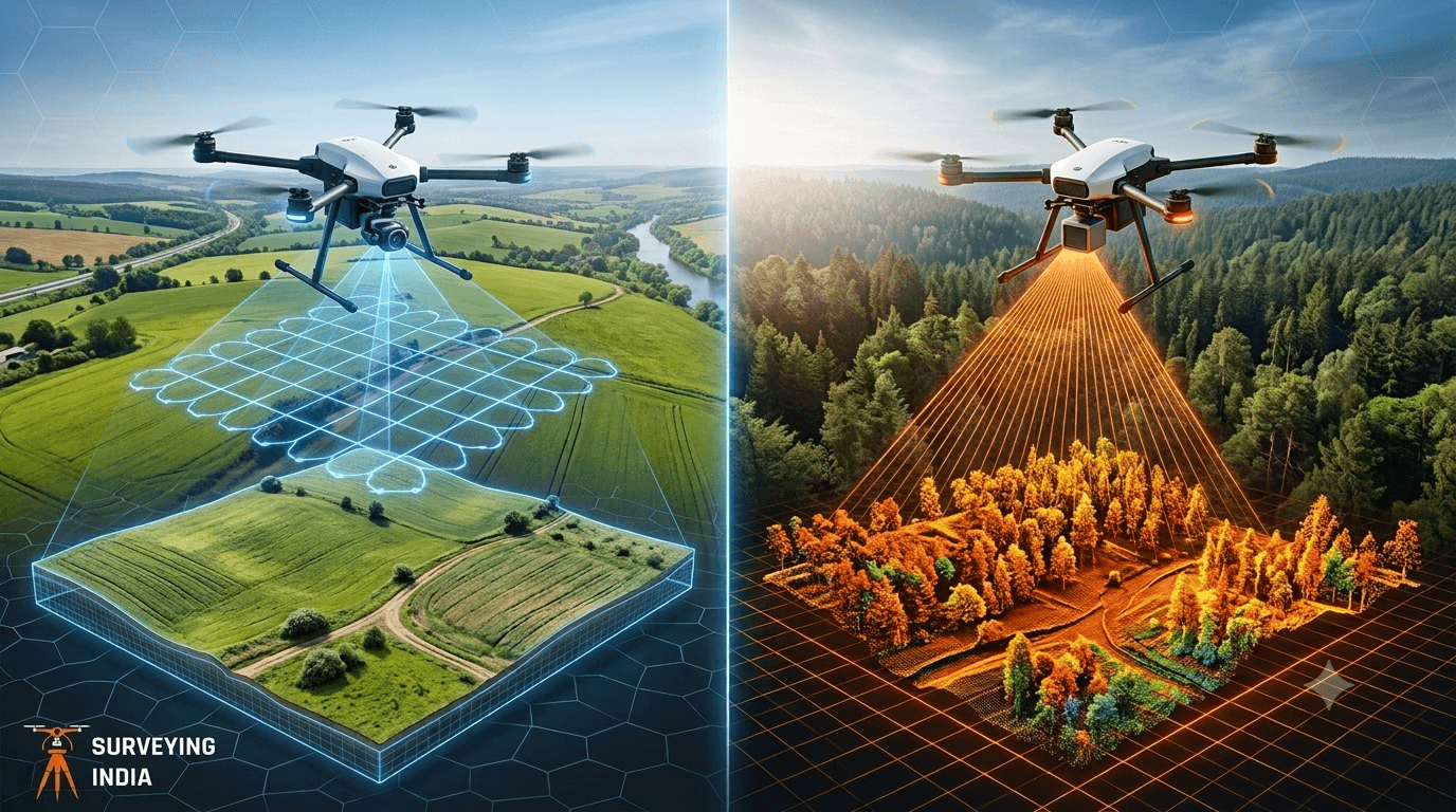
Photogrammetry uses overlapping photos to build 3D models and works best in open, well-lit areas at a lower cost. LiDAR uses laser pulses to measure distance and works better through vegetation, in low light, and where higher accuracy is needed. Choose photogrammetry for visual detail and budget projects; choose LiDAR for dense forests, powerlines, or engineering-grade accuracy.
What Is Photogrammetry? Explained Simply
Photogrammetry is the process of turning overlapping photographs into a 3D map or model. To define photogrammetry in one line: it is the science of measuring real-world objects and distances using photographs taken from multiple angles.
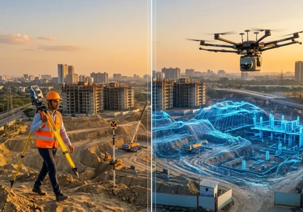
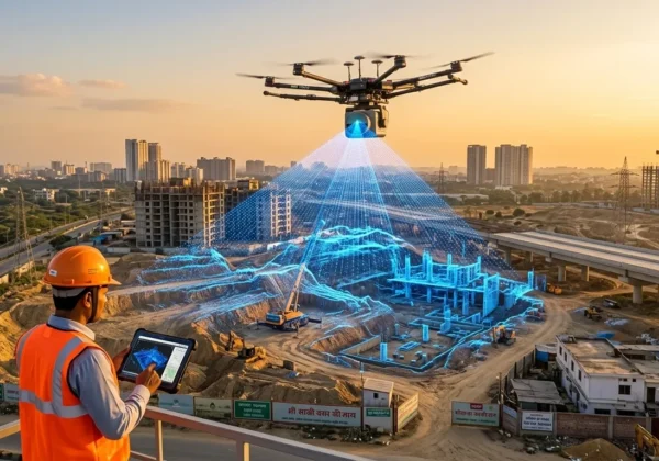
Here’s how it works in practice. A drone flies over a site and takes hundreds or thousands of photos, each overlapping the next by 70-80%. Software then matches common points across these photos — the same rock, corner of a building, or tree — and calculates their exact position in 3D space. The result is a detailed, photo-realistic model called an orthomosaic or a 3D mesh.
Drone photogrammetry has become the standard method for this because drones can cover large areas quickly and cheaply compared to older ground-based photo surveys. A single drone flight can map 50-100 acres in a couple of hours, depending on the camera and altitude.
Why Photogrammetry Is Popular
Photogrammetry gives you real visual texture — actual colours, textures, and surface detail — not just points in space. This is why it is widely used for:
- Land parcel mapping and boundary documentation
- Construction progress monitoring
- Mining volume calculations
- Agricultural land assessment
- Visual documentation for real estate and infrastructure projects
The industry standard body for this field, the American Society for Photogrammetry and Remote Sensing (ASPRS), publishes accuracy standards that most professional survey firms in India and globally follow when reporting positional accuracy.
What Is LiDAR and How Does It Work? Explained Simply
LiDAR stands for Light Detection and Ranging. Unlike photogrammetry, LiDAR does not rely on photos at all. Instead, it fires out laser pulses — thousands per second — and measures how long each pulse takes to bounce back after hitting a surface.
So how does LiDAR work in plain terms? Think of it like an extremely fast, extremely precise version of an echo. The sensor sends a laser beam, the beam hits the ground, a tree, or a building, and bounces back. The sensor calculates the distance based on the time the beam took to return. Millions of these distance readings, taken together, form what’s called a “point cloud” — a 3D map made entirely of measured points.
A lidar sensor for drone use is typically mounted underneath the aircraft, spinning or scanning as the drone flies. This setup is called a lidar drone, and it is now common for infrastructure corridor mapping, forestry, and power-line surveys across India.
Why LiDAR Stands Out
The biggest advantage of LiDAR is that laser pulses can pass through small gaps — like gaps between leaves in a forest canopy — and still return a ground reading. This means LiDAR can “see through” vegetation far better than a camera ever could. It also works in poor light or even at night, since it does not depend on ambient sunlight the way photogrammetry does.
This is why LiDAR Survey work is the preferred method for forested terrain, riverbank corridors, and power transmission line mapping, where photogrammetry would miss the actual ground surface hidden under tree cover.
Photogrammetry vs LiDAR: Side-by-Side Comparison
| Factor | Photogrammetry | LiDAR |
|---|---|---|
| Accuracy | Good (2-5 cm with ground control points) | Excellent (down to 1-3 cm, even in complex terrain) |
| Cost | Lower — standard drone and camera needed | Higher — specialised lidar sensor and processing required |
| Performance in low light | Poor — needs good daylight and consistent lighting | Strong — works in shadows, overcast weather, even at night |
| Performance through vegetation | Weak — cannot see the ground under tree canopy | Strong — laser pulses penetrate gaps in foliage to hit bare earth |
| Typical use case | Land parcels, construction sites, mining volumes, real estate documentation | Forests, power-line corridors, highways, flood mapping, engineering-grade digital terrain models |
A clear rule of thumb: photogrammetry gives you a better-looking model for less money, while LiDAR gives you a more reliable ground measurement in difficult terrain.
Decision Guide: When to Choose Photogrammetry vs LiDAR
Choose Photogrammetry When:
- Your site is open, flat, and has clear visibility (no dense trees or thick cover)
- You need photo-realistic visual output for reports, marketing, or client presentations
- Budget is a primary constraint
- The project involves land parcels, urban plots, construction sites, or open mining pits
- You need volumetric calculations for stockpiles or earthworks in exposed areas
Choose LiDAR When:
- The site has dense vegetation, forest cover, or tree canopy hiding the true ground level
- You are mapping power transmission lines, railway corridors, or highway alignments where vegetation and structures overlap
- The project requires engineering-grade accuracy for design or construction stakeout
- Time on-site is limited and low-light or early-morning flights are unavoidable
- You need a precise digital terrain model (DTM) for flood modelling, drainage design, or slope analysis
When You Might Need Both
Many large infrastructure and smart-city projects now combine both methods: photogrammetry for visual context and surface detail, and LiDAR for accurate ground elevation under cover. This hybrid approach is increasingly standard on projects that also require 3D laser scanning services for as-built documentation of existing structures, or a full digital twin delivered through our 3D Virtual Reality service.
If your project falls in the National Capital Region, our full LiDAR survey process guide for Delhi NCR covers site-specific permissions, flight planning, and local regulatory steps in detail — you can read it here: our full LiDAR survey process guide for Delhi NCR.
LiDAR Cost: What Affects the Price
Lidar cost varies more than most first-time clients expect, because several factors stack together. The main cost drivers are:
1. Sensor Grade
Survey-grade lidar sensors used for engineering projects cost significantly more to operate than lower-density sensors used for basic terrain mapping. Higher point density and better accuracy always raise the price.
2. Area and Terrain Difficulty
Larger areas reduce the per-acre cost, but difficult terrain — steep slopes, dense forest, or restricted airspace — increases flight time and processing effort, which raises the total cost.
3. Point Cloud Density Required
Projects needing very high point density (for detailed engineering design) cost more than projects needing a general terrain model for planning purposes.
4. Data Processing and Deliverables
Raw point clouds need classification, ground filtering, and conversion into usable formats like contour maps, DTMs, or CAD files. More deliverable formats mean more processing time and cost.
5. Regulatory and Flight Permissions
In India, drone operations for lidar drone surveys must comply with the Directorate General of Civil Aviation (DGCA) drone rules, including pilot certification and airspace clearance in controlled zones. Projects near airports, defence installations, or restricted zones may need additional permissions, which can add time and cost to the project timeline.
As a general rule, LiDAR surveys cost more per acre than photogrammetry surveys, but they save money later by avoiding re-surveys in areas where photogrammetry alone cannot produce a reliable ground model.
Which One Should You Choose?
There is no single “better” technology — only the right one for your site conditions and project goals. Photogrammetry is the practical, cost-effective choice for open, visible terrain where visual detail matters. LiDAR is the reliable choice when vegetation, low light, or engineering accuracy demands are non-negotiable. Understanding this difference before you commission a survey is the single best way to avoid delays, budget overruns, and inaccurate data.
At Surveying India, our teams assess site conditions first and recommend photogrammetry, LiDAR, or a hybrid approach based on what your project actually needs — not a one-size-fits-all package.
Frequently Asked Questions
Is LiDAR more accurate than photogrammetry? In most real-world conditions, yes. LiDAR typically delivers higher accuracy, especially on vegetated or complex terrain, because it measures distance directly with lasers rather than calculating it from photo angles.
Can photogrammetry work under tree cover? No, not reliably. Cameras can only capture what they can see, so dense canopy blocks the ground from view. LiDAR is the better choice for any site with significant tree or vegetation cover.
Why is LiDAR more expensive than photogrammetry? LiDAR requires a specialised laser sensor, which costs more than a standard survey camera, and the data processing is more complex. This higher equipment and processing cost is passed on as a higher per-acre survey price.
Do I need a drone for both photogrammetry and LiDAR? Yes, in most modern surveys both methods are drone-based. A drone photogrammetry setup uses a standard high-resolution camera, while a lidar drone carries a dedicated lidar sensor mounted on the aircraft.
Which technology is better for construction site monitoring? Photogrammetry is usually sufficient for open construction sites since it is faster and cheaper, and it also provides useful visual documentation. LiDAR becomes necessary if the site has dense vegetation, overlapping structures, or requires very high elevation accuracy for engineering work.
Surveying India provides professional LiDAR survey, drone photogrammetry, and 3D laser scanning services across India. Contact our team to discuss which technology is right for your next project.