Mining Drone Survey & LiDAR Scanning Services in India
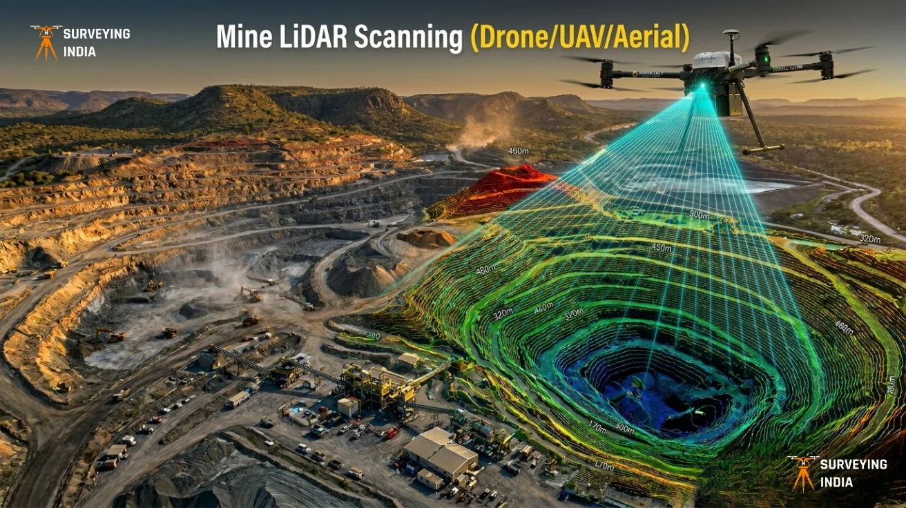
Surveying India provides professional mining drone survey and LiDAR scanning services across India for open-cast mines, coal mines, limestone quarries, metal mining operations, and mineral exploration projects. Our UAV-based LiDAR surveys deliver centimetre-level accuracy for mine planning, stockpile volume measurement, progress monitoring, and environmental compliance — faster and safer than any traditional survey method.
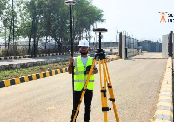
Trusted by 500+ clients across India with 800+ successfully completed drone survey projects, we are one of the most experienced DGCA-compliant UAV survey teams in the country — serving major mining belts across Jharkhand, Odisha, Chhattisgarh, Rajasthan, Madhya Pradesh, and Karnataka.
Get a free project quote → Contact Us
What Is Mining LiDAR Scanning?
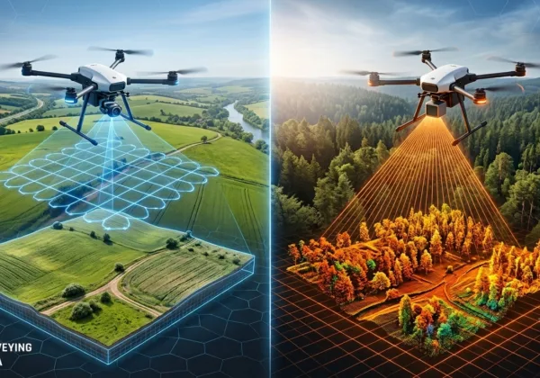
Mining LiDAR scanning is a remote sensing technology that fires millions of laser pulses per second from a drone-mounted sensor to build an exact 3D model of any mining site. Unlike photogrammetry, LiDAR penetrates vegetation and surface cover to capture true ground elevation — critical for accurate cut-and-fill calculations, haul road design, and pit slope monitoring.
When mounted on a UAV, LiDAR systems can survey hundreds of hectares in a single flight, producing point cloud data accurate to ±2–5 cm horizontally and ±3 cm vertically (subject to ground control point density and flight altitude).
Why Choose Drone-Based LiDAR Survey Over Traditional Methods?
Feature Drone LiDAR Survey Total Station / GPS Aerial Photogrammetry Accuracy ±2–5 cm ±1–3 cm ±5–10 cm Survey speed (100 ha) 1–2 days 7–14 days 2–4 days Works through vegetation Yes No No Hazardous area access Yes (remote) No Partial 3D point cloud output Yes No Yes Cost for large areas Low High Medium Drone LiDAR is the only method that combines high accuracy, full vegetation penetration, and safe remote operation in one workflow — making it the preferred choice for active mining environments.
Our Mining LiDAR Survey Services
Topographic Survey and Terrain Mapping
High-resolution topographic surveys for mine planning, expansion, haul road design, and land acquisition. We deliver Digital Terrain Models (DTM) and Digital Surface Models (DSM) with contour intervals as fine as 0.5 m, suitable for engineering-grade mine design software.
Stockpile Volume Measurement
Accurate volumetric calculations for coal, iron ore, limestone, aggregates, and all raw material stockpiles. Our stockpile surveys are repeatable to within 1–2% of true volume, making them reliable for inventory audits, dispatch reconciliation, and production reporting.
Mine Progress Monitoring
Periodic drone surveys (monthly, quarterly, or on-demand) to track excavation progress, compare actual versus planned extraction, and generate production volume reports. All data is geo-referenced and comparable across survey dates.
3D Mine Mapping and Pit Monitoring
Detailed 3D point cloud models of open pits, benches, ramps, and waste dumps. Identify slope instabilities, monitor bench geometry, and document site conditions for safety and regulatory compliance.
Digital Terrain Models (DTM) and Digital Surface Models (DSM)
Precision terrain datasets exported in formats compatible with AutoCAD, Civil 3D, Surpac, Datamine, QGIS, and ArcGIS. Contour maps, cross-sections, and longitudinal profiles available as standard deliverables.
Geological and Environmental Assessment
LiDAR-derived terrain data for geological mapping, drainage analysis, erosion monitoring, and environmental impact assessment. Supports mine closure planning and land rehabilitation documentation.
Mine Infrastructure Inspection
Efficient drone inspection of haul roads, drainage channels, conveyors, crushing plants, rail networks, and site perimeter fencing — without shutting down operations or exposing inspection teams to risk.
Survey Deliverables
Every mining LiDAR survey project from Surveying India includes:
- Topographic maps (PDF and CAD format)
- Contour maps (0.5 m, 1 m, or 2 m interval)
- Orthomosaic images (GeoTIFF, up to 2 cm/pixel resolution)
- 3D point cloud data (LAS / LAZ format)
- Digital Terrain Model — DTM (GeoTIFF / ASCII grid)
- Digital Surface Model — DSM (GeoTIFF / ASCII grid)
- Stockpile volume reports (Excel / PDF with method statement)
- CAD drawings (DWG / DXF)
- GIS-compatible datasets (Shapefile, KML, GeoJSON)
- Mine progress comparison reports
All deliverables are provided within the agreed project timeline with a full data quality report.
Applications of LiDAR Survey in Mining
Our mining drone survey services are used across all major mining sectors in India:
- Open-cast mine survey and planning
- Coal mine mapping and volume monitoring
- Limestone and cement quarry survey
- Iron ore and metal mining operations
- Aggregate, granite, and stone quarry mapping
- Stockpile inventory management and reconciliation
- Pit slope monitoring and stability analysis
- Mine expansion and feasibility planning
- Environmental compliance and rehabilitation monitoring
- Geological exploration and resource estimation support
States and Mining Regions We Serve
Surveying India operates pan-India with active project experience in all major mining belts:
Jharkhand — Dhanbad coal belt, Singhbhum iron ore, Bokaro, Hazaribagh
Odisha — Keonjhar iron ore belt, Sundargarh, Angul coal, Talcher
Chhattisgarh — Korba coalfields, Bailadila iron ore, Raigarh, Bilaspur
Rajasthan — Udaipur zinc, Barmer, Jodhpur limestone, Alwar granite
Karnataka — Bellary iron ore, Chitradurga, Tumkur quarries
Madhya Pradesh — Singrauli coal, Jabalpur, Balaghat manganese
Maharashtra, Telangana, Andhra Pradesh, Gujarat — on request
If your project site is not listed above, contact us — we mobilise to any location across India within 5–7 working days.
Why Mining Companies Choose Surveying India
DGCA-Certified Drone Operations All our drone operations are conducted under DGCA compliance with fully licensed Remote Pilot Certificate (RPC) holders and registered UAVs — essential for operating over active mining and industrial sites.
Industry-Grade LiDAR Sensors We use industry-grade LiDAR sensors and UAV platforms paired with dual-frequency GNSS receivers for maximum accuracy and reliability on every project.
Experienced Mining Survey Team Our team includes licensed surveyors, GIS analysts, and mining engineers with hands-on experience across coal, iron ore, limestone, and aggregate operations.
Fast Turnaround Standard deliverables within 5–7 working days of data capture. Urgent reporting available within 48–72 hours for stockpile and progress monitoring requirements.
Competitive and Transparent Pricing Survey costs are calculated based on site area, required accuracy, deliverable set, and mobilisation distance. Every project is unique — contact us for a free customised quote tailored to your specific requirements. We typically respond within 24 hours.
End-to-End Service From flight planning and DGCA permissions to data processing, quality checking, and final deliverable handover — we manage the complete project with one point of contact.
Frequently Asked Questions
What is a mining drone survey and how does it work? A mining drone survey uses a UAV (unmanned aerial vehicle) carrying either a LiDAR sensor or a photogrammetry camera to capture detailed aerial data of a mining site. The drone flies a pre-planned grid pattern over the site, collecting millions of measurement points. This raw data is then processed using specialist software to produce topographic maps, 3D models, volumetric reports, and other survey outputs. The entire process — from flight to final deliverable — typically takes 3–10 days depending on site area and complexity.
How accurate is LiDAR surveying for mining applications? Our drone LiDAR surveys achieve ±2–5 cm horizontal accuracy and ±3 cm vertical accuracy under standard conditions, using ground control points (GCPs) for georeferencing. This level of accuracy is sufficient for stockpile volume calculations, mine design, progress monitoring, and regulatory reporting. For projects requiring sub-centimetre accuracy, we recommend a hybrid approach combining LiDAR with RTK ground control.
How much does a mining drone survey cost in India? Survey costs vary based on site area, terrain complexity, required accuracy, and mobilisation distance. Rather than a fixed price list, we provide free project-specific quotations within 24 hours of receiving your project details. Contact us with your site location and area to get an accurate estimate.
Can LiDAR accurately measure stockpile volumes? Yes. LiDAR is one of the most accurate technologies available for stockpile volume measurement. Our surveys are repeatable to within 1–2% of true volume and can distinguish individual stockpiles even when stacked close together. We provide a full volume report with base plane method, cross-section method, and triangulated surface method calculations so you can choose the approach that matches your inventory standards.
How often should a mine be surveyed? Most active open-cast mines in India conduct stockpile and production volume surveys monthly for inventory reconciliation, and comprehensive topographic surveys quarterly or bi-annually for planning purposes. Environmental monitoring surveys are typically annual or tied to compliance submission deadlines. We offer retainer-based survey packages for mines requiring regular periodic surveys.
Is DGCA approval required for mining drone surveys in India? Yes. Under India’s Drone Rules 2021, all commercial drone operations require DGCA-registered UAVs and licensed remote pilots. Operating over active industrial or mining sites may also require additional permissions depending on the airspace category. Surveying India handles all DGCA compliance, flight permissions, and airspace coordination as part of our service — you do not need to manage this separately.
How long does it take to survey a 100-acre mine site? A 100-acre (approximately 40-hectare) mine site can typically be captured in a single drone flight of 1–2 hours. Including mobilisation, ground control setup, flight operations, and data upload, fieldwork is usually completed in one day. Processed deliverables are typically ready within 5–7 working days of data capture.
What file formats do you deliver survey data in? We deliver data in all standard GIS and CAD formats including LAS/LAZ (point cloud), GeoTIFF (rasters and orthomosaics), DWG/DXF (CAD drawings), Shapefile/KML/GeoJSON (vector data), and PDF/Excel (reports). We confirm the required format with each client before the survey begins to ensure full compatibility with your existing software.
Get a Free Quote for Your Mining Survey Project
Tell us your project location, site area, and survey objective — we will respond with a detailed quotation and methodology within 24 hours.
Call / WhatsApp: +91 9871880058
Email: info@surveyingindia.in
Website: www.surveyingindia.inServing mining projects across Jharkhand, Odisha, Chhattisgarh, Rajasthan, Karnataka, Madhya Pradesh, Maharashtra, Telangana, Andhra Pradesh, Gujarat, and all other states in India.
Surveying India — Trusted Mining Drone Survey and LiDAR Scanning Services Across India