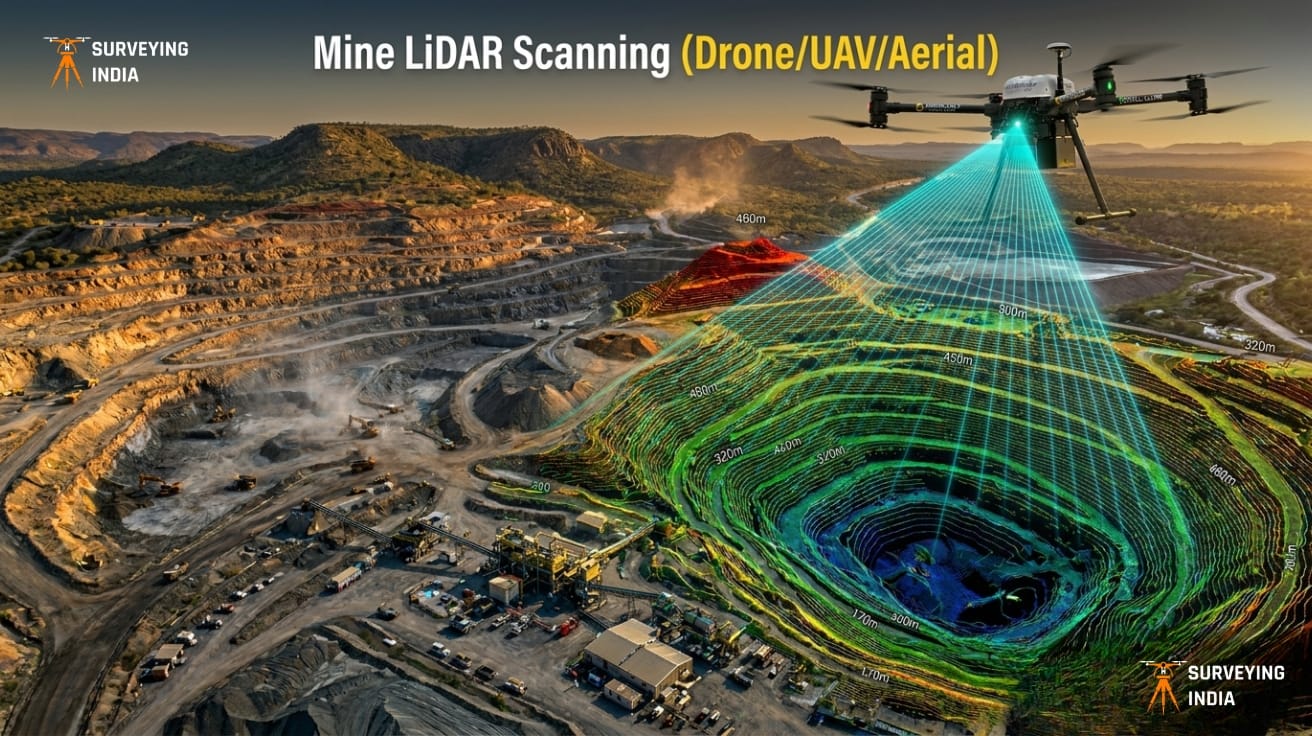
Mining Drone Survey & LiDAR Scanning Services in India Surveying India provides professional mining drone survey and LiDAR scanning services across India for open-cast mines, coal mines, limestone quarries, metal mining operations, and mineral exploration projects. Our UAV-based LiDAR surveys deliver centimetre-level accuracy for mine planning, stockpile volume measurement, progress monitoring, and environmental compliance — […]
Call Now
+91 9871880058
Email
info@surveyingindia.in
Address
144, Netaji Subhash Enclave, Sector 72A, Gurugram, HR-122101