Scan to BIM Services India — 3D Scanning & Point Cloud Solutions
Surveying India provides professional scan to BIM services and 3D scanning point cloud solutions across India for construction, architecture, infrastructure, heritage preservation, and industrial facility projects. With 800+ successfully delivered survey and scanning projects, our team converts real-world structures into highly accurate, software-ready BIM models with millimeter-level precision.
Whether you need as-built documentation for a renovation project, MEP clash detection for a new building, or a complete digital twin of an industrial facility — our end-to-end scan to BIM workflow delivers reliable results compatible with all major BIM platforms.
Get a free project quote → Contact Us
What is Scan to BIM?
Scan to BIM is the process of capturing a real-world structure using a LiDAR 3D scanner, processing the raw scan data into a point cloud, and converting that point cloud into an intelligent Building Information Model (BIM). The resulting BIM model contains accurate geometry, spatial relationships, and component data that can be used for design, renovation, construction management, and facility management.
Unlike traditional manual surveying, 3D scanning captures millions of measurement points simultaneously, producing a complete digital record of the structure as it actually exists — not as it was originally designed.
How Our Scan to BIM Process Works
Step 1 — Site Survey and Scanning Our team visits your site with industry-grade LiDAR scanners and captures a complete 3D scan of the structure — interior, exterior, or both. Scan stations are positioned to ensure full coverage with no data gaps. Typical scan time for a 1,000 sq ft floor is 2–4 hours.
Step 2 — Point Cloud Registration and Processing Raw scan data from all scan stations is registered together into a single unified point cloud using specialist software. The point cloud is cleaned, noise-filtered, and geo-referenced to produce a survey-accurate dataset.
Step 3 — BIM Modelling Our BIM modellers use the registered point cloud as a reference to build the BIM model in Autodesk Revit or the platform of your choice. Architectural elements, structural components, and MEP systems are modelled to your specified Level of Detail (LOD).
Step 4 — Quality Check and Validation Every BIM model is checked against the original point cloud to verify dimensional accuracy. Deviations beyond tolerance are corrected before delivery.
Step 5 — Delivery Final deliverables are handed over in your required format — RVT, DWG, IFC, NWD, or others — along with the point cloud in LAS/LAZ format and a full project report.
Our 3D Scanning and Scan to BIM Services
Scan to BIM Conversion
Convert point cloud data into fully parametric BIM models for any building type — commercial, residential, industrial, institutional, or heritage. Models delivered to LOD 200, LOD 300, or LOD 400 as required.
As-Built Documentation
Create accurate digital records of existing structures for renovation planning, space management, and compliance documentation. Ideal for buildings where original drawings are outdated, missing, or inaccurate.
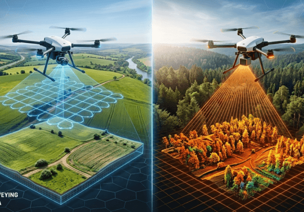
High-Resolution LiDAR Scanning
Indoor and outdoor 3D scanning for buildings, infrastructure, tunnels, bridges, industrial plants, and heritage structures. Accuracy up to ±2 mm depending on scanner type and site conditions.
Structural and MEP Scanning
Capture mechanical, electrical, and plumbing systems in 3D for clash detection, maintenance planning, and facility management. Identify conflicts between structural and MEP elements before construction begins.
Heritage and Historical Site Scanning
Preserve and document architectural heritage using high-resolution 3D scanning. Deliver detailed as-built models and point clouds for conservation planning, restoration work, and archival records.
Industrial Facility Scanning
Complete 3D documentation of factories, power plants, refineries, warehouses, and processing facilities. Supports plant modification planning, equipment installation, and safety inspections.
Floor Plan and Section Generation
Extract accurate 2D floor plans, sections, and elevations directly from point cloud data. Delivered in DWG or PDF format, survey-accurate to ±5 mm.
BIM Software Compatibility
Our scan to BIM deliverables are fully compatible with all major BIM and CAD platforms:
- Autodesk Revit (RVT format)
- AutoCAD (DWG / DXF format)
- Autodesk Navisworks (NWD / NWC format)
- Bentley MicroStation (DGN format)
- ArchiCAD (IFC / PLN format)
- SketchUp (SKP format)
- AVEVA Plant Design
- Open IFC format (compatible with all IFC-supporting platforms)
If your project uses a different platform, contact us — we confirm compatibility before the project begins.
Level of Detail (LOD) We Deliver
| LOD Level | What Is Modelled | Typical Use Case |
|---|---|---|
| LOD 200 | Approximate geometry, size, shape, location | Concept design, feasibility |
| LOD 300 | Precise geometry, exact dimensions, materials | Construction documentation |
| LOD 350 | Full geometry with connection details | Coordination and clash detection |
| LOD 400 | Fabrication-level detail, full specifications | Fabrication and installation |
We confirm the required LOD with every client before modelling begins to ensure the deliverable matches your project requirements.
Industries We Serve
Our scan to BIM and 3D scanning services are used across a wide range of sectors in India:
- Commercial and residential buildings
- Hospitals and healthcare facilities
- Educational institutions and campuses
- Industrial plants and manufacturing facilities
- Heritage and government buildings
- Hotels and hospitality properties
- Retail and shopping complexes
- Infrastructure — bridges, tunnels, metro stations
- Power plants and energy facilities
- Data centres and IT campuses
Why Choose Surveying India for Scan to BIM
800+ Projects Delivered Over 800 successful survey and scanning projects completed across India — making us one of the most experienced 3D scanning and BIM service providers in the country.
Millimetre-Level Accuracy Our LiDAR scanners deliver point cloud accuracy up to ±2 mm, ensuring your BIM model reflects the actual as-built condition of the structure.
DGCA-Certified Operations All drone-based exterior scanning operations are conducted with DGCA-registered UAVs and licensed remote pilots — fully compliant with India’s Drone Rules 2021.
Experienced BIM Team Our team includes certified BIM modellers, licensed surveyors, and LiDAR scanning specialists with hands-on experience across architectural, structural, and MEP disciplines.
All Major Software Formats Deliverables in RVT, DWG, IFC, NWD, LAS, and all other standard formats — no conversion issues with your existing workflow.
Fast Turnaround Standard deliverables within 7–10 working days of site scanning. Urgent delivery available within 3–5 days for smaller projects.
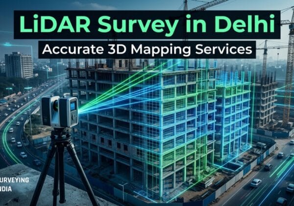
Pan-India Coverage Active project experience in Delhi, Gurgaon, Noida, Mumbai, Bangalore, Hyderabad, Chennai, Pune, Ahmedabad, Kolkata, and all other major cities. We mobilise to any location across India.
Scan to BIM vs Traditional Survey Methods
| Feature | Scan to BIM (LiDAR) | Manual Measurement | Photogrammetry |
|---|---|---|---|
| Accuracy | ±2–5 mm | ±10–20 mm | ±5–10 mm |
| Data completeness | Full 3D capture | Selected points only | Surface only |
| Time for 1,000 sqm | 1 day | 3–5 days | 1–2 days |
| MEP capture | Yes | No | No |
| BIM ready output | Yes | No | Partial |
| Suitable for complex geometry | Yes | No | Partial |
Frequently Asked Questions
What is the difference between a point cloud and a BIM model? A point cloud is the raw 3D scan data — millions of XYZ coordinate points representing the scanned surface. A BIM model is an intelligent parametric model built using the point cloud as a reference, where every element (wall, column, beam, pipe) is a modelled object with dimensions, materials, and properties. The point cloud is the measurement; the BIM model is the deliverable used for design and construction.
How accurate is 3D scanning for BIM projects? Our LiDAR scanners achieve point cloud accuracy up to ±2 mm under standard indoor conditions. Final BIM model accuracy depends on the LOD specified and the quality of the point cloud. For most architectural and structural BIM projects, we deliver models accurate to ±5 mm, which exceeds the requirements of most design and construction applications.
How long does it take to scan a building and deliver the BIM model? Site scanning for a typical 10,000 sq ft commercial building takes 1–2 days. Point cloud processing and BIM modelling typically takes 5–7 working days after data capture, depending on the LOD required and building complexity. Total project time from site visit to final delivery is usually 7–10 working days for standard projects.
What LOD level do I need for my project? LOD 200 is sufficient for feasibility and concept design. LOD 300 is the standard for construction documentation and renovation projects. LOD 350 is used for coordination and clash detection. LOD 400 is required for fabrication-level detail. If you are unsure which LOD is right for your project, share your project brief with us and we will recommend the appropriate level.
Can you scan buildings that are still in use or occupied? Yes. LiDAR scanning is non-intrusive and does not require the building to be vacated. Scanning can typically be conducted during normal working hours with minimal disruption. For sensitive environments like hospitals or data centres, we schedule scanning during off-peak hours.
What file formats do you deliver? We deliver in all standard BIM and CAD formats including RVT (Revit), DWG/DXF (AutoCAD), IFC (open standard), NWD/NWC (Navisworks), DGN (MicroStation), and SKP (SketchUp). Point cloud data is delivered in LAS or LAZ format. We confirm required formats with every client before the project begins.
How much does scan to BIM cost in India? Project costs depend on building size, complexity, number of floors, LOD required, and site location. Rather than a fixed price list, we provide free project-specific quotations within 24 hours of receiving your project details. Contact us with your building size and requirements for an accurate estimate.
Do you provide scan to BIM services outside major cities? Yes. We provide scan to BIM and 3D scanning services across India, including Tier 2 and Tier 3 cities. We mobilise to any location within 5–7 working days of project confirmation.
Get a Free Quote for Your Scan to BIM Project
Tell us your building size, location, and BIM requirements — we will respond with a detailed quotation and project methodology within 24 hours.
Call / WhatsApp: +91 9871880058
Email: info@surveyingindia.in
Website: www.surveyingindia.in
Also see: Mining Drone Survey and LiDAR Scanning Services
Surveying India — Professional Scan to BIM and 3D Scanning Services Across India