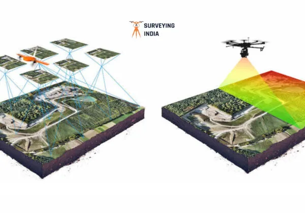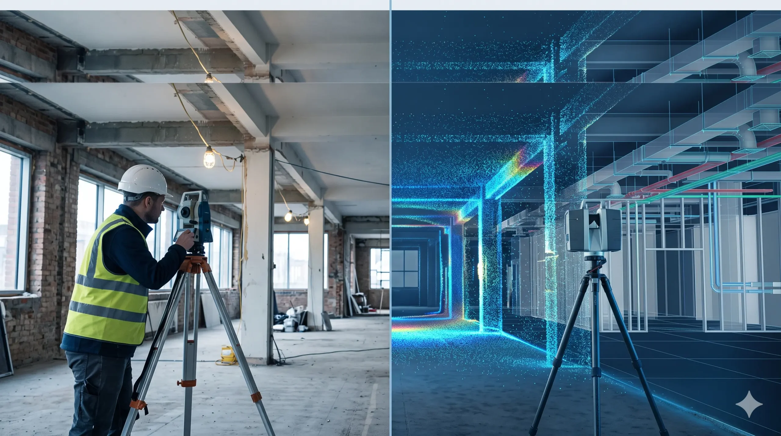
A traditional survey measures selected points on a site using tapes, laser distance meters, levels or a total station, and records them as 2D drawings. A Scan to BIM survey captures millions of points with a 3D laser scanner and converts them into an intelligent 3D BIM model. Traditional methods suit small, simple jobs. Scan to BIM suits renovation, retrofit, complex or MEP-heavy buildings where missing data causes expensive rework.
Scan to BIM vs Traditional Survey at a Glance
- Data captured: Traditional surveys record selected points. Scan to BIM records the full visible geometry as a point cloud.
- Output: Traditional gives 2D drawings. Scan to BIM gives a 3D model with data, plus 2D drawings.
- Speed on site: Scan to BIM usually needs less field time on medium and large buildings.
- Revisits: Traditional surveys often need return visits for missed measurements. A point cloud lets you measure later.
- Upfront cost: Traditional is usually lower. Scan to BIM often saves cost through less rework.
- Best for traditional: Small, simple, low-risk measurement jobs.
- Best for Scan to BIM: Renovation, retrofit, industrial, heritage and complex buildings.
What is a Traditional Survey?
A traditional survey is a manual or semi-manual way of measuring a site. The surveyor chooses the points that matter, measures them one by one and records them in a field book or data collector. The data is then drawn as 2D plans, sections and elevations, usually in CAD.
Common traditional tools include:
- Measuring tape and laser distance meters for room dimensions
- Total stations for angles and distances to selected points
- Levels and theodolites for heights and alignments
- GNSS / GPS receivers for outdoor positioning
These methods are proven and reliable. Their limit is not accuracy at a measured point but coverage: you only get what the surveyor decided to measure on the day.
What is a Scan to BIM Survey?
A Scan to BIM survey uses a laser scanner to capture an entire space as a dense point cloud, often millions of points per minute. BIM specialists then convert the point cloud into a parametric model of real building elements such as walls, slabs, columns, ducts and pipes, each carrying data. For the full process, equipment and LOD levels, read our guide on what is a Scan to BIM survey.
Key Differences: Scan to BIM vs Traditional Survey
| Factor | Traditional Survey | Scan to BIM Survey |
|---|---|---|
| Data captured | Selected points chosen by the surveyor | Millions of points covering all visible surfaces |
| Output | 2D drawings (plans, sections, elevations) | Intelligent 3D BIM model + 2D drawings + point cloud |
| Accuracy | High at measured points, depends on operator and number of points | Millimetre-level point cloud with proper control; model accuracy follows LOD |
| Field time | Longer for large or complex sites | Faster capture on medium and large sites |
| Missed data risk | High: unmeasured items need a revisit | Low: measure from the point cloud later |
| Clash detection | Not possible from 2D alone | Built into the BIM workflow |
| Safety | Needs access to ladders, edges and heights | Remote capture reduces risk in hard-to-reach areas |
| Upfront cost | Lower | Higher |
| Long-term value | Limited reuse of 2D files | Reusable for design, facility management and digital twins |
1. Accuracy and Reliability
A total station is very accurate at each point it measures. The problem is that a building has thousands of relevant points, and a manual survey measures only a fraction. Everything between those points is assumed, usually as straight and square. Old buildings are rarely straight and square.
A terrestrial laser scanner records the real surface, including bulges, tilts and sagging slabs. With proper control points and registration, point cloud accuracy is typically within a few millimetres. Manufacturers such as Leica Geosystems and FARO publish scanner specifications you can verify.
Note that the BIM model is only as accurate as the LOD and tolerance agreed. Ask for a deviation report that compares the model with the point cloud.
2. Speed and Site Time
For a single room, a tape or laser meter is quick. For a multi-floor building, a plant room or a factory, manual measurement can take days of repeated visits. A scanner captures a space in minutes per setup and records everything in view, so the field team spends less time on site. Modelling happens later in the office.
This also reduces disruption in occupied buildings such as hospitals, offices and malls.
3. Completeness of Data
This is the biggest practical difference. In a traditional survey, a missed dimension means a phone call, a revisit or a guess. With a point cloud, the site is stored digitally. If the designer later asks for the height of a beam or the position of a duct, the answer is already in the data.
4. Deliverables and Usability
Traditional surveys deliver flat 2D drawings. They show what was measured but do not carry information about objects. A Scan to BIM survey delivers:
- A Revit BIM model with intelligent elements
- The registered point cloud (E57, RCP or LAS)
- 2D plans, sections and elevations generated from the model
- Optional IFC export and QA report
Because the model is data-rich, it supports clash detection, quantity take-off, space planning and facility management. The BIMForum LOD specification explains how much detail each level of model contains.
5. Safety and Access
Manual surveys often need ladders, scaffolds or entry to unsafe areas to reach ceilings, roof edges and plant spaces. A scanner placed on a tripod can capture high and distant areas from a safe position. Drones and mobile scanners extend this to roofs, facades and tall structures.
6. Cost: Upfront vs Lifetime
Traditional survey is usually cheaper at the start, especially for small jobs. Scan to BIM costs more upfront because it includes scanning, registration and BIM modelling. However, the cost of one design clash found on site, or one beam missed in a drawing, can exceed the survey fee itself.
A fair comparison looks at total project cost, not survey price alone. For a breakdown of what drives pricing, see our guide on Scan to BIM survey cost in India.
7. Collaboration and Coordination
With 2D drawings, each consultant interprets measurements separately. A BIM model gives architects, structural engineers and MEP teams one shared reference. Issues are found in the model, before they are found on site.
Limitations of Each Method
Traditional survey
- Only selected points are recorded
- Revisits are common when data is missing
- 2D output has limited reuse
- Slower on large or complex sites
Scan to BIM survey
- Hidden elements inside walls or above solid ceilings cannot be captured unless exposed
- Glass and highly reflective surfaces can create noise
- Higher LOD increases modelling time and cost
- Results depend on skilled processing and modelling
When to Choose a Traditional Survey
- Small, simple spaces such as a single room or shop
- Basic floor area or boundary measurement
- Low-risk work where 2D drawings are enough
- Very tight budgets with no design or coordination needs
When to Choose Scan to BIM
- Renovation, retrofit or extension of existing buildings
- Buildings with missing, outdated or unreliable drawings
- MEP-heavy sites such as hospitals, data centres and factories
- Heritage and irregular structures
- Projects that need clash detection or facility management data
- Occupied buildings where site time must be short
The Hybrid Approach: Best of Both
The two methods are not rivals. Professional Scan to BIM projects use a total station to set control points, then laser scanners to capture detail. Control from traditional survey keeps the point cloud accurate, and scanning fills the gaps manual measurement would leave. In large projects, a LiDAR survey can also map surrounding terrain or corridors.
How to Decide: Quick Checklist
- Do you have reliable drawings? If not, lean towards Scan to BIM.
- Will the data be used in design, coordination or facility management? If yes, choose BIM.
- Is the building complex, old or MEP-heavy? If yes, choose Scan to BIM.
- Is access difficult or the site occupied? Scanning reduces disruption.
- Is the job small and simple? A traditional survey may be enough.
- Can a revisit be avoided? If revisits are costly, capture everything once.
Scan to BIM and LiDAR Services Across India
Surveying India provides Scan to BIM survey services in Mumbai, Pune, Delhi NCR, Bengaluru, Hyderabad, Chennai, Kolkata and Ahmedabad.
For terrain, corridor and large-site mapping, our LiDAR survey services are available in Mumbai, Pune, Delhi, Gurugram, Bengaluru, Hyderabad and Chennai.
Frequently Asked Questions
What is the difference between Scan to BIM and a traditional survey?
A traditional survey measures selected points and produces 2D drawings. Scan to BIM captures the full site with a laser scanner and produces an intelligent 3D BIM model along with a point cloud.
Is Scan to BIM more accurate than a traditional survey?
Both can be accurate at measured points. Scan to BIM captures far more points, so it records real conditions like tilts and bulges that manual surveys miss. Model accuracy depends on the agreed LOD and tolerance.
Is Scan to BIM faster than traditional surveying?
On medium and large buildings, yes. Scanning captures a whole space quickly and avoids repeated site visits. For a single small room, a manual measurement can be just as fast.
Is Scan to BIM more expensive than a traditional survey?
Usually it costs more upfront because it includes scanning and BIM modelling. It can reduce total project cost by preventing design errors, clashes and rework.
Can a traditional survey and Scan to BIM be used together?
Yes. Total station control points are often used to anchor laser scans to an accurate coordinate system, which combines both methods.
When should I not use Scan to BIM?
For small, simple jobs where 2D drawings are enough and no design coordination or future reuse is needed, a traditional survey is often more practical.
Does Scan to BIM replace the surveyor?
No. Surveying skill is still essential for control networks, scan planning, registration and quality checks. Scan to BIM extends traditional surveying with better capture and richer deliverables.
What does a traditional survey miss that Scan to BIM captures?
Anything the surveyor did not measure, such as small level changes, wall deviations, unrecorded alterations and the exact position of services. A point cloud keeps all visible geometry for later use.
Conclusion
Traditional survey and Scan to BIM are not good and bad options. They solve different problems. Traditional methods are practical for small, simple measurement. Scan to BIM is the better choice when accuracy, completeness and coordination matter, especially for renovation, retrofit and complex buildings. The strongest results come from combining both: survey-grade control with full laser scan capture.
Not sure which method fits your project? Explore our complete Scan to BIM Survey services or contact our team for a scope-based recommendation.