Drone vs Lidar Survey in Agartala: Which One Is Right for Your Project?
If you’re planning a construction, infrastructure, mining, agricultural, or land development project in Agartala or anywhere in Tripura, one of the first questions you’ll face is the classic drone vs lidar survey debate: should you go for a drone survey or a Lidar survey?
Both technologies have replaced traditional chain-and-compass land surveying methods because they are faster, more accurate, and far safer for surveying difficult terrain. But drone surveys and Lidar surveys are not interchangeable — they use different technology, serve different purposes, and suit different types of land. Choosing the wrong one for your project can lead to inaccurate data, wasted budget, and project delays.
In this complete guide, we break down how each technology works, where each one excels, and how to decide which is right for your specific project in Agartala.
What Is a Drone Survey?
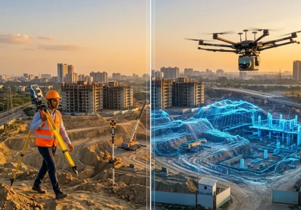
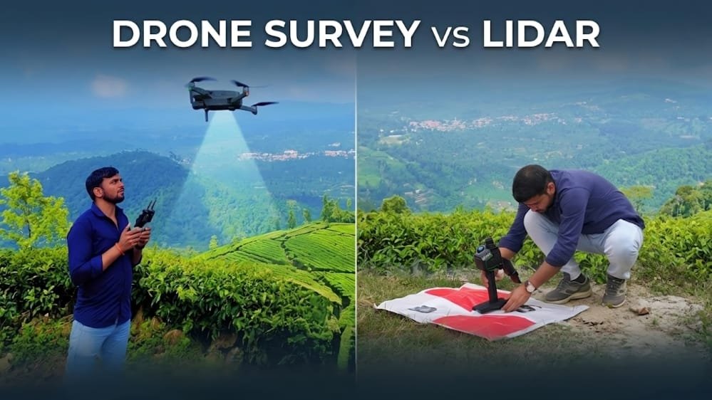
A drone survey in Agartala uses UAVs (Unmanned Aerial Vehicles) fitted with high-resolution cameras to capture hundreds or thousands of overlapping aerial images of a site. These images are then stitched together and processed using photogrammetry software to generate:
- Orthomosaic maps (accurate, geo-referenced aerial photos)
- Digital Elevation Models (DEMs) and Digital Terrain Models (DTMs)
- 3D terrain and structure models
- Volumetric (cut-and-fill) calculations for earthwork
- Contour maps and topographic surveys
- NDVI maps for crop and vegetation health (using multispectral cameras)
This process is known as photogrammetry, and it’s the same principle used in satellite mapping — just at a much closer range and higher resolution. You can read more about how aerial photogrammetry works on resources like the ASPRS (American Society for Photogrammetry and Remote Sensing).
Best suited for: open land mapping, agricultural surveys, real estate site documentation, progress monitoring of construction projects, road and layout planning, and general topographic surveys where vegetation cover is minimal to moderate.
What Is a Lidar Survey?
A Lidar survey in Agartala — short for Light Detection and Ranging — uses rapid pulses of laser light instead of cameras to measure distances. A sensor mounted on a drone, aircraft, or vehicle fires thousands of laser pulses per second at the ground, and measures how long each pulse takes to bounce back. This generates an extremely dense and accurate 3D point cloud of the surveyed area.
Because laser pulses can pass through small gaps in tree canopies and vegetation, Lidar can capture accurate bare-earth ground elevation data even in areas covered by forest — something optical drone photography simply cannot do. According to the U.S. Geological Survey (USGS), Lidar is widely used globally for forestry mapping, flood risk modeling, and infrastructure corridor surveys precisely because of this canopy-penetration capability.
Best suited for: forest and hilly terrain mapping (common across Tripura’s landscape), power transmission line corridor surveys, road and highway corridor mapping, flood and drainage modeling, mining volumetric surveys, and any project requiring millimeter-level vertical accuracy.
Drone vs Lidar Survey: Quick Comparison Table
| Factor | Drone Survey | Lidar Survey |
|---|---|---|
| Technology | Photogrammetry (camera-based) | Laser-based (LiDAR sensor) |
| Accuracy | High (centimeter-level) | Very High (millimeter-level) |
| Works Through Vegetation | Limited — needs visible ground | Yes, penetrates canopy gaps |
| Data Output | Orthomosaic, DEM, 3D model | Dense 3D point cloud |
| Cost | More economical | Higher investment |
| Processing Time | Faster | Slightly longer |
| Best Terrain | Open, clear, urban areas | Forested, hilly, dense terrain |
| Common Use in Tripura | Real estate, agriculture, urban planning | Hill terrain, forest cover, infrastructure corridors |
Why This Matters for Agartala & Tripura Projects
Tripura’s geography is unique — it’s a mix of urban plains around Agartala and extensive hilly, forested regions across districts like Khowai, Gomati, and Dhalai. This means the right survey technology genuinely depends on your project’s exact location and terrain type:
- Urban and semi-urban projects in Agartala — residential plots, commercial construction, road widening, real estate documentation — generally get excellent results from a drone survey. It’s faster, more budget-friendly, and provides high-quality visual data that’s easy for clients and government bodies to review.
- Hilly or forested sites, tea garden boundary mapping, or infrastructure corridors crossing vegetation typically need a Lidar survey for accurate ground-level data, since standard drone cameras can’t “see” the actual ground beneath tree cover.
Many large-scale infrastructure and government projects in the region actually combine both technologies — drone imagery for visual documentation and stakeholder presentations, and Lidar for precise elevation and volumetric data — giving the most complete and defensible dataset for planning and approval purposes.
Real-World Applications in Tripura
To make this more concrete, here’s how each survey type applies to common project types in and around Agartala:
Real Estate & Plot Documentation: A drone survey is typically sufficient — quick turnaround, clear orthomosaic maps, and accurate boundary visualization for buyers and legal documentation.
Road & Highway Projects: These often span both open and forested stretches, making a combined drone + Lidar corridor survey the most reliable option, especially where the route crosses hilly terrain.
Agricultural Land & Tea Estates: Drone surveys with multispectral cameras can assess crop health and boundaries efficiently across large open fields.
Forest & Hill Terrain Mapping: Lidar is the clear choice here, since it can generate accurate ground models even where dense canopy blocks aerial photography.
Government & Infrastructure Corridors (power lines, pipelines): Lidar survey is generally preferred for its precision and its ability to detect vegetation encroachment near assets.
Drone vs Lidar Survey: How to Decide Which You Need
Ask yourself these questions before choosing:
- Is the land covered with dense vegetation or forest? → Lean towards a Lidar survey.
- Do you need cost-effective, fast mapping for open, accessible land? → A drone survey is ideal.
- Is this a large infrastructure or utility corridor project spanning mixed terrain? → Lidar, or a combined drone + Lidar approach, is usually recommended.
- Do you need highly precise elevation data for engineering or flood modeling? → Lidar’s millimeter-level accuracy is worth the investment.
- Is budget a primary constraint and the site mostly open/urban? → A drone survey will meet most accuracy requirements at a lower cost.
Still unsure? Our survey team in Agartala can inspect your site details and recommend the most suitable technology at no obligation.
Frequently Asked Questions
Q1. In the drone vs lidar survey comparison, which is more accurate? Lidar survey is generally more accurate, offering millimeter-level precision, especially in areas with vegetation or complex terrain. Drone surveys offer centimeter-level accuracy, which is more than sufficient for most open-land applications like real estate and agricultural mapping.
Q2. Is drone survey cheaper than Lidar survey in Agartala? Yes. Drone surveys are typically more cost-effective because they use standard camera-based photogrammetry equipment, while Lidar requires specialized laser-sensor hardware and more advanced, computation-heavy data processing.
Q3. Can drones be used for hilly areas in Tripura? Drones can map hilly terrain effectively when the ground is visible. However, if the area has dense forest or thick tree cover — common in parts of Tripura — a Lidar survey is more reliable, since laser pulses can pass through small gaps in vegetation to capture accurate bare-earth elevation data that a camera simply cannot see.
Q4. How long does a drone or Lidar survey take in Agartala? Most drone surveys for small to mid-sized plots are completed within 1–3 days, including data processing and map generation. Lidar surveys may take slightly longer depending on terrain complexity, vegetation density, and total area coverage.
Q5. Do I need both drone and Lidar surveys for my project? Not always. For simple, open-land projects like residential plots or agricultural fields, a drone survey alone is usually sufficient. For forested, hilly, or large infrastructure corridor projects, combining both technologies gives the most complete, accurate, and defensible dataset for planning and government approvals.
Q6. Are drone and Lidar surveys legal in India? Yes, both are legal when conducted by operators registered under India’s Digital Sky platform and DGCA drone regulations. It’s important to work with a survey provider who follows proper permissions and airspace clearance, particularly near urban or restricted zones in Agartala.
Q7. What deliverables will I receive after the survey? Typical deliverables include an orthomosaic map, digital elevation model (DEM), contour maps, and a detailed survey report. Lidar surveys additionally include a classified 3D point cloud, which is especially valuable for engineering and infrastructure design work.
Final Word on Drone vs Lidar Survey — Get a Professional Survey in Agartala
Whether your project needs the speed and affordability of a drone survey in Agartala or the millimeter-level precision of a Lidar survey in Agartala, our Agartala-based team has the equipment, DGCA-compliant permissions, and local terrain expertise to deliver accurate, fast, and reliable results — tailored to Tripura’s unique mix of urban and hilly landscapes.
Not sure which technology fits your project? Get in touch with our drone survey experts or explore our Lidar survey services for a free, no-obligation site assessment and quote.