Consider a scenario where a metro rail corridor is already under construction, only for the engineering team to uncover that the foundational survey data is misaligned by several meters. What follows is inevitable—costly rework, cascading delays, and escalating budgets. It’s a disruptive and expensive setback, yet one that is entirely avoidable with the right precision and planning at the outset.
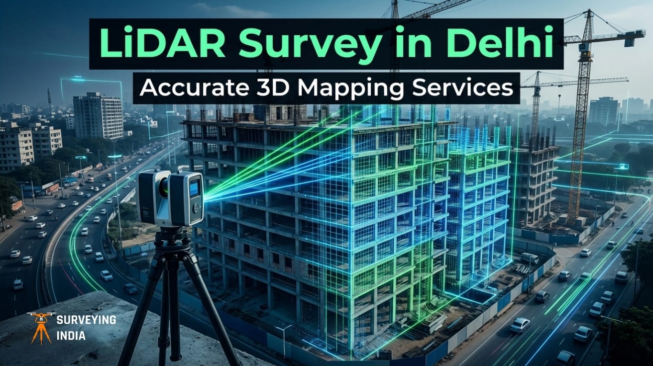
This is exactly why the demand for LiDAR mapping services in Delhi has accelerated in recent years. By using Light Detection and Ranging technology, surveyors can capture millions of data points per second, generating highly detailed, three-dimensional representations of terrain, structures, and infrastructure with centimeter-level precision. In a city as dense and rapidly evolving as Delhi, such accuracy is not optional—it is foundational to informed decision-making.
Whether you are a developer, municipal planner, architect, or conservation engineer, this guide outlines what LiDAR surveying entails, how to distinguish a high-quality provider from the rest, and how to avoid the costly setbacks that arise when spatial data is anything less than reliable.
What Is LiDAR Surveying — and Why Does Delhi Need It?
LiDAR works by emitting rapid laser pulses and measuring the time each takes to return after bouncing off a surface. The result is a dense point cloud — a precise, three-dimensional digital model of the physical environment, accurate to within a few millimeters.
Ground-Based vs. Aerial LiDAR Surveying
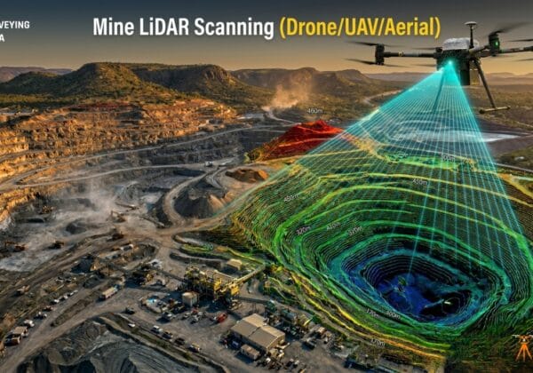
A terrestrial LiDAR survey uses a tripod-mounted scanner to capture building facades, interiors, and tight urban corridors in exceptional detail. An aerial LiDAR survey in Delhi, by contrast, mounts sensors on drones or manned aircraft to cover vast stretches of land within hours — making it ideal for highway alignments, floodplain modelling, and large-scale urban mapping.
Where Delhi Uses LiDAR Surveying Today
From the redevelopment of Lutyens’ Delhi bungalows to the rapid expansion of expressway networks, 3D LiDAR mapping in Delhi is transforming how infrastructure projects are planned and executed. Key applications include:
- Infrastructure and road surveys for metro corridors and highway projects
- City-wide elevation modelling for drainage systems and smart-city planning
- Heritage documentation of ASI-protected monuments and historical structures
- As-built verification for construction quality control and BIM workflows
How a Professional LiDAR Survey in Delhi Actually Works
Understanding the workflow helps you ask sharper questions when evaluating vendors — and set realistic expectations for timelines and deliverables.
Stage 1 — Project Scoping
Any professional LiDAR mapping company in Delhi — such as Surveying India — begins with a structured briefing: defining the geographic extent, required point density, and deliverable format (LAS, LAZ, DWG, or BIM-ready IFC). Regulatory permits are secured at this stage too, especially critical for drone LiDAR surveys operating near Delhi’s restricted airspace corridors.
Stage 2 — Data Acquisition
For aerial LiDAR surveys in Delhi, this involves programming precise flight paths and deploying GNSS base stations for accurate georeferencing before executing the scan. For ground-based work, field teams establish control points using total stations or GPS, then scan each station position methodically — ensuring full spatial coverage with minimal occlusion.
Stage 3 — Point Cloud Processing
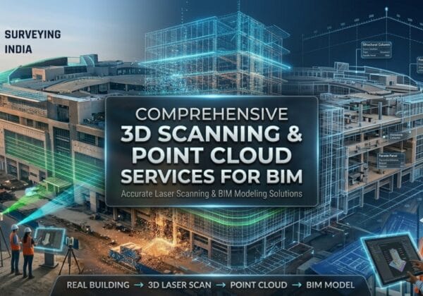
Raw data is classified, noise-filtered, and stitched into a seamless, georeferenced dataset. Ground points are carefully separated from vegetation, built structures, and underground utilities — a step that directly determines a deliverable’s accuracy and usefulness in downstream design, GIS, and BIM workflows.
Stage 4 — Final Deliverables
Clients receive a complete suite of outputs:
- Digital Terrain Model (DTM) and Digital Surface Model (DSM) for elevation analysis
- Ortho-mosaic imagery for visual and planimetric reference
- 3D meshes for volumetric modelling and visualization
- Classified feature layers ready for integration into GIS or BIM platforms
The difference between a mediocre and an excellent LiDAR dataset rarely comes down to the sensor — it lies in the rigout of ground control, flight planning, and post-processing methodology.
Key Benefits of Aerial LiDAR Survey for Large-Scale Delhi Projects
Traditional total-station surveys still have their place, but for projects spanning tens or hundreds of hectares, aerial LiDAR survey in Delhi offers advantages that are difficult to match.
- Speed Without Sacrificing Accuracy — A drone-mounted LiDAR sensor can capture over 200,000 points per second across a corridor that would take a ground team weeks to complete. Project timelines shrink while data quality stays high.
- Vegetation Penetration — Unlike optical cameras, LiDAR pulses filter through tree canopies to capture the bare-earth terrain beneath. This is critical for forest roads, riverbanks, and Delhi’s greenbelt and ridge zones.
- Safety in Challenging Environments — Utility corridors, active railway tracks, and busy expressways pose real risks to ground survey crews. Aerial surveys eliminate that hazard entirely while capturing geometry that would otherwise be inaccessible.
- Seamless Integration — Processed LiDAR data integrates directly with AutoCAD, Revit, ArcGIS, and open-standard BIM platforms, making it immediately actionable for design and planning teams.


Common Mistakes to Avoid When Commissioning a LiDAR Survey
Even experienced project managers make these errors. Recognizing them in advance saves significant time and money.
- Skipping Airspace Clearance — Delhi’s proximity to IGI Airport and several defense establishments means DGCA permits are non-negotiable for drone surveys. Starting without them can halt an entire field campaign.
- Under-Specifying Point Density — A 2-point/m² dataset suited for corridor mapping is woefully inadequate for structural inspection or heritage documentation. Define your end-use application before specifying scan resolution.
- Ignoring Ground Control — Accurate dereferencing depends on precisely placed Ground Control Points. Cutting corners here introduces systematic errors that can invalidate an entire dataset.
- Choosing Price Over Methodology — A cheap survey that produces unusable data costs far more in rework than a properly priced survey done correctly the first time.
- Not Requesting QA Reports — Always ask for point density maps, accuracy certificates, and overlap statistics before accepting final deliverables from any vendor.
Why Surveying India Is the Right LiDAR Partner in Delhi-NCR?
There is no shortage of survey firms operating across Delhi NCR. What is rare is a team that combines field rigour with deep data processing capability — and that is the niche Surveying India has built its reputation in.
- DGCA-Certified Drone Operations — All aerial missions are flown with fully licensed pilots and pre-approved flight plans. There are no permit shortcuts and no compliance gaps.
- Latest-Generation Sensors — Missions are equipped with industry-leading LiDAR platforms matched to each project’s specific accuracy and density requirements.
- End-to-End Delivery — From initial scoping through to final GIS and BIM deliverables, one integrated team manages every stage. There is no outsourced processing and no fragmented accountability.
- Deep Delhi NCR Local Knowledge — Years of ground-level experience across the capital’s varied terrain, regulatory landscape, and seasonal survey windows mean fewer surprises and smoother delivery.
Clients ranging from urban development authorities to private developers and heritage conservation bodies return to Surveying India project after project — not because of grand promises, but because of consistent, verified results.
Visit surveyingindia.in to discuss your next project.
Frequently Asked Questions
Q1. What is the typical turnaround time for a LiDAR survey project in Delhi?
For a standard aerial corridor survey of 5 to 10 kilometers, data acquisition typically takes one to two days, with processed deliverables ready within seven to fourteen working days depending on area complexity and output specifications. Larger urban mapping projects are scoped individually.
Q2. Do I need special permits for drone-based LiDAR surveys in Delhi?
Yes. Delhi falls under multiple restricted and controlled airspace zones. DGCA approvals under India’s CAR UAV Rules 2021 are mandatory, and proximity to IGI Airport or defense installations may require additional NOCs. A professional LiDAR survey company in Delhi will manage all permit applications as part of the engagement.
Q3. What accuracy can I expect from a LiDAR survey?
Well-controlled aerial LiDAR surveys typically achieve vertical accuracy of ±5–15 cm RMSE and horizontal accuracy of ±10–30 cm RMSE, depending on flight altitude, GNSS quality, and sensor grade. Terrestrial LiDAR scanners, operating at close range with established control points, can deliver sub-centimetre accuracy in both axes — making them the preferred choice for structural, heritage, and as-built documentation work.
Defining your required accuracy class upfront is essential — it directly determines the methodology, sensor selection, and ground control density needed to meet your project specifications.
Q4. How does 3D LiDAR mapping differ from drone photogrammetry?
Photogrammetry relies on overlapping images processed into point clouds via software. It struggles in low-light conditions, under vegetation, or on featureless surfaces. LiDAR uses active laser pulses that operate in any lighting condition, penetrate canopy gaps, and produce denser, more accurate point clouds for topographic and structural applications.
Q5. Can LiDAR data be integrated with AutoCAD or Revit?
Absolutely. Processed LiDAR deliverables can be exported as DWG or DXF for AutoCAD, RCS or RCP for Autodesk ReCap and Revit, or IFC for open-standard BIM workflows. Most clients working on infrastructure or building projects receive multi-format packages to ensure compatibility across their design software stack.
Conclusion — Precision Is the Foundation Everything Else Rests On
Delhi is being rebuilt, reimagined, and digitally mapped at a pace that has no precedent in its history. From smart-city infrastructure to ancient monument preservation, every project built on accurate spatial data stands on firmer ground — literally and figuratively.
Investing in reliable LiDAR mapping services in Delhi is not purely a technical decision. It is a risk management strategy that protects your timeline, your budget, and the long-term integrity of whatever you are building or planning.
If your next project demands survey-grade accuracy, do not settle for legacy methods or under-qualified vendors. Partner with a LiDAR mapping company in Delhi that brings certified expertise, modern equipment, and transparent methodology to every assignment.
Surveying India is ready when you are. Visit surveyingindia.in to start the conversation.