Nearly half of all height clearance applications filed with AAI don’t get approved on the first attempt. That’s not an exaggeration for effect. It’s a documented pattern, and understanding it can save your project months.
In short, the most common airport NOC rejection reasons involve technical data errors, not paperwork gaps. Wrong coordinate formats, certificate mismatches, and height requests that exceed the permissible elevation cause far more rejections than missing signatures ever do. This guide ranks the top 10 reasons. It draws on AAI’s own published rejection data and documented appeal patterns, so you can catch these mistakes before you file.
The Real Numbers Behind AAI NOC Rejections
Before we get into the list, it helps to see the scale of the problem. An independent analysis of AAI’s public NOCAS portal data looked at applications filed from January 2016 through November 2024, across 12 states. It found that AAI approves only 58% of all processed applications. The rejection rate varies sharply by state. Some regions approve more than 75% of applications, while others approve as few as 30%.
The timeline pattern tells its own story. AAI takes a median of just 3 days to reject an application. Approval, by contrast, takes a median of 25 days. This gap suggests that most rejections happen early. They occur at the basic data-verification stage, often before a case ever reaches detailed technical review. AAI’s own service charter confirms this pattern. Verification of uploaded documents is meant to take just 5 working days, with a maximum overall settlement window of 30 working days from submission.
AAI has also published its own document listing common grounds for rejection at the verification stage, available through the NOCAS portal. The reasons below draw directly from that document, from AAI’s Annexure-A service standards, and from documented patterns in appeal filings. None of it is generic guesswork.
1. Site Elevation or Coordinate Certificate Not in AAI’s Required Format
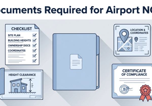
This tops AAI’s own list of standard rejection grounds. NOCAS expects your site elevation and coordinate certificate to follow a specific format. A certificate that’s technically accurate but doesn’t match this structure still gets flagged during verification. Our documents required guide shows the exact certificate format NOCAS expects.
2. Mismatch Between Application Data and Certificate
You type your coordinates and elevation into the NOCAS form. Then you upload a certificate showing the same data. If these two don’t match, even by a small margin, AAI’s reviewer flags it immediately. This is one of AAI’s most frequently cited rejection grounds, and it’s entirely avoidable through careful cross-checking before submission.
3. Undertaking Form Not in AAI’s Prescribed Format
Every application needs a signed undertaking. AAI specifies an exact format for this document. Even a generic or self-drafted undertaking that says the right things gets rejected if it doesn’t follow AAI’s template.
4. Incomplete or Missing Owner Information
AAI needs complete details about who owns the property or holds the applicable lease. Gaps here appear directly on AAI’s published list of standard rejection reasons. This includes missing names, incomplete addresses, or unclear ownership chains.
5. Incomplete Application Fields
NOCAS runs some automated validation, but it doesn’t catch every gap. AAI’s own guidance warns applicants to check every row and column in the application form carefully. Incomplete applications are liable to be rejected outright, regardless of how complete the supporting documents are.
6. Requested Top Elevation (RTE) Exceeding the Permissible Top Elevation (PTE)
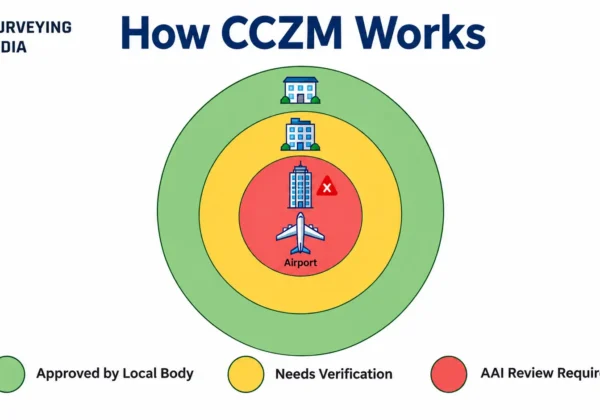
This is a technical rejection, not a paperwork one. Your proposed structure’s Requested Top Elevation might exceed the Permissible Top Elevation set by the applicable Colour Coded Zoning Map, or the airport’s Obstacle Limitation Surface. When that happens, AAI’s Designated Officer either reduces your approved height or rejects the application outright. This pattern shows up consistently in documented appeal cases. Applicants either misjudged their site’s PTE, or worked from outdated elevation data.
7. Duplicate Application for the Same Coordinates
NOCAS permits only one active application per set of coordinates. Suppose you, or someone else associated with the project, files a second application for the same site while the first is still under review. In that case, the system flags it as a duplicate rather than fast-tracking it.
8. Elevation Certificate Not Authenticated by an Approved Government Agency
AAI’s own indicative expectations state plainly that your site elevation certificate must be authenticated by a government agency. A certificate from an uncertified private surveyor doesn’t meet this requirement, however accurate the actual measurement turns out to be. Acceptable sources include Survey of India, CPWD, State PWD, or another AAI-recognised agency.
9. Coordinates Not Submitted in WGS-84 Format
AAI’s service standards explicitly require site coordinates in the WGS-84 coordinate system. Applications submitted in a different datum, even a widely used one, fail this basic technical check before reaching detailed review.
10. Failing to Respond to AAI’s Technical Queries in Time
Sometimes AAI doesn’t reject an application outright. Instead, the reviewing officer raises a query, asking for clarification or a corrected document. Applicants who don’t respond within the stipulated window often see their case rejected by default. This isn’t because the underlying project failed technical review. It happens simply because the query went unanswered. Checking your NOCAS dashboard regularly during the review period prevents this entirely.
What This Data Actually Tells You
[IMAGE SUGGESTION 2: Simple bar-style infographic comparing “3 days” (median rejection time) against “25 days” (median approval time), with a small icon representing document review. Alt text: “AAI NOC rejection timeline data — median days to reject versus approve applications”]
Notice a pattern across these ten reasons. Only two of them, reason 6 and reason 10, involve genuine technical or process judgment calls. The other eight come down to formatting, matching, and completeness. These are things entirely within your control before you ever click submit. This lines up with what AAI’s fast rejection timeline suggests. Most cases fail early, at the data-verification stage. It’s usually not because the project itself was unsafe or non-compliant, but because the submission didn’t meet a checklist requirement.
This also means most rejections are preventable. A certified survey provider prepares your coordinates and elevation data in AAI’s exact required format. Doing this eliminates seven or more of these ten failure points before you even file.
How to Reduce Your Rejection Risk
- Verify your airport classification first. Confirm whether your nearest airport is VFR or IFR, since this determines your applicable radius and, indirectly, your PTE.
- Use only AAI-recognised elevation sources. Survey of India, CPWD, State PWD, or an empanelled private survey firm, not a general-purpose surveyor.
- Cross-check every number twice. Compare your typed application data against your uploaded certificates line by line before submitting.
- Calculate your RTE conservatively. If your site sits near a CCZM boundary, get your ground elevation independently verified rather than relying on estimates.
- Check your dashboard weekly. Don’t wait for an email notification alone; log in directly to catch queries before they expire.
- Never file a second application for the same coordinates. If you need to make a correction, contact AAI’s regional office rather than submitting a duplicate.
How Surveying India Helps You Avoid These Rejections
Since most rejections come down to preventable technical errors, our team focuses on eliminating exactly these failure points before you submit. We prepare certified WGS-84 coordinates and AMSL elevation certificates through RTK-GNSS survey equipment, accurate to within ±5 cm. Everything is formatted precisely as NOCAS requires. We also cross-verify your requested height against current CCZM and OLS data before filing. This way, you’re not caught off guard by a PTE breach after weeks of waiting. Explore our complete Airport NOC survey services for end-to-end support, from initial feasibility through to final NOC approval.
Frequently Asked Questions
What percentage of AAI NOC applications get rejected? Independent analysis of AAI’s public portal data shows an overall approval rate of 58%, meaning a significant share of applications, roughly 42%, are rejected or don’t clear on the first attempt. Approval rates vary widely by state and airport.
What is the single most common reason for AAI NOC rejection? Format and data-mismatch issues top AAI’s own published list. Specifically, this means site elevation and coordinate certificates that don’t match AAI’s required format, or don’t match the data entered in the application form.
How long does AAI take to reject an application? AAI’s median time to reject an application is around 3 days. That’s much faster than its median 25-day approval timeline, since most rejections happen at the initial data-verification stage.
Can I reapply after an AAI NOC rejection? Yes. You can file a fresh application through NOCAS after correcting the issues that caused the rejection. Alternatively, you can pursue a formal review or appeal if you believe the rejection was incorrect.
Does exceeding the Permissible Top Elevation always mean rejection? Not always. AAI’s Designated Officer may reduce your approved height instead of rejecting the application outright. The outcome depends on how far your Requested Top Elevation exceeds the Permissible Top Elevation for your grid.
What happens if I don’t respond to an AAI query in time? Your application can be rejected by default. This can happen even if the underlying project meets all technical requirements, simply because the query window closed without a response.
Can two NOC applications be filed for the same site? No. NOCAS permits only one active application per set of coordinates. A second filing for the same site gets flagged as a duplicate rather than processed as a fresh case.
Do private, uncertified surveyors’ elevation certificates get accepted? No. AAI requires elevation certificates authenticated by a government agency, such as Survey of India, CPWD, State PWD, or an AAI-empanelled survey firm.
Don’t want to risk a rejection on avoidable errors? Talk to our survey team — we prepare your entire NOCAS submission to AAI’s exact technical format before you file.