Archives: Services

Multispectral Drone Technology for Smart Farming in India

Surveying India provides advanced multispectral drone surveying services in India designed to support modern precision agriculture. By using high-resolution drone sensors and intelligent data analysis, we help farmers, agribusiness companies, and agricultural researchers monitor crop health, improve productivity, and manage farms more efficiently.

Our multispectral drone solutions allow accurate field monitoring and provide valuable insights that help farmers take informed decisions about irrigation, fertilizer usage, pest control, and crop planning. With extensive experience in on-site drone data collection and post-processing, Surveying India delivers reliable agricultural intelligence across diverse farming landscapes in India.

For farmers and agricultural organizations looking to adopt modern technology, our services work seamlessly alongside solutions such as drone land surveying, drone mapping services, and DGPS land survey services, creating a complete digital agriculture ecosystem.


Advanced Multispectral Cameras for Crop Monitoring

Surveying India uses advanced multispectral cameras capable of capturing multiple wavelength bands of light. These sensors produce highly detailed imagery that helps identify crop stress, plant health variations, and vegetation density.

The collected data supports farmers in improving field management while complementing other services like drone photogrammetry mapping and aerial land surveys, which provide accurate geographical insights for agricultural planning.


High-Precision Drone Technology

Our agricultural drones are equipped with modern flight control systems, long-duration batteries, and high-accuracy GPS navigation. This technology allows us to perform systematic and reliable surveys across large farms, plantations, and agricultural research fields.

By integrating drone technology with GIS mapping services and digital land mapping solutions, we ensure that farmers receive highly precise and easy-to-interpret agricultural data.


Agricultural Insights Generated by Drone Surveys

Surveying India’s multispectral drone surveys generate several important agricultural insights, including:

  • NDVI vegetation health analysis

  • Enhanced Vegetation Index (EVI) mapping

  • Soil health and nutrient monitoring

  • Field moisture distribution mapping

  • Crop plant count and spacing analysis

  • Early pest and disease detection

  • Crop yield prediction and productivity analysis

  • Chlorophyll concentration monitoring

These insights help farmers detect problems early and improve crop performance through data-driven decision making.


Advanced Data Processing and Agricultural Analysis

The drone data collected during field surveys is processed by our experienced geospatial specialists using advanced analytics tools. We convert raw aerial imagery into actionable reports, vegetation maps, and crop health assessments.

This analytical process works alongside our GIS survey services and drone mapping solutions, allowing farmers and agricultural planners to better understand field conditions and plan farming operations effectively.


Professional On-Site Drone Data Collection

Surveying India’s experienced field team conducts professional drone surveys directly on farms. Each project is customized based on crop type, land size, and environmental conditions to ensure the most accurate results.

Our field operations are supported by advanced technologies such as DGPS land surveys and drone topographic mapping, ensuring accurate geospatial data collection for agricultural planning.


Integration with Modern Farm Management Systems

The insights generated from our multispectral drone surveys can be easily integrated with modern farm management software and agricultural monitoring platforms. This allows farmers to track crop performance, monitor field changes, and plan agricultural activities more efficiently.


Transforming Agriculture with Drone Technology

Multispectral drone technology is revolutionizing agriculture in India by enabling farmers to adopt precision farming techniques. With accurate aerial insights into crop health, soil conditions, and field variations, farmers can reduce resource wastage and improve productivity.

Surveying India combines advanced drone technology, geospatial analysis, and field expertise to deliver reliable agricultural intelligence across India. Our mission is to empower farmers with practical technology solutions that support sustainable and profitable farming.

Partner with Surveying India to integrate multispectral drone surveys, drone land mapping, and GIS agricultural analysis into your farming operations and move toward smarter, data-driven agriculture.

Landscape Survey

SurveyingIndia provides a comprehensive range of topographic and earthwork surveys. Surveys are carried out using a Global Positioning System (GPS), which allows detailed geo-referenced data to be acquired and readily and correctly transmitted to base maps for a range of archaeological and other uses.

Among the archaeological GPS applications are:

  • Trench stake out – aiming for geophysical abnormalities or features identified in aerial images or prior surveys;
  • Artefact mapping – precise 3D plots of field-walking discoveries or artefacts recovered during excavation
  • Specialist site identification is using metal detectors to locate spots of historical relevance, such as battles or aircraft crashes.
  • Topographic surveys allow for extensive investigation of a terrain in order to give contour and earthwork surveys.
  • Grid and transect layout – properly laying out grids and transects on pre-determined points on a site or in the field;
  • Pre and post excavation planning – accurate real-time planning allowing site plans to be instantaneously displayed onscreen, and survey control points – providing permanent references for future surveys removing the need to reference successive surveys

Surveying India – Landscape Survey Company in Delhi NCR

Surveying India is a premier Landscape Survey Company in Delhi NCR, known for delivering precise and detailed surveys that are essential for effective landscape planning and design. Our services cater to a wide range of industries, including architecture, urban planning, environmental management, and real estate development.

What is a Landscape Survey?

A landscape survey involves the systematic collection and analysis of data related to the physical features of a land area. This includes topography, vegetation, water bodies, built structures, and other natural and man-made elements. The information gathered helps in the planning, design, and management of landscapes to ensure sustainable and aesthetically pleasing environments.

Our Landscape Survey Services

At Surveying India, we offer comprehensive landscape survey services that are tailored to meet the specific needs of our clients. Our services include:

  1. Topographic Mapping
    We create detailed topographic maps that showcase the contours and elevations of the land, which are crucial for landscape design and planning.
  2. Vegetation and Soil Analysis
    Our surveys include the assessment of existing vegetation and soil types to inform sustainable landscaping and conservation efforts.
  3. Hydrological Studies
    We conduct hydrological surveys to map water bodies, drainage systems, and water flow patterns, essential for effective water management in landscape planning.
  4. Environmental Impact Assessment
    We provide data for environmental impact assessments, helping in the evaluation of potential effects of development projects on the natural environment.
  5. Urban and Regional Planning
    Our landscape surveys support urban and regional planning initiatives by providing accurate data for the development of parks, gardens, and other green spaces.

Why Choose Surveying India for Landscape Surveys?

  • Experienced Professionals
    Our team of experienced surveyors and environmental experts bring extensive knowledge and expertise to every project.
  • Cutting-Edge Technology
    We utilize advanced surveying equipment and software to deliver highly accurate and reliable results.
  • Customized Solutions
    We understand that each project has unique requirements, and we offer customized solutions to meet those specific needs.
  • Commitment to Sustainability
    We prioritize sustainable practices in our surveys, ensuring that the development and management of landscapes are environmentally responsible.

Applications of Landscape Surveys

Landscape surveys are vital in various sectors, including:

  • Architecture and Design
    Providing critical data for designing landscapes that are both functional and aesthetically pleasing.
  • Environmental Management
    Supporting the conservation and rehabilitation of natural environments through informed planning.
  • Real Estate Development
    Assisting in the planning and development of residential, commercial, and industrial properties with sustainable landscapes.
  • Urban Planning
    Contributing to the creation of green spaces in urban areas, enhancing the quality of life for residents.

Contact Us

For expert Landscape Survey Services in Delhi NCR, trust Surveying India to deliver accurate and comprehensive surveys. Our dedication to precision, innovation, and sustainability ensures that we provide valuable insights for successful landscape projects.

Contact us today to learn more about our services and how we can assist with your landscape survey needs.

Project Overview

A Contour Survey (also known as a Detail Survey or Topographic Survey) depicts the features and structures on and around a parcel of land.
The quantity of information displayed varies based on the user’s needs, but it can include the location of buildings, windows, driveways, walls, trees, and natural surface features such as watercourses, embankments, rock outcrops, and contours.

A Contour Survey is needed for a number of reasons.
It is typically submitted with a Development Application (DA) to Council or as a provision to an Architect or Engineer for building and infrastructure design. Flood studies, comprehensive landscape design, and structural engineering may also necessitate it.

Our surveys are as unique as each land parcel.
To make the procedure as simple as possible, we customize each survey to your individual needs and give easy-to-read plans and well-structured CAD models.

The Contour Survey Methodology

  • Determine the goal and scope of the survey, as well as the survey cost.
  • Site survey and measurements will be performed during this visit.
  • Calculations in the office, plan writing, and quality assurance
  • Contour Survey plan distribution in electronic (PDF and DWG) formats.

Surveying India – Contour Survey/Topographic Survey Services in Delhi NCR

Surveying India is a trusted name in the field of Contour Survey and Topographic Survey Services in Delhi NCR. Our expertise in these surveying techniques provides invaluable data for planning, designing, and executing various projects in construction, engineering, and environmental management.

What is a Contour Survey?

A contour survey, also known as a topographic survey, involves mapping the elevation of the land and its natural and man-made features. This type of survey produces contour lines on a map, representing the terrain’s shape and elevation, which is crucial for understanding the land’s topography.

Our Contour/Topographic Survey Services

At Surveying India, we offer comprehensive contour and topographic survey services that cater to diverse project needs. Our services include:

  1. Elevation Mapping
    We create detailed elevation maps that illustrate the land’s contours, helping in the planning and design of infrastructure projects.
  2. Land Feature Identification
    Our surveys identify and map natural features like hills, valleys, rivers, and artificial structures, providing a complete picture of the terrain.
  3. Site Planning and Analysis
    We assist in site planning by providing accurate topographic data, which is essential for determining suitable locations for construction and development.
  4. Infrastructure Development
    Our contour surveys support infrastructure projects such as roads, bridges, and drainage systems by providing precise terrain data.
  5. Environmental and Agricultural Planning
    We help in environmental conservation and agricultural planning by mapping land use, soil erosion, and water flow patterns.

Why Choose Surveying India for Contour/Topographic Surveys?

  • Experienced Surveyors
    Our team consists of skilled surveyors with extensive experience in conducting contour and topographic surveys for various industries.
  • Advanced Technology
    We utilize the latest surveying equipment and software to deliver high-accuracy results.
  • Customized Solutions
    We understand the unique requirements of each project and provide tailored surveying solutions to meet specific needs.
  • Timely and Accurate Data
    We are committed to delivering precise and reliable survey data within the agreed timelines, ensuring project efficiency.

Applications of Contour/Topographic Surveys

Contour and topographic surveys are essential in multiple sectors, including:

  • Construction and Engineering
    Providing critical data for the design and construction of buildings, roads, and infrastructure.
  • Urban and Regional Planning
    Assisting in the development of urban layouts and regional development plans.
  • Environmental Management
    Supporting environmental impact assessments and conservation efforts.
  • Agriculture
    Enhancing land use planning, irrigation design, and soil conservation practices.

Contact Us

For reliable Contour Survey/Topographic Survey Services in Delhi NCR, Surveying India is your trusted partner. Our dedication to accuracy, professionalism, and client satisfaction sets us apart.

Contact us today to learn more about our services and how we can assist with your next project using our expert contour and topographic survey solutions.

Survey with Drones and UAV's

  • Unmanned Aerial Vehicle (UAV) technology has been present for nearly a century, but it was never deployed in the way it is now.
  • SurveyingIndia continues to evolve in tandem with the ever-changing spectrum of technology.
  • SurveyingIndia utilizes unique talents and cutting-edge technology to provide customers with first-rate aerial surveying and mapping services.
  • At any given time, SurveyingIndia strives to provide superior quality aerial drone surveying and mapping services with extremely accurate topographic maps and centimetre-level accuracy.
  • We deliver results faster, allowing our clients to make more agile decisions. We are equipped with high-end surveying drones and a workforce of expert surveyors.
  • Our maps and survey data typically have a resolution of 1 to 3cm per pixel (1-3cm GSD).
  • We process the data to produce comprehensive 3D terrain models (e.g., DSM, DTM), with an accuracy of 50mm horizontal and 50-80mm vertical.

LiDAR Scanning - Drone & Terrestrial

LiDAR Survey Company in India — Precision Mapping at Scale

Surveying India is one of India’s leading LiDAR survey companies, delivering high-accuracy 3D mapping, point cloud data, and terrain models across infrastructure, construction, mining, agriculture, and urban planning sectors. With 500+ successfully completed projects across India — including operations at sensitive, high-security environments like Delhi International Airport (GMR Group) — we bring proven expertise and advanced LiDAR technology to every project.

Whether you need drone aerial LiDAR, terrestrial LiDAR scanning, or handheld LiDAR for confined or indoor environments, Surveying India has the capability, equipment, and experienced team to deliver — on time and on spec.

What is LiDAR Surveying?

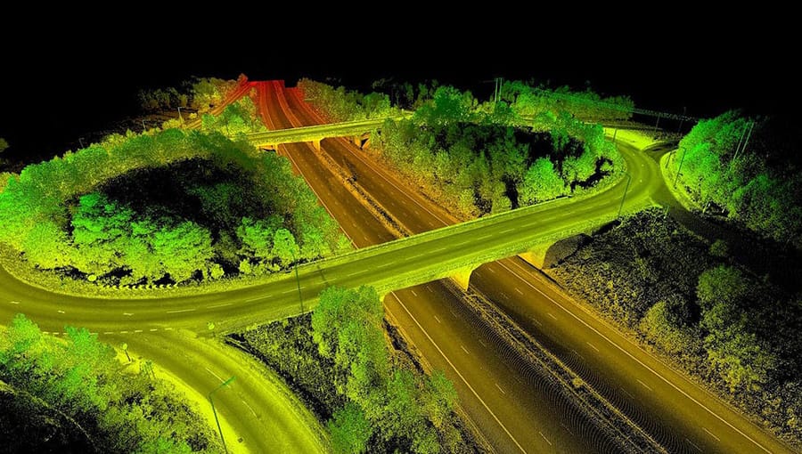
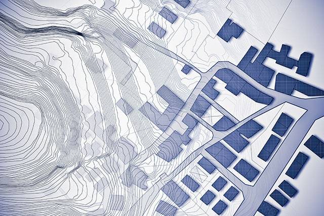
LiDAR stands for Light Detection and Ranging. It is a remote sensing technology that emits rapid laser pulses — thousands per second — and measures the time each pulse takes to reflect back from a surface. This data is used to generate highly accurate 3D point clouds representing the exact shape, elevation, and features of any terrain or structure.

Unlike traditional surveying or photogrammetry, LiDAR:

  • Penetrates dense vegetation to capture true ground elevation
  • Works in low-light and night conditions
  • Captures millions of data points per second
  • Delivers sub-centimetre accuracy in many applications
  • Covers large areas rapidly with drone-based systems

LiDAR has become the standard for large-scale infrastructure projects, corridor surveys, mine volume calculations, and heritage documentation across India.

Types of LiDAR Survey Services We Offer

1. Drone Aerial LiDAR Survey

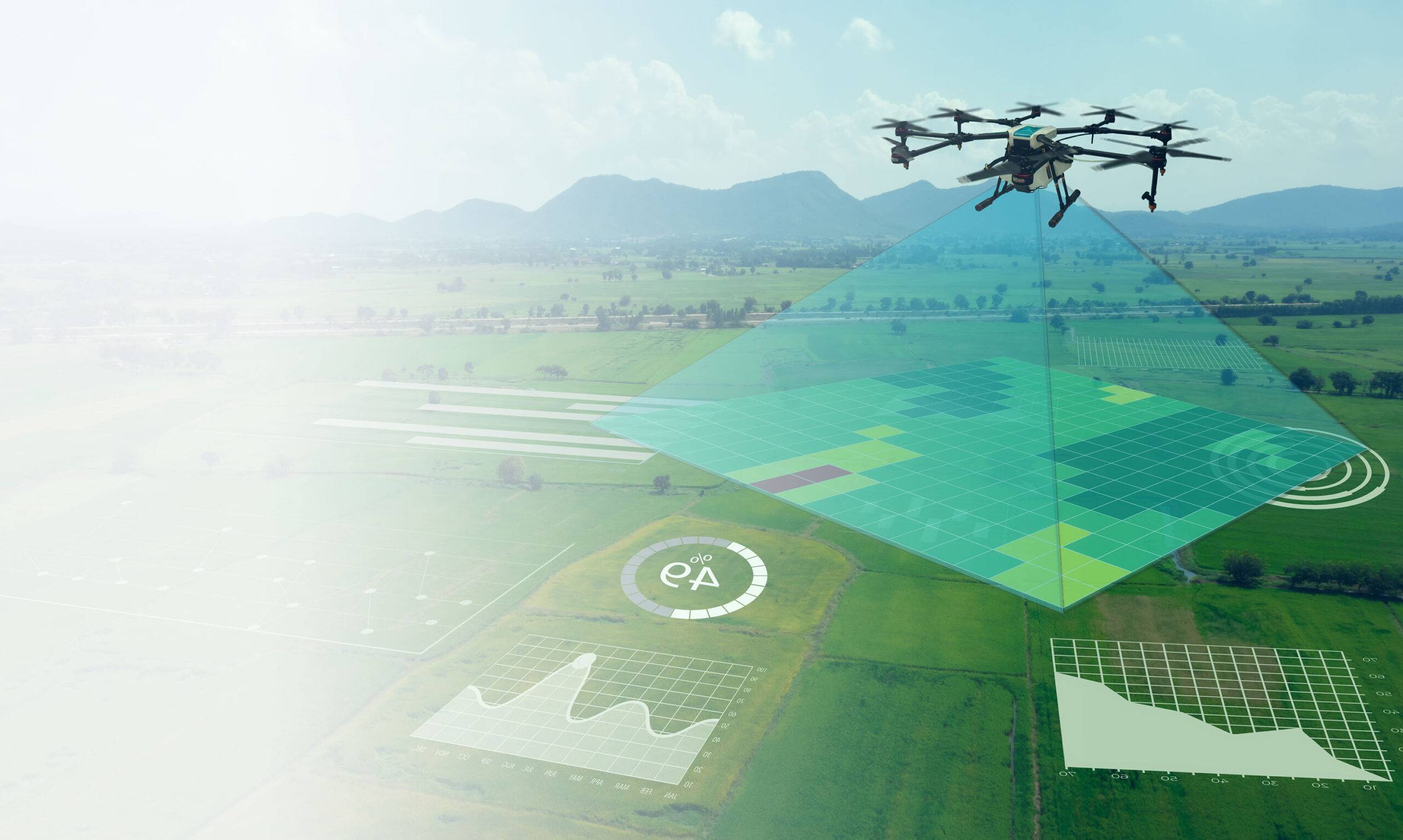
Our UAV-mounted LiDAR systems cover large areas quickly with exceptional accuracy. Ideal for:

  • Highway and railway corridor surveys
  • Large agricultural land mapping
  • Forest canopy and terrain analysis
  • Flood plain and river basin mapping
  • Pre-construction topographic surveys

Drone LiDAR is the most efficient method for covering hundreds of hectares in a single mobilisation, reducing survey time by up to 70% compared to traditional methods.

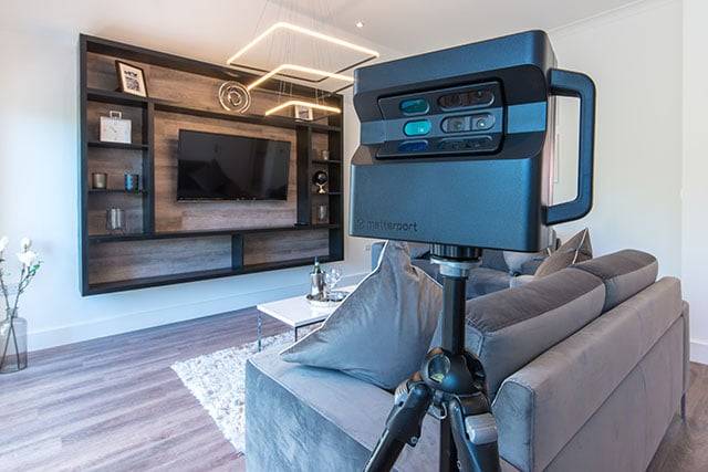
2. Terrestrial LiDAR Scanning (TLS)

Ground-based static LiDAR scanners deliver ultra-high-density point clouds for:

  • Building and structure as-built documentation
  • Industrial plant and facility mapping
  • Heritage and monument documentation
  • Bridge and infrastructure inspection
  • Underground tunnel and mine scanning

Terrestrial LiDAR captures millions of points from a fixed position, generating millimetre-level detail ideal for engineering and BIM workflows.

3. Handheld & Mobile LiDAR Survey

For areas inaccessible to drones or tripod-mounted scanners, our handheld LiDAR systems provide rapid, accurate capture in:

  • Airport terminals and operational infrastructure
  • Metro stations and railway platforms
  • Indoor environments and confined spaces
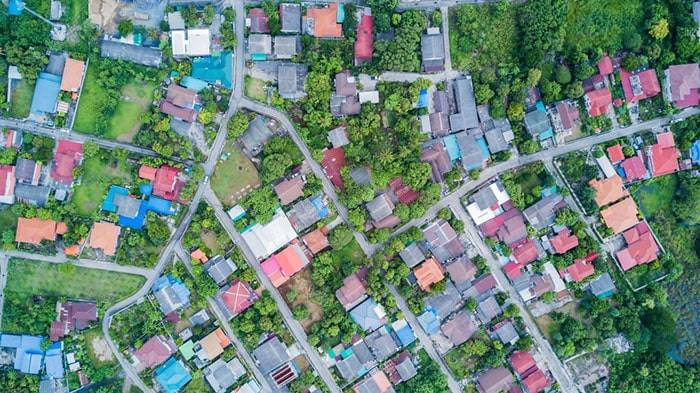
  • Urban street-level mapping
  • Emergency access corridors

Our team successfully completed Handheld LiDAR Survey operations at Delhi International Airport Ltd (GMR Group) — one of India’s most operationally sensitive infrastructure environments — demonstrating our ability to work within strict operational, safety, and security constraints.


Industries We Serve — LiDAR Survey India

IndustryLiDAR Application
Infrastructure & HighwaysCorridor surveys, DEM, road design
AviationAirport mapping, obstacle surveys, terminal scanning
MiningVolume calculation, pit mapping, stockpile measurement
RailwaysTrack geometry, clearance surveys, station scanning
Construction & Real EstateTopographic surveys, as-built documentation
AgricultureTerrain mapping, irrigation planning, NDVI integration
ForestryCanopy height, biomass estimation, ground DEM
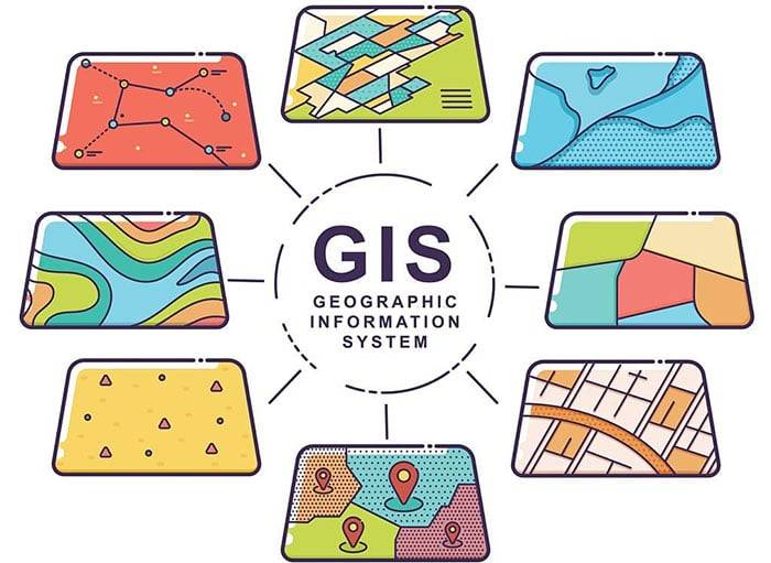
Urban PlanningCity modelling, smart city GIS integration
Oil & GasPipeline corridor, plant documentation
Disaster ManagementFlood mapping, landslide assessment, damage survey

Why Choose Surveying India for LiDAR Surveys?

500+ Projects Completed Across India

From single-hectare site surveys to multi-state corridor projects, we have delivered LiDAR survey solutions for government agencies, PSUs, private developers, and international clients.

Experience in High-Security & Sensitive Environments

Our team has successfully executed LiDAR surveys at Delhi International Airport (DIAL) — GMR Group, demonstrating compliance with strict operational, safety, and access protocols that most survey companies cannot meet.

Pan-India Mobilisation

We operate across all major states including Delhi NCR, Haryana, Uttar Pradesh, Maharashtra, Rajasthan, Gujarat, Karnataka, Tamil Nadu, Telangana, Madhya Pradesh, and more. Single-point mobilisation — no need to coordinate with multiple regional vendors.

End-to-End Delivery

From field survey to final deliverable — point cloud processing, DEM/DTM generation, contour mapping, BIM integration, and GIS outputs — all under one roof.

DGCA-Certified Drone Pilots

All our UAV operations are conducted by DGCA-certified drone pilots from recognised training schools, ensuring full legal compliance for aerial LiDAR surveys anywhere in India.

Qualified Engineering Team

Our surveyors and geospatial engineers are trained and authorised for all civil and engineering survey work, bringing technical depth to every project deliverable.


LiDAR vs Photogrammetry — Which One Do You Need?

ParameterLiDARPhotogrammetry
Dense VegetationExcellent — laser penetrates canopyPoor — cannot see ground
Open TerrainVery goodVery good
AccuracySub-centimetre to 5cm typical3–10cm typical
Data VolumeVery high point densityModerate
CostHigherLower
SpeedVery fast for large areasFast for small areas
Night OperationsYesNo
Indoor UseHandheld LiDARNot suitable

Recommendation: For projects involving vegetation, infrastructure corridors, indoor environments, or night-time operations — LiDAR is the right choice. For open terrain with moderate accuracy requirements and budget constraints, photogrammetry may suffice. Our team will advise the best approach for your specific project.


Our LiDAR Survey Process — Step by Step

Step 1 — Project Brief & Scope Definition We understand your project requirements, area extent, accuracy needs, and deliverable formats before any mobilisation.

Step 2 — Site Reconnaissance & Flight Planning Our team conducts remote site analysis and prepares a detailed survey plan including ground control point (GCP) layout, flight parameters, and safety protocols.

Step 3 — Ground Control Point (GCP) Setup Accurate GCPs are established using DGPS to ensure absolute positional accuracy of all LiDAR data.

Step 4 — LiDAR Data Acquisition Drone, terrestrial, or handheld LiDAR data is captured per the survey plan. Multiple passes ensure complete coverage and redundancy.

Step 5 — Point Cloud Processing Raw LiDAR data is processed using industry-standard software to generate classified point clouds, removing noise and separating ground, vegetation, and structure returns.

Step 6 — Deliverable Generation Final outputs are prepared per your requirements — DEM, DTM, contour maps, 3D models, orthomosaics, BIM-ready point clouds, or GIS layers.

Step 7 — Quality Check & Delivery All data undergoes rigorous QA/QC before delivery. We provide full technical support during client review.


LiDAR Survey Deliverables

  • Classified 3D Point Cloud (LAS/LAZ format)
  • Digital Elevation Model (DEM)
  • Digital Terrain Model (DTM)
  • Digital Surface Model (DSM)
  • Contour Maps (0.5m, 1m, 2m intervals as required)
  • Orthomosaic Imagery
  • Cross-Section Profiles
  • Volume Calculations
  • BIM-Ready Point Cloud (for Revit, AutoCAD, etc.)
  • GIS Layers (SHP, KML, GeoTIFF)

Frequently Asked Questions — LiDAR Survey India

Q1. What is the accuracy of your LiDAR surveys? Our drone LiDAR systems deliver vertical accuracy of ±3–5 cm and horizontal accuracy of ±5–10 cm under standard conditions with properly established GCPs. Terrestrial and handheld systems can achieve millimetre-level accuracy for close-range scanning.

Q2. How large an area can you survey in a day? A drone LiDAR system can typically cover 200–500 hectares per day depending on terrain, flight altitude, and overlap requirements. Terrestrial LiDAR covers smaller areas but with much higher point density.

Q3. Do you need permission to fly drones for LiDAR surveys? Yes. All drone operations in India require prior permissions under DGCA regulations. Our DGCA-certified pilots handle all necessary permissions and comply fully with airspace regulations, including controlled zones near airports and urban areas.

Q4. Can LiDAR survey through tree cover and forests? Yes — this is one of LiDAR’s greatest advantages. Laser pulses penetrate gaps in vegetation to reach the ground, enabling accurate terrain modelling even in dense forest areas where photogrammetry fails.

Q5. What file formats do you deliver LiDAR data in? We deliver in LAS, LAZ, DWG, DXF, SHP, KML, GeoTIFF, and other formats as required by your project or software workflow.

Q6. Can you work at airports and other restricted sites? Yes. Surveying India has experience working at operationally sensitive environments including Delhi International Airport (DIAL). We coordinate all necessary permissions, follow site safety protocols, and work within operational constraints without disrupting ongoing activity.

Q7. How long does a LiDAR survey project take? Typical timelines range from 1–3 days for small sites to 2–4 weeks for large corridor projects. Final deliverables are usually ready within 7–14 days of field completion.

Q8. Do you offer LiDAR survey services across all of India? Yes. We provide LiDAR survey services pan-India including Delhi NCR, Mumbai, Bangalore, Chennai, Hyderabad, Pune, Ahmedabad, Jaipur, Lucknow, Chandigarh, and all tier-2 and tier-3 cities and rural project sites.

Q9. What industries use LiDAR surveys most in India? Infrastructure (highways and railways), mining, aviation, urban planning, agriculture, construction, and forestry are the primary sectors driving LiDAR adoption in India.

Q10. How do I get a quote for a LiDAR survey? Contact us with your project location, area extent (in hectares or km), required accuracy, and deliverable format. We will provide a detailed proposal within 24–48 hours.


Service Coverage — LiDAR Survey Across India

Surveying India provides LiDAR survey services in all major cities and states:

North India: Delhi, Gurugram, Noida, Faridabad, Ghaziabad, Chandigarh, Lucknow, Jaipur, Agra, Meerut, Dehradun, Jammu

West India: Mumbai, Pune, Ahmedabad, Surat, Nagpur, Nashik, Vadodara

South India: Bangalore, Chennai, Hyderabad, Coimbatore, Kochi, Visakhapatnam

East India: Kolkata, Bhubaneswar, Patna, Ranchi, Guwahati

Central India: Bhopal, Indore, Raipur, Jabalpur


Get a Free Consultation for Your LiDAR Survey Project

Have a project in mind? Our team is ready to discuss your requirements and recommend the right LiDAR solution — drone, terrestrial, or handheld — for your site and budget.

Call us: +91 9871880058
Email: info@surveyingindia.in
Office: 144, Netaji Subhash Enclave, Sector 72A, Gurugram, Haryana – 122101

Request a Free Quote →


Surveying India — Trusted LiDAR Survey Company in India. 500+ projects. Pan-India coverage. DGCA-certified operations.

Geographical Information Systems (GIS)

SurveyingIndia offers experience in analysis methods and modelling techniques through complete Geographic Information Systems (GIS), surveying, and mapping services. We assist clients from different industries in making educated decisions to aid in planning and development while visualising project outcomes.

Our teams will carry out and manage all types of data collection, from topographic surveys to drainage condition surveys and traffic counts, in areas as diverse as noise, air quality, ecology, energy, and waste management.

SurveyingIndia also performs and manages complicated measurement assignments ranging from GIS measuring and laser scanning to digital terrain modelling for planning and quantity computations.
Our experienced teams include qualified land surveyors, GIS specialists, digital terrain modellers, and transportation evaluation specialists.

Our services include:

  • Desktop, mobile and web-based GIS and spatial data analysis
  • Database design, administration and management
  • Application development
  • Asset management
  • Engineering surveys for future construction and expansion projects
  • Legal, industrial, piping and structural surveys
  • Environmental monitoring
  • Data acquisition
  • Data storage and management
  • Constraints mapping
  • Visual impact assessment
  • Applications development
  • Aerial mapping and data acquisition

Total Station (TS) Survey Solution

Surveyors all across the world demand the most precise instruments to perform their crucial work. Every survey task necessitates the utmost level of precision, which is where Total Stations come in.

From land surveyors to road and building surveys, and even scanning and tracking total stations, total stations are a versatile product that will quickly become your most useful business partner.

Total Stations are utilised in a wide range of applications to increase productivity while providing scalability to meet future challenges and opportunities.

Cadastral & Land Survey

Urban and rural land subdivisions, building subdivisions, and title re-establishment surveys are among the services we provide, as are feature and level survey plans and site analysis plans for development projects.

Developing property is an expensive endeavour, and the quality of work that goes into its planning and preparation is critical to the success of any project.

A thorough and reliable land survey is an essential aspect of the early stages of success preparation. As a dependable and trustworthy land surveying firm in India. SurveyingIndia has assisted in the establishment of various projects, subdivisions, and re-establishments.

Surveying India – Cadastral & Land Survey Company in Delhi NCR

When it comes to cadastral and land surveying in Delhi NCR, Surveying India is a name synonymous with accuracy and reliability. Our comprehensive range of surveying services ensures precise mapping and measurement of land parcels, making us a trusted partner for property owners, developers, and government agencies.

What is Cadastral Surveying?

Cadastral surveying involves the detailed measurement and mapping of land parcels to define property boundaries. It plays a critical role in land ownership, development, and legal documentation. By using advanced surveying techniques, cadastral surveys provide accurate and official records of property lines and ownership.

Our Cadastral & Land Survey Services

At Surveying India, we offer a wide array of cadastral and land survey services tailored to meet the specific needs of our clients. Our services include:

  1. Boundary Surveys
    We accurately determine property lines and resolve boundary disputes by providing precise measurements and legal documentation.
  2. Topographic Surveys
    Our topographic surveys map the natural and man-made features of the land, including elevation contours, to assist in planning and development projects.
  3. Land Subdivision
    We facilitate the division of land into smaller parcels for development or sale, ensuring compliance with local regulations and legal requirements.
  4. Construction Layout Surveys
    We provide essential data for the correct placement of structures, ensuring that construction projects are executed according to plan.
  5. Land Registration and Documentation
    We assist in the preparation of legal documents required for land registration, ensuring all records are accurate and up-to-date.

Why Choose Surveying India for Cadastral & Land Surveys?

  • Expertise and Experience
    Our team consists of seasoned surveyors with extensive experience in cadastral and land surveying across various sectors.
  • Advanced Technology
    We utilize the latest surveying equipment and software to deliver high-precision results.
  • Customized Solutions
    We understand the unique needs of each project and provide tailored surveying solutions to meet those requirements.
  • Compliance and Accuracy
    Our surveys adhere to all legal standards and regulations, ensuring that the data provided is both accurate and legally sound.

Applications of Cadastral & Land Surveys

Cadastral and land surveys are crucial in several areas, including:

  • Real Estate Development
    Ensuring accurate property boundaries and aiding in the planning and development of new projects.
  • Legal Disputes
    Providing precise measurements and documentation to resolve boundary disputes and ownership issues.
  • Government and Municipal Planning
    Assisting in urban planning, infrastructure development, and land management.
  • Agriculture
    Helping in land use planning and agricultural development through accurate land measurements.

Contact Us

If you need a reliable Cadastral & Land Survey Company in Delhi NCR, Surveying India is here to assist you. Our commitment to precision, professionalism, and customer satisfaction makes us the ideal choice for all your surveying needs.

Contact us today to learn more about our services and how we can support your next project with our expert cadastral and land survey solutions.

360 VR & Panorama for Real Estate and Street View

Bring properties and locations to life with stunning 360° panoramic photography. Our team of experienced professionals specializes in 360-degree panorama photo stitching, seamlessly merging multiple images to create immersive, high-resolution visuals that leave a lasting impression.

Using the latest 360 panoramic software, our designers craft images with exceptional clarity and aesthetic appeal. We focus on delivering visuals that not only meet but exceed client expectations, ensuring every project showcases the space in its best light.

What We Offer:

  • High-Resolution HDR Imaging – Capture every detail with vibrant colors and perfect lighting.
  • Vertical & Horizontal Panorama Stitching – Flexible solutions for indoor and outdoor spaces.
  • Color Correction & White Balance – Accurate tones that enhance realism.
  • Ghosting & Haze Removal – Clean, professional imagery without distractions.

Whether you’re looking to highlight real estate listings, showcase streets for navigation apps, or provide virtual tours for clients, our 360° panorama services deliver a fully immersive experience. Perfect for property marketing, virtual walkthroughs, and online listings, our images make spaces feel tangible even online.

Let us transform your visuals into interactive, panoramic experiences that engage viewers and elevate your brand.

DGPS Survey Services in India – High Accuracy Land Survey Solutions

Surveying India provides professional DGPS survey services across India, helping businesses, infrastructure developers, and government projects obtain highly accurate land positioning data. By using advanced Differential Global Positioning System (DGPS) technology, we deliver precise geospatial measurements that support modern surveying and mapping requirements.

Compared to traditional surveying methods, DGPS technology allows large areas of land to be surveyed more efficiently while maintaining exceptional accuracy. Since DGPS surveying does not require a constant line of sight between instruments, our field teams can collect continuous data across open landscapes, making the process faster and more cost-effective.

This method is particularly effective for surveying large open areas such as agricultural lands, highways, railway corridors, pipelines, industrial zones, and infrastructure development sites.

What is DGPS Surveying?

DGPS stands for Differential Global Positioning System, an advanced positioning technology that improves the accuracy of standard GPS measurements.

DGPS works by using fixed reference stations that transmit correction signals to GPS receivers used in the field. These corrections reduce satellite positioning errors and improve accuracy to a few centimeters, making DGPS one of the most reliable surveying methods available today.

This level of precision is essential for projects that require accurate mapping, infrastructure planning, and geospatial data analysis.


Advanced DGPS Technology Used by Surveying India

At Surveying India, we use high-precision GNSS receivers from trusted global manufacturers such as Trimble and Spectra Precision. These advanced surveying instruments enable us to collect accurate geospatial data even in challenging environments.

Our DGPS survey process ensures:

  • High precision spatial data collection

  • Reliable positioning accuracy across large areas

  • Faster survey completion compared to traditional methods

  • Efficient field data collection with minimal manual intervention

By combining DGPS surveying with modern technologies such as GIS mapping services, drone surveys, and digital land mapping, we provide a comprehensive geospatial solution for our clients.


Our DGPS Survey Services

Surveying India offers a wide range of DGPS surveying solutions designed for different industries and project requirements.

Topographic Surveys

Our DGPS-based topographic surveys capture detailed information about land elevation, terrain features, and natural structures. This data is essential for construction planning, infrastructure development, and environmental studies.

Land Boundary Surveys

We use DGPS technology to accurately identify and map property boundaries. This helps landowners, developers, and government authorities resolve boundary disputes and maintain clear land records.

Infrastructure Development Surveys

DGPS surveys play a critical role in the planning and development of infrastructure projects such as highways, bridges, railways, pipelines, and industrial facilities.

Geodetic Control Surveys

For large-scale mapping and engineering projects, establishing accurate control points is essential. Our DGPS surveys provide highly reliable geodetic reference points for mapping and construction work.

Environmental and Agricultural Surveys

DGPS technology is also widely used for environmental monitoring, land use planning, and precision agriculture projects where accurate spatial data is required.


Why Choose Surveying India for DGPS Surveys?

Advanced Surveying Equipment

We use modern DGPS and GNSS surveying instruments to ensure highly accurate measurements and reliable results.

Experienced Survey Professionals

Our team includes trained surveyors and geospatial experts with experience in land surveying, mapping, and infrastructure development projects across India.

Project-Specific Survey Solutions

Every surveying project has unique requirements. We provide customized DGPS survey solutions based on project size, terrain conditions, and data accuracy requirements.

Fast and Reliable Data Delivery

Our streamlined surveying process allows us to collect and process data quickly, ensuring timely delivery of accurate survey reports.


Industries That Use DGPS Surveying

DGPS surveys are widely used in multiple sectors where accurate land positioning and mapping are essential.

Construction and Engineering
DGPS helps engineers plan construction layouts, design infrastructure, and ensure precise project implementation.

Urban Planning
City planners rely on DGPS data for designing road networks, residential zones, and public infrastructure.

Environmental Management
Accurate spatial data from DGPS surveys supports environmental monitoring, land conservation, and natural resource management.

Agriculture
DGPS surveying supports precision farming by helping farmers map land boundaries, analyze field conditions, and improve farm management.


Work with a Trusted DGPS Survey Company in Delhi NCR

Surveying India is recognized as a reliable DGPS survey company in Delhi NCR, providing high-accuracy land surveying solutions for commercial, infrastructure, and government projects.

Our commitment to precision, advanced technology, and professional expertise ensures that clients receive dependable survey data for informed decision-making.

If you are planning a land development, infrastructure, or mapping project, contact Surveying India today to learn how our DGPS survey services can support your requirements.