LiDAR Scanning - Drone & Terrestrial
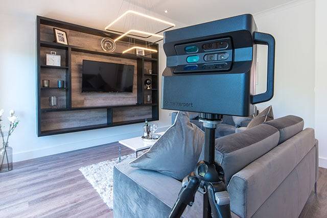
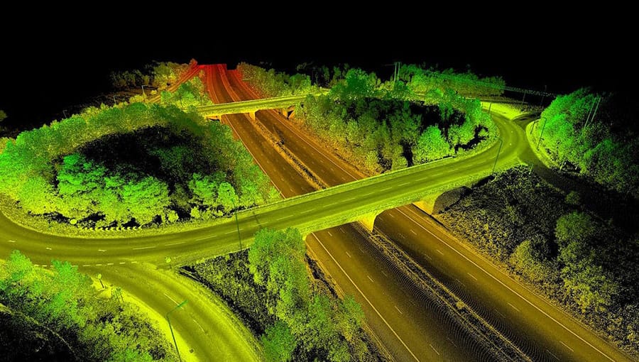
LiDAR (Light, Detection, and Ranging) is a survey data capturing technology in which a laser is reflected off an object and the response time to the return sensor allows the distance to be calculated. A detailed 3D point cloud of the surroundings can be formed when thousands of laser pulses occur per second.
SurveyingIndia has created a detailed analysis of the differences between drone aerial LiDAR surveys and photogrammetric surveys. Data capture with a drone-based LiDAR is more expensive than photogrammetry, owing to the costs of the sensors and drones required to transport them.
There are several sensors on the market at various price ranges, which can have a significant impact on the accuracy of the final data. Where there is dense vegetation, LiDAR comes into its own since the laser pulse may reach the ground more easily than a photogrammetry-derived survey model.
See our list of industries we serve for additional information on asset inspection in your specific area of interest, or contact us to discuss your needs.
Surveying India – LiDAR Survey Company in Delhi NCR
Surveying India stands out as a leading LiDAR Survey Company in Delhi NCR, offering advanced and highly accurate surveying solutions. Our expertise in Light Detection and Ranging (LiDAR) technology allows us to provide detailed and precise 3D representations of the surveyed areas, essential for a wide range of applications in urban planning, infrastructure development, environmental studies, and more.
What is LiDAR Surveying?
LiDAR surveying is a remote sensing method that uses laser pulses to measure distances to the Earth’s surface. These measurements are then used to create detailed 3D models and maps of the surveyed area. LiDAR technology is highly efficient in capturing vast amounts of data with exceptional accuracy, making it invaluable for complex and large-scale projects.
Our LiDAR Survey Services
At Surveying India, we offer a comprehensive suite of LiDAR survey services designed to meet the diverse needs of our clients. Our services include:
- Topographic LiDAR Surveys
We provide high-resolution topographic maps and models that are crucial for planning and development projects. - Forestry and Vegetation Mapping
Our LiDAR surveys help in detailed mapping and analysis of forested areas, vegetation cover, and biomass estimation. - Urban Planning and Development
We support urban planning initiatives by providing precise data for infrastructure development, zoning, and land use planning. - Infrastructure Monitoring
Our LiDAR technology is used for monitoring and managing infrastructure like roads, bridges, and railways, ensuring safety and maintenance. - Environmental Impact Studies
We conduct LiDAR surveys to assess environmental changes, manage natural resources, and support conservation efforts.
Why Choose Surveying India for LiDAR Surveys?
- Advanced Technology
We utilize state-of-the-art LiDAR equipment and software to deliver high-accuracy data and detailed 3D models. - Experienced Professionals
Our team consists of skilled surveyors and technicians with extensive experience in LiDAR technology and its applications. - Custom Solutions
We offer tailored LiDAR survey solutions to meet the specific requirements of each project, ensuring optimal results. - Timely and Efficient
Our efficient survey processes ensure timely data collection and analysis, keeping your projects on schedule.
Applications of LiDAR Surveys
LiDAR surveys have wide-ranging applications across various industries, including:
- Construction and Engineering
Providing detailed topographic data for the design and construction of buildings, roads, and infrastructure. - Environmental Conservation
Assisting in the monitoring and management of natural resources, forest cover, and wildlife habitats. - Agriculture
Enhancing precision agriculture practices through detailed terrain mapping and analysis. - Disaster Management
Supporting disaster preparedness and response efforts by providing accurate data on terrain and infrastructure.
Contact Us
For cutting-edge LiDAR Survey Services in Delhi NCR, Surveying India is your trusted partner. Our commitment to precision, innovation, and client satisfaction ensures that we deliver exceptional surveying solutions.
Contact us today to learn more about our services and how we can assist with your LiDAR survey needs.