
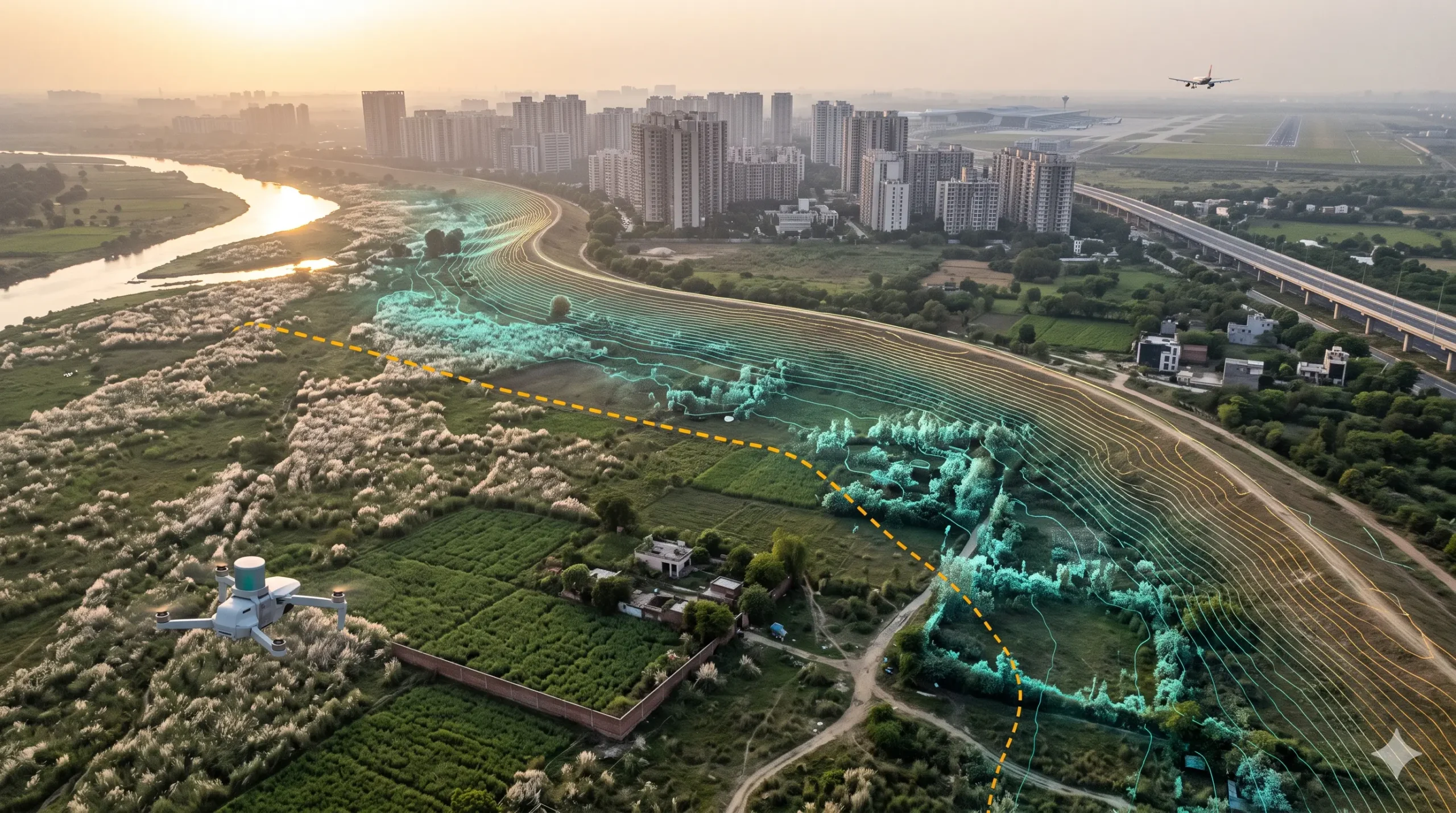
LiDAR, Drone, Land & DGPS Survey Services in Noida
Noida’s authorities have ordered an aerial drone survey of the Yamuna and Hindon riverbeds to document every existing construction there. Officials have also warned that anyone who builds in the floodplain should expect no compensation if floods wash the structure away. Meanwhile, Noida International Airport at Jewar opened to flights on 15 June 2026, and the land around it is changing fast.
Both stories depend on the same thing: reliable ground levels. This page explains what a LiDAR survey in Noida delivers, what it adds beyond drone photographs, and where it helps in a city growing along a river and around a new airport
Why the Yamuna and Hindon Floodplains Need Elevation Data
According to Millennium Post, the Noida Authority’s chief executive directed officials to identify and demolish illegal construction in the Hindon–Yamuna floodplains. The plan starts with an aerial survey using drone cameras to document what already stands in the riverbed. After that, any new unauthorised construction would draw action against the officials responsible, followed by demolition, and the CEO said FIRs would be filed against illegal colony developers.
Upstream in Delhi, the same issue has reached the courts. The Delhi High Court directed the Delhi Development Authority to use satellite imagery and drone photography to establish the current status of the Yamuna floodplain. The DDA’s survey then recorded that 7,362.56 hectares of the 9,700 hectares in Zone O had been encroached upon, roughly two-thirds.
Photographs show what has been built. Whether a structure sits inside a flood line is a different question, and it depends on ground height compared with river and embankment levels. That is where elevation data does the work.
Drones Already Map Noida. What Does LiDAR Add?
Noida has used drones for years. In 2021, the Noida Authority extended a drone-based property survey covering all 54 villages and urban sectors across roughly 20,000 hectares, partly to contain unauthorised construction. In 2023, the Yamuna Expressway Industrial Development Authority (YEIDA) prepared a six-month aerial drone survey across seven zones, starting with 15 villages.
Camera-based drone mapping gives sharp images and good surface models. LiDAR adds three things that matter on a riverbed and a large greenfield site:
- Ground level under vegetation. A laser pulse reaches the soil through crops, kans grass, and scrub, so the bare-earth model shows the true terrain.
- Heights and volumes. LiDAR measures embankment crests, stockpiles, new fill, and structure heights directly.
- Slope and flow. From a clean elevation model, engineers can trace drainage paths and check how water would move.
Many surveys combine both methods. Photographs show what a structure looks like, and LiDAR shows where it stands in relation to the land.
The Jewar Airport Corridor and YEIDA Growth Zones
Noida International Airport received its DGCA aerodrome licence on 6 March 2026 and began flight operations on 15 June 2026. It sits within the YEIDA region, a planned area of about 25,000 hectares along the Yamuna Expressway.
Large greenfield areas like this need a precise terrain baseline before and during development. Planners use it for road and utility alignments, drainage design, earthwork volumes, and plot layouts. Repeat surveys then track progress and check that cut-and-fill matches the design.
Height also matters near an airport. Buildings and towers close to the airfield may need an AAI height clearance NOC, and the process starts with an accurate site elevation. Our Airport NOC Survey Delhi NCR page explains how that works, and our Airport NOC Survey Dholera page covers another new-airport region in Gujarat.
Aerial vs Terrestrial LiDAR: Which Does Your Noida Project Need?
Aerial LiDAR, flown by drone, suits riverbeds, floodplain edges, large plots, and corridor surveys along expressways. It covers wide areas quickly and captures ground levels through vegetation.
Terrestrial and mobile LiDAR suits individual structures, basements, and built-up sectors where fine detail matters more than coverage. It records facades, boundary walls, and building footprints at high point density.
Many Noida projects need both. A floodplain-edge development, for example, may need aerial capture of the surrounding land and a terrestrial scan of an existing building.
How a LiDAR Survey Works
- Project briefing and scope definition — We confirm the area, required point density, and deliverable format, and we flag early whether floodplain or boundary checks are part of the goal.
- Flight or ground planning — For aerial work, we plan flight lines over the riverbed, plot, or corridor; for terrestrial work, we plan scan positions that cover built-up areas without gaps.
- Data capture — Our in-house equipment records dense point cloud data across the survey area.
- Point cloud processing and classification — We classify the data into ground, vegetation, water, and structures, and produce a bare-earth elevation model. For repeat surveys, we also run change detection between dates.
- Deliverable generation — You receive elevation models, contour and topographic maps, change maps, or BIM-ready point clouds in your required format.
Applications of LiDAR Survey in Noida
- Floodplain and riverbed mapping for boundary checks, encroachment evidence, and flood-level comparisons
- Topographic and contour surveys for large plots, townships, and industrial sites in Noida and Greater Noida
- Greenfield baselines across the YEIDA region and the Jewar airport corridor
- Corridor mapping for expressway, Metro, and utility alignments
- Earthwork and stockpile volumes for construction and mining-type operations
- Redevelopment and as-built documentation, feeding into our Scan to BIM services in Delhi NCR
- Construction progress monitoring across multi-phase developments
Choosing the Right Point Density
Point density, measured in points per square metre, should match your question. A broad floodplain or greenfield survey can use a lower density, since the goal is overall terrain shape and level changes. A facade or structure scan needs a much higher density to capture edges and fine detail.
Scoping this correctly at the briefing stage avoids two common problems. You do not pay for more density than you need, and you do not discover later that the data is too sparse for its purpose.
How Long Does a LiDAR Survey Take?
A terrestrial scan of a single building or small plot typically wraps up data capture within a day, and processed deliverables follow within about a week to ten days. A larger aerial survey takes longer for both planning and processing, often two to four weeks depending on area and density.
Weather and access also affect scheduling. Monsoon conditions and standing water can limit flying and field work, so we plan realistic windows with you from the start.
Why an In-House Team Matters
Noida projects often combine open terrain with built structures in one engagement, which is hard to manage across several vendors. Because our team handles aerial and terrestrial LiDAR in-house, from flight planning through classification and deliverables, you get one point of contact for the whole scope. Our head office is in Gurugram, in the same NCR region, so site visits and equipment deployment stay straightforward.
Useful Resources for Noida Landowners and Developers
These independent sources explain the floodplain actions, drone surveys, and airport details this page refers to, so you can check them yourself.
- Millennium Post: Noida to raze illegal constructions on Yamuna floodplains — Reporting on the CEO’s directions, the aerial survey plan, and the no-compensation warning.
- Deccan Herald: DDA survey finds encroachment on two-thirds of Yamuna floodplain — The Delhi High Court’s direction to use satellite and drone data, and the survey’s findings.
- Hindustan Times: Noida extends property survey — The Noida Authority’s drone-based property survey across 54 villages and sectors.
- Daily Pioneer: Aerial survey of Greater Noida — YEIDA’s plan for a drone survey across seven zones.
- Noida International Airport (Wikipedia) — Licensing, opening, and build-out details for the Jewar airport.
- Yamuna Expressway (Wikipedia) — Background on the expressway and the YEIDA development region.
- Central Water Commission — India’s national agency for flood and river management guidance.
- ASPRS LiDAR Guidelines and Standards — The accuracy standards that govern LiDAR data quality.
Why Get Your LiDAR Survey Done by Surveying India
We bring over 10 years of combined team experience delivering high-accuracy LiDAR, DGPS, drone, and airport NOC survey data across India. Our in-house equipment covers both aerial and terrestrial LiDAR, and we prepare elevation data to the precision that floodplain and boundary questions genuinely require.
Our head office team also delivers LiDAR survey in Gurugram and across Delhi NCR. Other cities show how the same method adapts. Kolkata’s wetland-edge mapping detects filled land, Ahmedabad’s lake and floodplain work tracks the Sabarmati, and Hyderabad’s lake boundary verification turns on Full Tank Level. Bengaluru’s lake and drain mapping, Chennai’s wetland freeze, Pune’s river corridor mapping, and Mumbai’s coastal and Metro surveys follow similar methods.
Planning a project anywhere in Noida or Greater Noida? Share your site location, whether it sits near the Yamuna or Hindon, and your intended use. We’ll recommend whether aerial LiDAR, terrestrial LiDAR, or a combination fits best.
Frequently Asked Questions
Why does Noida use aerial surveys for the Yamuna and Hindon floodplains?
The Noida Authority’s chief executive directed an aerial survey using drone cameras to document existing constructions in the riverbed, so that any new unauthorised construction can be identified and acted on.
What can LiDAR show that drone photographs cannot?
LiDAR measures ground level through vegetation, and it measures embankment crests, fill, and structure heights directly. That lets you compare a structure’s position against river and embankment levels, not only see that it exists.
Is Noida already using drones for surveys?
Yes. The Noida Authority ran a drone-based property survey across 54 villages and urban sectors, and YEIDA prepared a six-month aerial drone survey across seven zones. LiDAR can complement this work with elevation data.
Does the new Noida International Airport affect construction nearby?
Structures close to an airport may need an AAI height clearance NOC, which starts with an accurate site elevation. Our Airport NOC Survey Delhi NCR page explains the process.
What is the difference between aerial and terrestrial LiDAR for a Noida project?
Aerial LiDAR covers large areas like riverbeds and corridors quickly. Terrestrial and mobile LiDAR delivers higher point density for individual structures and built-up sectors, where detail matters more than coverage.
Do you handle permits for aerial LiDAR or drone survey work in Noida?
Yes, permit applications and flight clearances are managed as part of the engagement for any aerial or drone-based LiDAR survey work.
Reference: Floodplain actions are reported by Millennium Post and Deccan Herald. Drone survey details come from Hindustan Times and the Daily Pioneer, and airport details from Wikipedia. Confirm floodplain boundaries and permissions with the Noida Authority, YEIDA, and the relevant irrigation and flood departments before finalising a project.