
BIM Survey Services India — Precision Scan-to-BIM for the Discerning Builder
Surveying India delivers precision BIM survey and Scan-to-BIM services across India, converting heritage buildings, commercial towers, and industrial sites into millimetre-accurate Building Information Models — from 3D laser scanning and point cloud capture to LOD 200-500 Revit modeling, MEP coordination, and clash detection — trusted by architects, developers, and infrastructure companies nationwide.
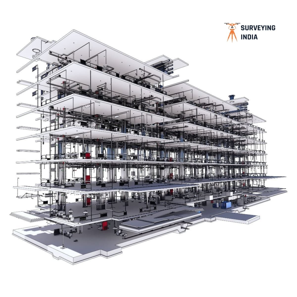
The Art and Science of BIM Survey Services
What Is a Scan-to-BIM Survey?
Our Signature Building Information Modeling Offerings
Bespoke 3D Laser Scanning & Point Cloud Capture
Using premium terrestrial and drone-mounted LiDAR instruments, we capture your site with jewel-like precision, laying the groundwork for an exceptional outcome. Every scan station is planned with the same deliberation an architect brings to a floor plan — minimal occlusion, maximal fidelity.
Point Cloud to BIM Conversion
Raw scan data is meticulously registered, cleaned, and sculpted into Revit-native models, ready for design development and construction documentation. Our modelers work element by element, ensuring geometry reflects reality rather than assumption.
Architectural, Structural & MEP Modeling
From LOD 200 concept massing to LOD 500 verified as-built intelligence, our deliverables cover walls, columns, slabs, HVAC, plumbing, and electrical systems with equal finesse — each discipline modeled to a standard that survives real-world scrutiny on site.
Clash Detection & Multidisciplinary Coordination
We identify and resolve design conflicts before a single brick is laid, sparing our clients the costly indignities of on-site rework, change orders, and schedule slippage.
Heritage & As-Built Documentation
For India’s storied palaces, havelis, and colonial-era landmarks, our documentation work preserves architectural legacy with archival-grade accuracy — a subject explored further in our Best Scan to BIM Services in Delhi NCR guide.
Facility Management & Digital Twin Delivery
Long after construction concludes, your finished model continues to serve — as a living digital twin for maintenance scheduling, compliance reporting, and asset lifecycle planning across the building’s entire operational life.
Bespoke 3D Laser Scanning & Point Cloud Capture
Using premium terrestrial and drone-mounted LiDAR instruments, we capture your site with jewel-like precision, laying the groundwork for an exceptional outcome. Every scan station is planned with the same deliberation an architect brings to a floor plan — minimal occlusion, maximal fidelity.
Point Cloud to BIM Conversion
Raw scan data is meticulously registered, cleaned, and sculpted into Revit-native models, ready for design development and construction documentation. Our modelers work element by element, ensuring geometry reflects reality rather than assumption.
Architectural, Structural & MEP Modeling
From LOD 200 concept massing to LOD 500 verified as-built intelligence, our deliverables cover walls, columns, slabs, HVAC, plumbing, and electrical systems with equal finesse — each discipline modeled to a standard that survives real-world scrutiny on site.
Clash Detection & Multidisciplinary Coordination
We identify and resolve design conflicts before a single brick is laid, sparing our clients the costly indignities of on-site rework, change orders, and schedule slippage.
Heritage & As-Built Documentation
For India’s storied palaces, havelis, and colonial-era landmarks, our documentation work preserves architectural legacy with archival-grade accuracy — a subject explored further in our Best Scan to BIM Services in Delhi NCR guide.
Facility Management & Digital Twin Delivery
Long after construction concludes, your finished model continues to serve — as a living digital twin for maintenance scheduling, compliance reporting, and asset lifecycle planning across the building’s entire operational life.
Our Process, From Site Visit to Final Handover
Level of Development (LOD) — Choosing Your Standard of Excellence
| LOD | Refinement | Ideal Application |
|---|---|---|
| LOD 200 | Generalised geometry & systems | Early concept & feasibility design |
| LOD 300 | Precise geometry, accurate quantities | Construction documentation, most projects |
| LOD 350–400 | Fabrication-level detail | MEP coordination, shop drawings |
| LOD 500 | Field-verified as-built | Facility management & asset handover |
Why India's Finest Projects Choose Surveying India
- Over a decade of combined expertise in precision surveying and modeling craftsmanship
- 800+ distinguished projects delivered across India
- An in-house atelier of scanning specialists and modelers — no outsourcing, no compromise
- DGCA-certified drone pilots for aerial and terrestrial LiDAR capture
- Deliverables in Revit, IFC, DWG, and RCS/RCP — effortlessly compatible with your workflow
- The trusted digital-modeling partner of Tata, NHAI, GMDA, and India’s leading PSUs
This discipline is one facet of a wider precision-surveying philosophy — one that also spans LiDAR Survey, DGPS Survey, and GIS & Mapping — each engineered to the same exacting standard. Learn more about our journey on the About Us page, or explore our complete range of services.
A Pan-India Presence, With a Local Touch
The Return on Investing in Precision Modeling
Discerning clients rarely ask whether they can afford this level of documentation — they ask whether they can afford to proceed without it. A meticulously modeled digital twin shortens design-review cycles, reduces the friction between architect, contractor, and MEP consultant, and quietly eliminates the change orders that erode both timeline and budget. For asset owners, the value compounds further: a verified, field-accurate model becomes the reference document for every renovation, lease negotiation, and compliance audit that follows for years to come.
In heritage and adaptive-reuse projects especially, this documentation often becomes irreplaceable — the only faithful digital record of a structure whose original drawings have long since been lost to time.
Instruments Worthy of the Task
Precision begins with instrumentation. Our teams deploy high-density terrestrial laser scanners alongside drone-mounted LiDAR platforms, selecting the configuration best suited to your site’s geometry — whether an intricate interior fit-out, a sprawling industrial plant, or a façade demanding centimetre-level fidelity. Every dataset is georeferenced, quality-checked, and archived, so the value of a single capture extends well beyond the immediate project brief.
A BIM Survey Partner You Can Trust With Your Legacy
Every project we undertake — whether a boutique residence in Gurugram or a sprawling industrial campus on Mumbai’s outskirts — receives the same unhurried attention to detail. We believe a BIM survey should feel less like a transaction and more like a collaboration between craftsmen: our scanning specialists and modeling engineers working in quiet partnership with your architects and consultants, until the digital model in front of you is indistinguishable, in accuracy, from the building it represents.
That is the standard we hold ourselves to on every commission, and it is the standard that has earned Surveying India its place among India’s most trusted names in Building Information Modeling.
Frequently Asked Questions — BIM Survey Services
What distinguishes a BIM survey from a conventional survey?
A conventional survey — topographic, DGPS, or total station — records land data as points and contours. This service elevates that further, converting scanned data into an intelligent 3D model enriched with architectural, structural, and MEP information, ideal for design coordination and long-term facility stewardship.
How long does a premium engagement take to complete?
Timelines are tailored to your building’s scale and desired LOD. A single floor at LOD 300 typically requires a few days of scanning and one to three weeks of modeling; grander or LOD 400–500 commissions are scoped individually after a private consultation.
Which file formats accompany delivery?
We deliver in Revit (RVT), open-standard IFC, and point cloud formats such as RCS/RCP or E57 — chosen to complement your existing design ecosystem.
Can this process honour a heritage structure's legacy?
Absolutely. Scan-to-BIM is exceptionally suited to heritage buildings where original drawings are incomplete or lost. Our laser scanning captures the true, present-day condition, preserving architectural heritage for generations to come.
Does Surveying India serve clients beyond Delhi NCR?
Begin Your BIM Survey Journey
Speak with our specialists about your vision, your timeline, and the level of refinement your project deserves.