
Revolutionizing Surveying in Northeast India: Surveying India’s Pioneering Drone Mapping Services in Guwahati, Assam, India
Surveying India provides certified LiDAR and drone mapping services in Guwahati, Assam — delivering high-accuracy UAV surveys, point cloud data, orthomosaic maps, and 3D terrain models for construction, mining, agriculture, and government projects across Northeast India. With DGCA-compliant operations and centimeter-level accuracy (±2cm horizontal), we are the trusted drone survey partner for Assam and the broader Northeast India region.
Drones are reshaping the landscape of surveying, mapping, and data collection by providing unparalleled precision, speed, and efficiency across various sectors. From agriculture to urban planning, this cutting-edge technology offers high-resolution imagery and actionable insights, enabling better decision-making processes. Surveying India, a top-tier drone surveying firm based in Guwahati, Assam, has become a reliable partner for industries, government organizations, and private enterprises across Northeast India.
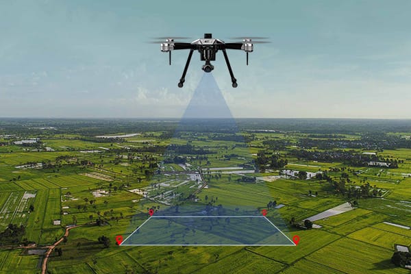
Why Drone Surveying is Transforming Modern Industries
Conventional surveying techniques often require extensive labor, significant time, and high costs. Drones revolutionize this process, collecting highly accurate data faster and more efficiently, even in remote or challenging terrains. Surveying India’s drones, equipped with advanced cameras, sensors, and GPS systems, achieve centimeter-level precision while offering real-time data processing. These capabilities empower faster, more informed decisions—a crucial advantage in today’s fast-paced environment. The integration of artificial intelligence (AI) and machine learning into Surveying India’s workflows further refines accuracy, particularly for topographic mapping and volumetric assessments.
Our LiDAR and Drone Mapping Services in Guwahati
We provide end-to-end LiDAR and drone mapping solutions tailored for Guwahati and Assam’s diverse project requirements:
UAV LiDAR Survey — 3D point cloud, bare-earth DTM, DSM
Drone Photogrammetry — orthomosaic maps, 3D models
Corridor Mapping — roads, railways, pipelines
Topographic Survey — contour maps at 0.5m/1m intervals
Volumetric Survey — stockpile and earthwork calculations
Flood Plain Mapping — Brahmaputra and tributary corridors
Agricultural Drone Survey — crop health, soil mapping
Construction Monitoring — progress tracking, cut-fill analysis
Industries We Serve in Assam and Northeast India
Our LiDAR and drone mapping services in Guwahati support a wide range of industries across Assam and Northeast India:
Construction & Infrastructure — topographic surveys, site planning, progress monitoring for roads, bridges, and buildings.
Mining — stockpile volume measurement, haul road mapping, safety inspections using aerial LiDAR.
Agriculture — tea garden mapping, crop health analysis, irrigation planning across Assam’s vast farmlands.
Government & Smart City — urban planning, land records, Smart City zone mapping for Guwahati Municipal Corporation projects.
Oil & Gas — pipeline corridor surveys, ROW mapping, infrastructure inspection across Assam’s oil fields.
Environment & Forest — forest canopy analysis, wetland mapping, wildlife corridor surveys in Northeast India.
Railways — alignment surveys, DPR support for Northeast Frontier Railway projects.
LiDAR Survey Applications in Guwahati
LiDAR technology is transforming how projects are planned and executed in Guwahati. Key applications include:
Flood Risk Mapping — Brahmaputra river basin LiDAR surveys generate accurate floodplain models for disaster preparedness and urban drainage planning.
Urban 3D Modelling — Guwahati Smart City projects use LiDAR-derived 3D city models for infrastructure planning, shadow analysis, and zoning decisions.
Road & Highway Surveys — NH-27 and state highway DPRs use LiDAR corridor mapping for cut-fill optimization and alignment planning.
Forest & Vegetation — LiDAR penetrates canopy to reveal bare-earth terrain beneath dense Northeast India forests — critical for pipeline and transmission line routing.
Accuracy Specifications:
Horizontal accuracy: ±2–5 cm
Vertical accuracy: ±3–7 cm
Point density: 50–200 points per m²
Equipment: DJI Matrice 300 RTK + Zenmuse L1 LiDAR
How Our Drone Mapping Process Works
Step 1 — Project Consultation
We understand your project scope, area, terrain, and deliverable requirements. Free consultation for all Guwahati and Assam projects.
Step 2 — DGCA Permission & Flight Planning
We obtain all necessary DGCA flight permissions. Flight paths are planned for maximum coverage and accuracy.
Step 3 — Field Data Capture
Our DGCA-certified pilots conduct drone LiDAR surveys. Typical coverage: 50–500 hectares per day depending on terrain.
Step 4 — Data Processing
Raw LiDAR point clouds are classified, filtered, and processed using industry-standard software (TerraSolid, LiDAR360, Pix4D).
Step 5 — Quality Check
All deliverables go through accuracy verification against ground control points (GCPs) before delivery.
Step 6 — Delivery
Final files delivered via secure cloud link:LAS/LAZ point cloud · GeoTIFF · DTM · DSM · Contour SHP · Report
Innovative Applications of Drone Surveying by Surveying India
Surveying India has carved a niche in the drone surveying industry by providing tailored solutions for a wide range of sectors in Northeast India.
- Urban Development and Infrastructure Projects:
Drones generate detailed aerial images that assist in city planning, zoning, and infrastructure development. Surveying India provides Digital Elevation Models (DEMs) and Digital Terrain Models (DTMs) that streamline urban planning and construction. - Precision Agriculture:
Drones are game-changers in agriculture, aiding in crop health monitoring, soil analysis, and irrigation management. Surveying India delivers 3D GIS maps and contour maps, enabling farmers to enhance productivity while conserving resources. - Mining Operations:
In the mining industry, drones facilitate accurate measurement of stockpiles and analyze surface changes over time. Surveying India offers volumetric reports and cut-fill analysis to optimize resource management and planning. - Environmental and Forestry Conservation:
Drones are effective for tracking deforestation, monitoring ecosystems, and evaluating forest health. Surveying India provides Digital Surface Models (DSMs) and orthomosaic maps, empowering conservationists to safeguard biodiversity. - Disaster Management and Recovery Efforts:
Post-disaster scenarios require rapid action. Drones map affected regions efficiently, aiding rescue operations. Surveying India’s 3D point clouds and orthomosaic outputs enhance recovery planning and expedite response times. - Smart Cities and Sustainable Urban Planning:
Surveying India supports smart city initiatives by providing comprehensive GIS mapping, enabling efficient planning and management of greenfield projects that tackle modern urban challenges.
Advanced Technology and Industry-Leading Deliverables
Surveying India is renowned for its advanced drone systems and premium-quality outputs that meet global industry standards.
Some key services include:
- Orthomosaic Mapping: High-definition images offering a holistic view of the area.
- 3D Point Clouds and 3D GIS Models: Essential tools for detailed terrain analysis.
- Digital Terrain Models (DTMs) and Digital Surface Models (DSMs): Comprehensive data for terrain assessment.
- Contour Mapping: Visualizing elevation differences for precise construction planning.
- 3D Textured Meshes: Adding realism to architectural designs.
- Detailed AutoCAD/GIS Drawings: Highlighting critical land features with precision.
- Volumetric Reports: Accurate measurements for industries like mining and construction.
Harnessing AI to Enhance Accuracy and Efficiency
Surveying India leverages AI-powered data processing to achieve exceptional precision and speed. This technology ensures up to 99% accuracy in complex projects, significantly reducing decision-making timelines. From estimating crop yields to infrastructure inspections, this approach enables industries to stay agile in a dynamic market.
Extensive Expertise in Northeast India’s Diverse Landscapes
With substantial experience throughout Northeast India—especially in Guwahati—Surveying India is adept at handling the region’s unique challenges. Whether navigating rugged mountainous terrain or densely populated cities, their skilled team ensures accurate data collection across varied environments.
Industries Benefiting from Surveying India’s Expertise
Surveying India caters to multiple industries, offering customized solutions such as:
- Construction: Topographic surveys and progress monitoring.
- Agriculture: Crop health analysis and resource optimization.
- Mining: Stockpile measurements and land analysis.
- Urban Development: Support for smart city initiatives.
- Environmental Conservation: Sustainable land-use management.
- Utilities: Inspections of powerlines and other infrastructure.
Why Surveying India Stands Out in Guwahati, Assam, India
Surveying India’s blend of advanced technology, industry expertise, and dedication to quality makes them the go-to choice for drone surveying in Guwahati and across Northeast India. Their commitment to accuracy, quick delivery times, and customized solutions enhances client decision-making and project success.
Partner with Surveying India: Your Gateway to Precision and Innovation
Surveying India’s cutting-edge solutions cater to the unique demands of each client, ensuring reliable data for impactful projects. Collaborate with them to gain a competitive edge as you navigate Northeast India’s challenging terrains. With Surveying India, you can access precise, actionable insights to transform landscapes and drive progress.
Frequently Asked Questions — LiDAR Drone Survey Guwahati
Q: What is LiDAR drone mapping?
A: LiDAR drone mapping uses laser sensors on UAVs to capture millions of 3D data points, creating accurate terrain models and contour maps. Unlike photogrammetry, LiDAR penetrates vegetation to show bare-earth surfaces — ideal for Assam’s forested and flood-prone terrain.
Q: How accurate is LiDAR drone survey in Guwahati?
A: Surveying India achieves ±2–5 cm horizontal and ±3–7 cm vertical accuracy — meeting engineering-grade standards for construction, infrastructure, and government projects in Guwahati.
Q: Is drone LiDAR survey DGCA-compliant in Guwahati?
A: Yes. We operate with DGCA-certified pilots, registered UAS equipment, and all required flight permissions across Guwahati and Northeast India.
Q: How long does a LiDAR drone survey take in Guwahati?
A: Field capture takes 1–3 days. Final deliverables are ready within 5–7 working days.
Q: What industries use LiDAR drone mapping in Assam?
A: Roads and highways, mining, tea gardens, railways, Smart City planning, oil & gas pipelines, flood mapping, and government land records across Assam and Northeast India.
Q: What files will I receive after a LiDAR survey?
A: LAS/LAZ point cloud, GeoTIFF orthomosaic, DTM, DSM, and contour shapefiles — compatible with AutoCAD, ArcGIS, and QGIS.
Q: What is the cost of LiDAR drone survey in Guwahati?
A: Cost depends on area size, terrain, and deliverables. Contact us for a free custom quote for your Guwahati or Assam project.
Conclusion
Drone mapping and surveying has become an essential tool for businesses, government bodies, and individuals across Guwahati and the wider Northeast India region. With Surveying India’s advanced drone technology, AI-powered data processing, and deep understanding of local terrain — from the riverine plains of the Brahmaputra to the hilly outskirts of the city — clients get faster, more accurate, and cost-effective survey results compared to traditional methods. Whether it’s topographic surveys for construction, crop health monitoring for agriculture, stockpile assessment for mining, or infrastructure inspection for utilities, Surveying India delivers centimeter-level precision tailored to each project’s needs. For anyone planning a project in Guwahati or across Assam, partnering with an experienced drone surveying team like Surveying India ensures reliable data, smarter decisions, and faster project timelines. Get in touch today to discuss your drone mapping and surveying requirements.