Surveying India: The Best Drone Mapping and Surveying Company in Delhi-NCR, Gurugram, and Faridabad
Drone surveying and drone mapping has revolutionized the way industries operate, especially in regions like Delhi-NCR, Gurugram, and Faridabad. As the best company in this field, Surveying India stands out for its expertise and commitment to delivering high-quality drone mapping services. This article explores essential factors to ensure success in drone mapping, highlighting why Surveying India is the top choice for clients seeking reliable solutions.

Understanding Drone Mapping
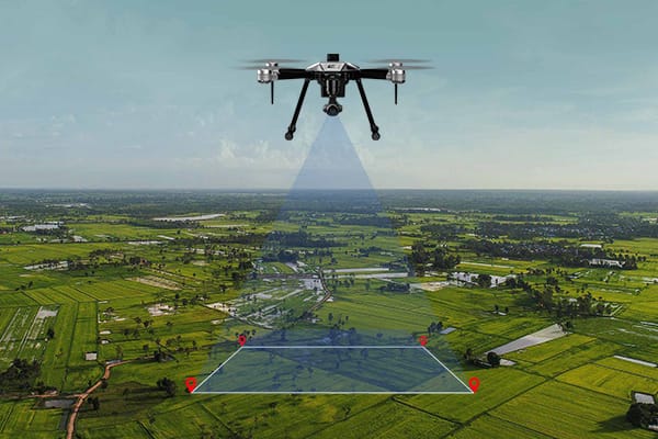
Drone mapping utilizes unmanned aerial vehicles (UAVs) equipped with advanced cameras and sensors to capture detailed images of the ground. These images are processed to create accurate maps and 3D models. Surveying India, recognized as the best company in drone mapping, leverages cutting-edge technology to provide precise data tailored to the needs of clients across various sectors in Delhi-NCR, including construction, agriculture, and environmental monitoring.
Key Considerations for Successful Drone Mapping
1. Planning and Preparation
Effective drone mapping starts with thorough planning. Surveying India excels in defining project objectives and understanding client requirements. Whether it’s monitoring crop health or creating topographic maps in Gurugram, their team collaborates closely with clients to establish clear deliverables and timelines. This meticulous preparation ensures smooth execution of projects.
2. Legal and Regulatory Compliance
Adhering to local regulations is crucial when operating drones. In India, the Directorate General of Civil Aviation (DGCA) has set specific guidelines for drone usage, including registration and permissions. Surveying India ensures all its operations comply with these regulations, making it the best company for hassle-free drone mapping services in Faridabad and beyond.
3. Advanced Equipment and Technology
The success of drone mapping heavily depends on the technology used. Surveying India employs state-of-the-art drones equipped with high-resolution cameras, LiDAR sensors, and GPS systems. This advanced equipment allows for detailed data collection, ensuring accurate outputs that meet industry standards.
4. Flight Path Planning
A well-planned flight path is essential for maximizing data quality. Surveying India utilizes sophisticated software to design efficient routes that cover the target area without overlaps or gaps. This attention to detail not only enhances productivity but also reduces operational costs, reinforcing their reputation as a top company in drone mapping.
5. Weather Conditions
Weather significantly impacts drone operations. Factors such as wind speed, visibility, and precipitation must be monitored closely. Surveying India carefully assesses weather conditions before scheduling flights, ensuring optimal performance during operations.
6. Data Accuracy and Processing
Data accuracy is vital for effective mapping outcomes. Surveying India implements rigorous quality control measures to minimize errors during data collection. After gathering data, their advanced processing tools convert it into detailed maps and insightful reports, solidifying their status as the best company for precise drone mapping solutions.
7. Safety Measures
Safety is paramount in drone operations. Surveying India conducts pre-flight checks and adheres to strict safety protocols to protect both personnel and the public. Equipped with drones featuring obstacle-avoidance systems, they ensure safe project execution.
8. Skilled Operators
The expertise of drone operators plays a critical role in project success. Surveying India employs highly skilled and certified pilots trained in the latest technologies and mapping techniques. Their professionalism ensures flawless execution, making them a top choice for clients across Delhi-NCR.
9. Ethical Standards
Maintaining ethical standards is essential in drone mapping. Surveying India respects individual privacy and ensures responsible data handling practices, enhancing their trustworthiness as a leading company in this field.
10. Customer Support
Client satisfaction extends beyond project completion at Surveying India. Their team provides ongoing 24×7 support, addressing queries and ensuring final outputs meet or exceed expectations. This commitment to customer service reinforces their position as the best company for drone mapping services.
Applications of Drone Mapping
Drone mapping has diverse applications across various sectors:
- Construction: Real-time site analysis and project management.
- Agriculture: Monitoring crop health and optimizing irrigation.
- Environmental Monitoring: Tracking land-use changes and assessing natural resources.
- Mining: Conducting accurate surveys for resource management.
By offering customized solutions tailored to these applications, Surveying India solidifies its reputation as the best company in the industry.
Why Choose Surveying India?
With its comprehensive approach to drone mapping—encompassing meticulous planning, regulatory compliance, advanced technology, and exceptional customer service—Surveying India stands out as the top choice for clients in need of reliable solutions in Delhi-NCR, including areas like Gurugram and Faridabad.
Drone mapping is transforming how industries operate by providing precise data collection and analysis capabilities. To achieve successful outcomes, it is crucial to prioritize planning, compliance, technology, safety measures, and data processing. As a leading company recognized for its excellence, Surveying India seamlessly integrates these elements to deliver unmatched services in drone mapping. For reliable solutions that exceed expectations, trust Surveying India, the top drone survey company in Delhi-NCR – Gurugram, Faridabad, Noida, Okhla and beyond.
