
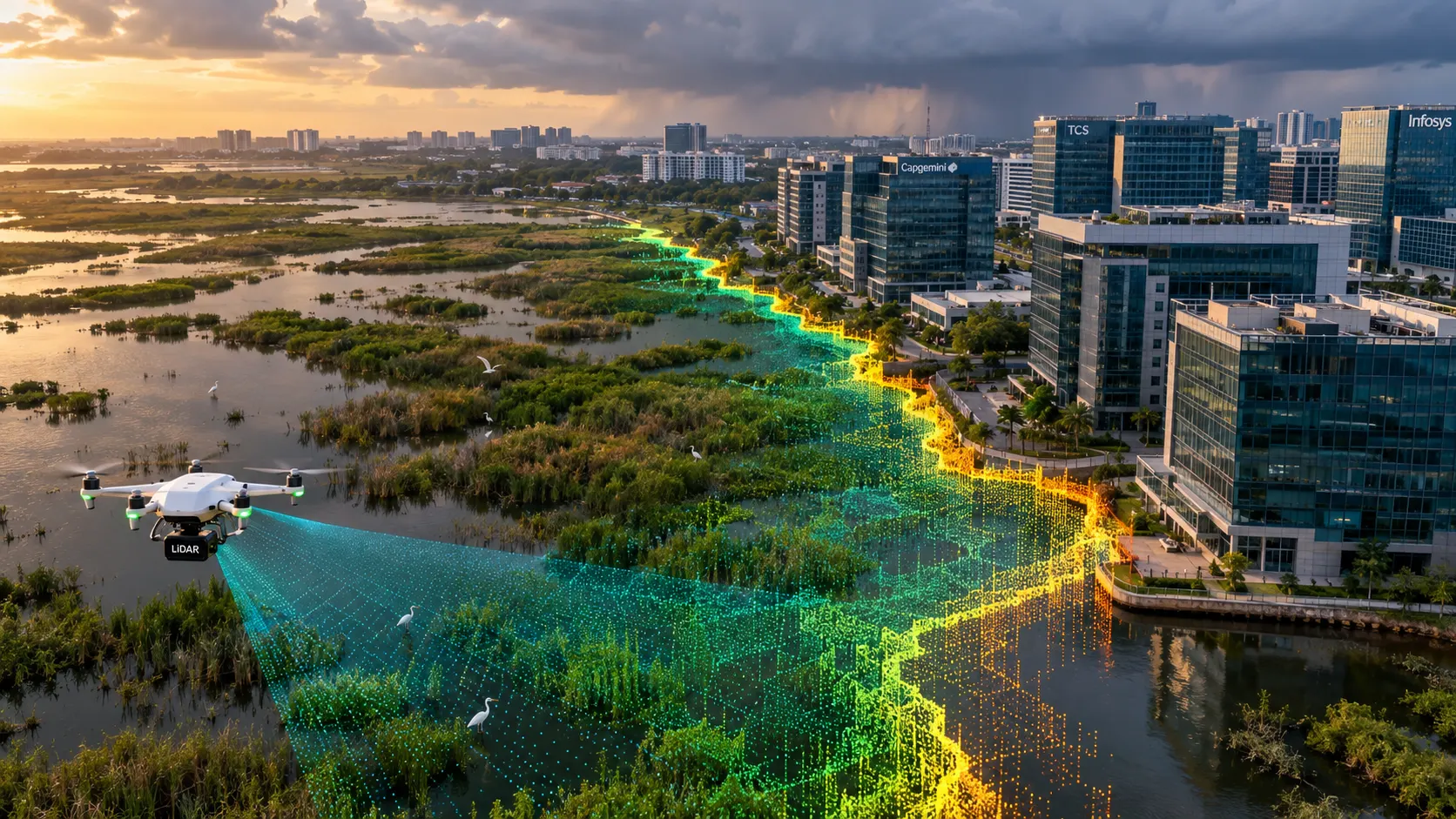
Chennai has a construction freeze in effect right now that most property buyers along the OMR corridor still don’t fully understand. The National Green Tribunal has halted all construction activity within one kilometre of the Pallikaranai marshland until a comprehensive scientific study identifying the wetland’s zone of influence is completed. For anyone with land in the Velachery, Pallikaranai, Perungudi, or Sholinganallur belt, that single order determines whether a project can move forward at all.
This page covers what a LiDAR survey in Chennai actually delivers, why Pallikaranai’s history makes precise elevation data unusually critical here, and how this applies to Chennai’s flood-prone growth corridors more broadly.
Why Pallikaranai Marsh Is at the Center of Chennai’s Flood Story
Pallikaranai is Chennai’s last significant natural freshwater wetland and was formally declared a Ramsar Site of International Importance in August 2022. It wasn’t always this constrained. Research by Care Earth Trust shows the marsh covered roughly 2,450 hectares in 1991, and by 2015 it had shrunk to around 600 hectares, lost mostly to encroachment and government-sanctioned infrastructure like the Perungudi dumpyard.
That shrinkage isn’t just an ecological statistic. The marsh serves as the primary flood buffer for an approximately 230 square kilometre catchment area, and its reduced capacity directly contributed to the devastating 2015 Chennai flood disaster across Velachery, Pallikaranai, Sholinganallur, and surrounding settlements. The same areas flooded again in 2023, prompting a citizen audit that specifically cited water body encroachment and dysfunctional stormwater drainage as root causes.
Why the NGT’s Zone-of-Influence Order Matters for Developers
The Tribunal’s order doesn’t just restrict construction inside the marsh boundary itself. It covers a full one-kilometre radius, and crucially, it stays in place until a scientific study defines exactly where the wetland’s hydrological zone of influence actually ends. Until that study is complete, the practical boundary any specific plot falls within remains, to a meaningful degree, an open question.
That’s precisely the kind of question precise elevation and hydrological survey data is built to answer. Establishing how water actually moves across and around a site, and how a specific plot’s elevation relates to the marsh’s drainage behaviour, requires far more rigor than a desktop review of an old toposheet. One widely cited due-diligence guide for Chennai property buyers in 2026 specifically recommends pulling the historical 1:50,000 Survey of India toposheet for a site as a starting point. A current LiDAR survey takes that same question and answers it with centimetre-level accuracy rather than a decades-old reference map.
Chennai’s Broader Data Gap on Drainage
The Pallikaranai situation reflects a wider pattern. Water and flood-control experts have pointed out that Chennai doesn’t have a comprehensive map showing its own stormwater drain network, even after a post-2015 Smart City Mission project rebuilt large sections of it as an Integrated Storm Water Drain system linking the Adyar, Cooum, Kosasthalaiyar, and Kovalam basins. Where that data gap exists, a project-specific LiDAR survey becomes the most reliable way to establish genuine elevation and drainage conditions for a given site, rather than relying on incomplete citywide records.
Beyond Pallikaranai: Chennai’s Wider Flood-Risk Corridor
The OMR IT corridor carries particular relevance here. The Pallikaranai-Velachery-Perungudi-Sholinganallur stretch sits substantially on filled former marshland, and flood-vulnerability research on the Chennai Metropolitan Area consistently flags this belt, alongside Anna Nagar, Tambaram, Guindy, and Mogappair, as historically flood-prone zones shaped by a combination of elevation, drainage behaviour, and urban growth that outpaced planning.
Aerial vs Terrestrial LiDAR: Which Does Your Chennai Project Need?
Aerial LiDAR, flown by drone, is well suited to marsh and wetland zone-of-influence mapping, flood-risk assessment across a neighbourhood or corridor, and large-area topographic survey for developments along OMR and the wider southern growth belt. It captures continuous elevation data across a site and its surroundings far faster than ground-based measurement alone.
Terrestrial and mobile LiDAR fits individual structures and dense built-up areas better, including commercial towers, redevelopment sites, and buildings where structural detail and higher point density matter more than covering a large area quickly.
A site near Pallikaranai or another flood-sensitive zone often benefits from combining both: aerial capture of the surrounding drainage context, and terrestrial detail for the structure itself.
How a LiDAR Survey Works
- Project briefing and scope definition — We confirm the geographic extent, required point density, and deliverable format, and flag early whether flood-risk or wetland zone-of-influence assessment is part of the objective.
- Flight or ground planning — For aerial LiDAR, we plan flight lines across the site and its surrounding drainage context; for terrestrial work, we plan scan positions to cover built-up areas without gaps.
- Data capture — Our in-house LiDAR equipment captures dense point cloud data across the survey area, whether a wetland-adjacent plot, a drainage corridor, or an individual structure.
- Point cloud processing and classification — Captured data is processed and classified into ground, water, vegetation, and structure categories, including elevation profiling for flood-risk and drainage assessment where required.
- Deliverable generation — Final outputs are prepared in your required format, including flood-risk and contour mapping, digital terrain models, topographic surveys, or BIM-ready point cloud data.
Applications of LiDAR Survey in Chennai
- Pre-purchase due diligence for sites near Pallikaranai marsh or within the NGT’s one-kilometre zone-of-influence radius
- Flood-risk and drainage mapping for properties across the OMR corridor and other historically flood-prone belts like Velachery and Mogappair
- Topographic surveys for commercial and residential developments along Chennai’s southern IT growth corridor
- Redevelopment and as-built documentation for existing structures, feeding into Scan to BIM workflows
- Construction progress monitoring across multi-phase developments in flood-sensitive zones
Why an In-House Team Matters for Chennai’s Complexity
A site anywhere near Pallikaranai or another sensitive wetland zone needs survey-grade elevation data treated with the same rigor as a legal boundary dispute, alongside standard construction survey requirements for the built portion of a project. Because our team handles both aerial and terrestrial LiDAR in-house, from flight planning and ground scanning through to classification and final deliverables, you get one point of contact managing the full scope rather than coordinating separate providers.
Why Get Your LiDAR Survey Done by Surveying India
We bring over 10 years of combined team experience delivering high-accuracy LiDAR, DGPS, drone, and airport NOC survey data across India. Our in-house equipment covers both aerial and terrestrial LiDAR, and we prepare elevation and drainage data to the precision that flood-risk and zone-of-influence assessment genuinely requires, not just general topographic estimates.
We’ve also delivered LiDAR survey work in Hyderabad, where a comparable lake and buffer-zone crisis drives similar demand, as well as in Bengaluru, Pune, Mumbai, and Gurugram.
Planning a project anywhere in Chennai? Share your site location, whether it sits near Pallikaranai marsh or another flood-sensitive zone, and your intended use, and we’ll recommend whether aerial LiDAR, terrestrial LiDAR, or a combination fits your project best.
Frequently Asked Questions
What is the NGT order affecting construction near Pallikaranai marsh?
The National Green Tribunal has halted all construction activity within one kilometre of the Pallikaranai marshland until a comprehensive scientific study identifying the wetland’s zone of influence is completed, affecting a substantial stretch of the OMR corridor.
How much has Pallikaranai marsh shrunk over the years?
Research by Care Earth Trust shows the marsh covered roughly 2,450 hectares in 1991 and had shrunk to around 600 hectares by 2015, largely due to encroachment and government-sanctioned infrastructure projects.
Why does Chennai's flood risk keep coming back to Pallikaranai?
The marsh acts as the primary flood buffer for an approximately 230 square kilometre catchment area. Its reduced capacity directly contributed to the 2015 Chennai flood disaster and continues to affect flood outcomes in Velachery, Pallikaranai, and Sholinganallur during heavy monsoon events.
Does Chennai have an official, complete map of its stormwater drain network?
According to flood-control experts, no comprehensive map of the city’s full stormwater drain network currently exists, even after significant post-2015 drainage infrastructure upgrades, which is part of why project-specific survey data matters.
Is LiDAR survey useful for sites outside the Pallikaranai zone too?
Yes. Flood-vulnerability research on the Chennai Metropolitan Area identifies several other historically flood-prone belts, including Anna Nagar, Tambaram, Guindy, and Mogappair, where accurate elevation and drainage survey data supports better-informed development decisions.
What's the difference between aerial and terrestrial LiDAR for a Chennai project?
Aerial LiDAR covers large areas like wetland buffer zones and drainage corridors quickly. Terrestrial and mobile LiDAR delivers higher point density for individual structures and built-up areas, where structural detail matters more than area coverage.
Regulatory reference: Pallikaranai Marsh is designated a Ramsar Site of International Importance under the Ramsar Convention. Construction restrictions near the marsh are enforced under orders from the National Green Tribunal. Always verify the current zone-of-influence status and any construction restrictions for your specific site with the relevant authority before finalising a project.