
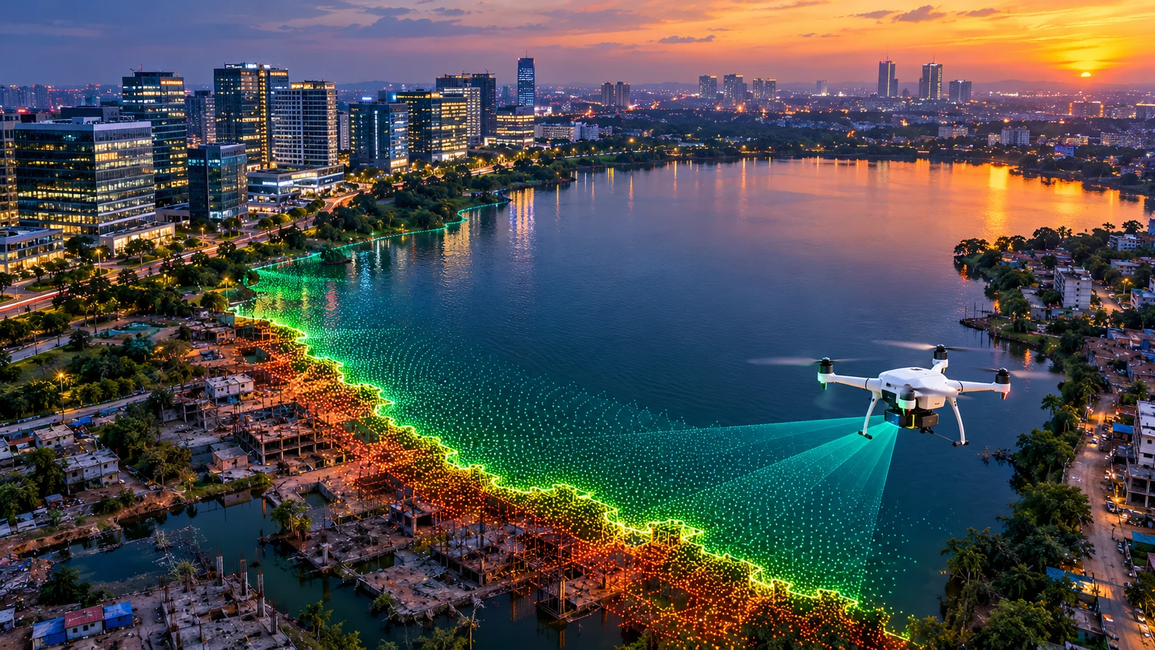
Hyderabad is currently running one of the most active lake-encroachment enforcement drives of any Indian city, and the numbers behind it reveal just how far behind the documentation has fallen. Of roughly 3,132 lakes identified across the Hyderabad Metropolitan Development Authority’s jurisdiction, official Full Tank Level and buffer zone notifications exist for only about 165. HYDRAA, the agency formed specifically to enforce these boundaries, has been actively demolishing FTL and buffer zone violations since September 2024.
This page covers what a LiDAR survey in Hyderabad actually delivers, why Full Tank Level demarcation is fundamentally an elevation problem that LiDAR is uniquely suited to solve, and how the same technology supports Hyderabad’s booming IT corridors.
Why Full Tank Level Is, at Its Core, an Elevation Measurement
Full Tank Level, or FTL, is defined as the maximum water level a lake or tank can hold under normal conditions, as determined and recorded by the Irrigation Department. Any construction within the FTL boundary is treated as encroachment, liable for removal, and under current Telangana regulation, lakes of 10 hectares or more carry an additional 30-metre no-construction buffer zone measured outward from that FTL line.
Read that definition again and the core issue becomes obvious: FTL is an elevation contour, not an arbitrary boundary drawn on a map. Determining it accurately requires precise ground elevation data across the lake bed and surrounding land, exactly the kind of dataset a LiDAR survey produces at a level of detail far beyond what older topographic methods typically achieve.
Why the Backlog Matters for Anyone Building in Hyderabad
HMDA’s Lake Protection Committee began this FTL demarcation exercise back in 2013. More than a decade later, final notifications for over 3,000 lakes remain pending, even as HYDRAA’s demolition drive has made FTL and buffer zone violations an active legal and financial risk for property owners and developers. HMDA does operate a public lakes portal where anyone can check a specific lake’s notified boundaries, but for the roughly 2,967 lakes still awaiting final notification, that portal can’t offer the certainty a buyer or developer actually needs.
This is exactly where a certified, independent LiDAR survey earns its value. Rather than relying on an unnotified or outdated boundary, a precise elevation survey of your specific site establishes defensible data before you commit to a purchase or a design, not after an enforcement notice arrives.
A Real Example: Khajaguda Lake
Khajaguda Lake illustrates how quickly boundaries can shift without rigorous monitoring. An official 2014 survey recorded its FTL area at just over 38 acres. Years of encroachment from surrounding construction later, the Telangana High Court was directly questioning HMDA about why the lake had shrunk to roughly 37 acres, with litigation over its boundary still ongoing. A single acre of difference, in a case significant enough to reach the High Court, underscores how much precision matters in this kind of boundary work.
Beyond Lakes: Hyderabad’s IT Corridor Demand
Hyderabad’s lake crisis sits alongside a separate, equally active driver of LiDAR demand: the city’s IT and commercial growth corridors. HITEC City, Gachibowli, and the Financial District continue adding commercial towers and campuses at a rapid pace, and many of these sites sit close enough to notified or unnotified water bodies that both topographic survey and FTL verification become relevant on the same project.
Aerial vs Terrestrial LiDAR: Which Does Your Hyderabad Project Need?
Aerial LiDAR, flown by drone, is the right fit for FTL and buffer zone boundary mapping, since it captures continuous elevation data across an entire lake bed and surrounding land far faster and more consistently than ground-based measurement, and it’s equally suited to large-area topographic survey for new IT campuses and township developments.
Terrestrial and mobile LiDAR fits individual structures and dense built-up areas better, including commercial towers, redevelopment sites, and Metro station structures where higher point density and structural detail matter more than covering a large area quickly.
Projects sitting near a lake or buffer zone while also including built structures typically benefit from combining both methods in one engagement.
How a LiDAR Survey Works
- Project briefing and scope definition — We confirm the geographic extent, required point density, and deliverable format, and flag early whether FTL or buffer zone verification is part of the objective.
- Flight or ground planning — For aerial LiDAR, we plan flight lines across the lake bed and surrounding buffer area or large campus sites; for terrestrial work, we plan scan positions to cover built-up areas without gaps.
- Data capture — Our in-house LiDAR equipment captures dense point cloud data across the survey area, whether a lake boundary, a buffer zone, or an individual structure.
- Point cloud processing and classification — Captured data is processed and classified into ground, water, vegetation, and structure categories, including FTL contour extraction where lake boundary verification is the objective.
- Deliverable generation — Final outputs are prepared in your required format, including boundary and FTL mapping, digital terrain models, topographic surveys, or BIM-ready point cloud data.
Applications of LiDAR Survey in Hyderabad
- FTL and buffer zone boundary verification for property purchase, development planning, or legal review near Hyderabad’s lakes
- Topographic surveys for new IT campuses and commercial developments across HITEC City, Gachibowli, and the Financial District
- Redevelopment and as-built documentation for commercial towers and tech parks, feeding into Scan to BIM workflows
- Construction progress monitoring across multi-phase developments in the city’s fast-growing peripheral zones
- Due diligence support for land acquisition where lake proximity creates FTL or buffer zone risk
Why an In-House Team Matters for Hyderabad’s Complexity
A site near an unnotified lake in Hyderabad often needs the same rigor as a cadastral boundary dispute, alongside standard construction survey requirements for the built portion of the project. Because our team handles both aerial and terrestrial LiDAR in-house, from flight planning and ground scanning through to classification and final deliverables, you get one point of contact managing the full scope rather than coordinating separate providers for the boundary work and the structural survey.
Why Get Your LiDAR Survey Done by Surveying India
We bring over 10 years of combined team experience delivering high-accuracy LiDAR, DGPS, drone, and airport NOC survey data across India. Our in-house equipment covers both aerial and terrestrial LiDAR, and we prepare elevation and boundary data to the precision that FTL verification and legal review genuinely require, not just general topographic estimates.
We’ve also delivered LiDAR survey work in Bengaluru, where a strikingly similar lake and stormwater drain encroachment crisis drives comparable demand, as well as in Pune, Mumbai, and Gurugram.
Planning a project anywhere in Hyderabad? Share your site location, whether it sits near a lake or buffer zone, and your intended use, and we’ll recommend whether aerial LiDAR, terrestrial LiDAR, or a combination fits your project best.
Frequently Asked Questions
What is Full Tank Level, and why does it matter for construction in Hyderabad?
Full Tank Level, or FTL, is the maximum water level a lake can hold under normal conditions. Construction within the FTL boundary is treated as encroachment and is liable for removal, and lakes of 10 hectares or more carry an additional 30-metre buffer zone where construction is also restricted.
How many of Hyderabad's lakes actually have official FTL boundaries notified?
Out of roughly 3,132 lakes identified across HMDA’s jurisdiction, official FTL and buffer zone notifications exist for only about 165, despite the demarcation exercise having started back in 2013.
What is HYDRAA, and why is it relevant to property buyers in Hyderabad?
HYDRAA, the Hyderabad Disaster Response and Asset Protection Agency, was formed in July 2024 and has been actively demolishing structures found within FTL and buffer zones since September 2024, making boundary verification a genuine financial and legal risk factor before buying or building near a lake.
Can I just check HMDA's lakes portal instead of commissioning a survey?
HMDA’s public portal shows notified boundaries for lakes that have completed the process, but with over 2,900 lakes still awaiting final notification, an independent LiDAR survey provides defensible elevation data for sites where official notification hasn’t yet been completed.
Is LiDAR survey useful for Hyderabad's IT corridor developments too?
Yes. Beyond FTL and buffer zone verification, aerial and terrestrial LiDAR support topographic surveys and as-built documentation for commercial towers and campuses across HITEC City, Gachibowli, and the Financial District.
What's the difference between aerial and terrestrial LiDAR for a Hyderabad project?
Aerial LiDAR covers large areas like lake beds and buffer zones quickly. Terrestrial and mobile LiDAR delivers higher point density for individual structures and built-up areas, where structural detail matters more than area coverage.
Regulatory reference: FTL and buffer zone regulations in Hyderabad are administered by the Hyderabad Metropolitan Development Authority under the HMDA Act, 2008, with official lake boundary data published on the HMDA Lakes Portal. Always verify current FTL and buffer zone status for your specific site before finalising a project.