Transforming Surveying in Northeast India: How Surveying India Leads in Advanced Drone Mapping and Surveying in Itanagar, Arunachal Pradesh, India
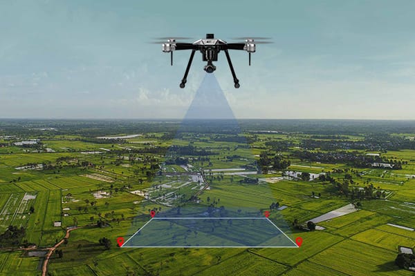
Drones are playing a crucial role in transforming surveying, mapping, and data collection. They offer unmatched accuracy, speed, and efficiency across various industries. From agriculture to urban planning, drone technology is changing how we approach surveying by providing high-resolution imagery and data-driven insights that facilitate informed decision-making. Surveying India, a leading and one of the top drone surveying company based in Itanagar, Arunachal Pradesh, has established itself as a trusted partner for diverse industries, government agencies, and private businesses throughout Northeast India.

Why Drone Surveying is a Game-Changer in Modern Era
Traditional surveying methods often demand significant manpower, time, and resources. In contrast, drones enable businesses to capture precise data much more quickly and with fewer resources, even in difficult or remote areas. With advanced cameras, sensors, and GPS technology, Surveying India’s drones deliver centimeter-level accuracy and real-time data processing. This capability accelerates decision-making—an essential advantage in today’s competitive environment. Additionally, the integration of artificial intelligence (AI) and machine learning into Surveying India’s processes enhances accuracy for applications like topographic surveys and volumetric measurements.
Modern Applications of Drone Surveying by Surveying India
Surveying India is amongst one of the best companies in Drone Surveying industry excels in a wide range of applications tailored to meet the needs of various sectors in Northeast India.
Here’s how drone technology is being utilized across different industries:
- Urban Planning and Infrastructure Development: Drones capture detailed aerial images that aid in city layout planning, zoning, and infrastructure projects. Surveying India provides Digital Elevation Models (DEMs) and Digital Terrain Models (DTMs), helping urban planners assess land effectively and streamline construction efforts.
- Agriculture and Precision Farming: In agriculture, drones are invaluable for crop health analysis, soil monitoring, and irrigation planning. Surveying India offers 3D GIS maps and contour maps that empower farmers to optimize resources and improve yields while promoting sustainable practices.
- Mining and Quarrying: Drone surveys in mining facilitate accurate stockpile volume measurements and land surface change analysis. Surveying India provides detailed volumetric assessments and cut-fill analysis reports essential for effective resource management.
- Environmental Conservation and Forestry: Drones are efficient tools for tracking deforestation, monitoring ecosystems, and assessing forest health. With Digital Surface Models (DSMs) and orthomosaic maps from Surveying India, conservationists can evaluate changes over time to protect biodiversity.
- Disaster Management and Recovery: After natural disasters occur, drones quickly map affected areas to help rescue teams assess damage. Surveying India’s 3D point clouds and orthomosaic maps support efficient recovery efforts by enabling faster responses.
- Smart City Design and Planning: Surveying India aids smart city initiatives through comprehensive GIS mapping. By capturing detailed geospatial data, the company helps design and manage greenfield projects that address modern urban challenges.
Cutting-Edge Technology and High-End Deliverables at the Surveying India
Surveying India is recognized as top company for its state-of-the-art drone technology and high-quality deliverables that adhere to the highest industry standards.
Some specialized services offered include:
- Orthomosaic Maps: High-resolution images that provide a comprehensive view of the surveyed area.
- 3D Point Clouds and 3D GIS Maps: Tools for creating digital landscapes essential for analysis.
- Digital Terrain Models (DTMs) and Digital Surface Models (DSMs): Models capturing variations in terrain for land assessment.
- Contour Maps: Visual representations of elevation changes useful for construction planning.
- 3D Textured Mesh: Adds realism to models for architectural design.
- AutoCAD/GIS Drawings with All Feature Markings: Detailed drawings highlighting land features.
- Volumetric Measurement Reports: Precise volume calculations vital for mining and construction.
Leveraging AI-Driven Data Processing for Precision and Speed
Surveying India employs AI-driven data processing to enhance measurement accuracy, assessments, and damage detection. This approach achieves up to 99% accuracy in complex projects while expediting decision-making processes. Whether estimating crop yields or conducting inspections, this integration ensures optimal efficiency—enabling industries to adapt quickly in a dynamic market.
Extensive Experience in Northeast India and Hilly terrains
With extensive experience across Northeast India—especially in Itanagar—Surveying India’s team is well-equipped to tackle the region’s unique challenges. From rugged mountainous terrain to densely populated urban areas, they operate effectively in diverse environments while ensuring accurate data collection.
Industries Benefiting from Surveying India, best company for Drone Services
Surveying India serves a wide range of industries including:
- Construction: For topographic mapping and monitoring.
- Agriculture: Assisting with crop health monitoring.
- Mining: Providing stockpile measurements.
- Urban Planning: Supporting smart city initiatives with accurate GIS data.
- Environmental Conservation: Contributing to sustainable land management.
- Power Utilities: Offering powerline inspections.
Why Surveying India is the Preferred Choice for Drone Surveying in Itanagar, Arunachal Pradesh, India
Surveying India’s combination of expertise, cutting-edge technology, and commitment to quality makes it the top choice for drone surveying in Itanagar and Northeast India. Clients from various sectors trust them for their accuracy, quick turnaround times, and customized deliverables that enhance decision-making processes.
Partner with Surveying India: Precision, Reliability, and Innovation
Surveying India’s innovative solutions cater to each client’s unique needs, ensuring precise data for successful projects. Partnering with them gives you a competitive edge as you navigate Northeast India’s challenging terrains. With Surveying India at your side, accurate data is always within reach—supporting your vision to transform landscapes through informed decisions.
